Elevation: 8,382 ft
Prominence: 402
This peak is not in the book. Published November 2020
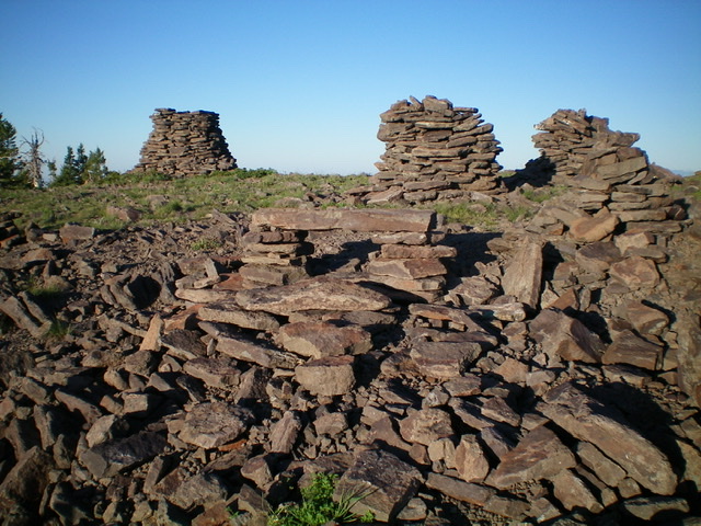
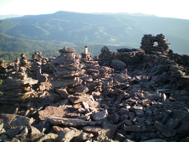
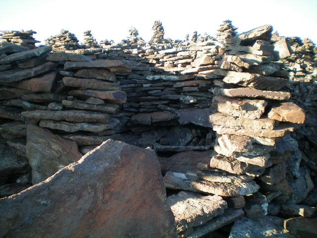
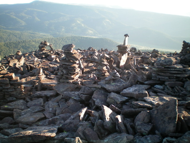
Peak 8382 is located in the Western Centennials. It sits at the head of Allan Canyon and is due east of Lookout Point (8,716 feet). Peak 8382 has the greatest number of cairns and other talus-based “artwork” that I have ever seen on a mountain top. It is impressive. Consequently, I unofficially call the peak “Rock Art Peak.” It is most easily reached via FST-005, an ATV trail (not shown on the USGS topo map) that skirts the south edge of the summit area. USGS Lookout Point
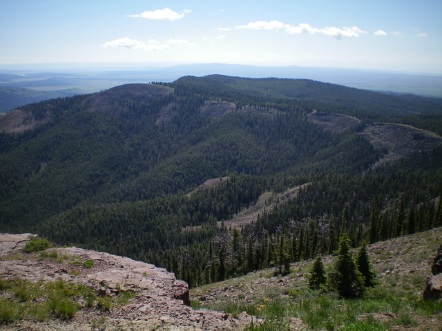
Peak 8382 (the bald hump left of center) and its southwest ridge (bare ridgeline heading to the right from the summit) as viewed from the summit of Lookout Point to the west. Livingston Douglas Photo
Access
Allan Canyon Road/FSR-015 is located 4.5 miles up West Camas Creek Road/FSR-006 from its beginning at a signed road junction northwest of Kilgore, ID. FSR-015 is also 0.5 miles southeast of Steel Creek Road/FSR-478 on West Camas Creek Road/FSR-006. Drive 1.4 miles up Allan Canyon Road to its gated closure just after it crosses to the east side of Allan Canyon Creek. There is a small pullout alongside the road here (6,930 feet).
Northwest Spur/North Ridge, Class 2
The Climb
From the gated road closure on FSR-015, bushwhack southeast up a forested slope that soon becomes a well-defined ridge/shoulder. This bushwhack is a bit tedious due to brush, veg, and a fair amount of blowdown. Scramble up a section of open talus higher up to reach the north ridge at about 8,000 feet. From this ridge juncture, head south through forested terrain to reach a section of talus/boulders. Scramble up the rocky patch to arrive at the summit.
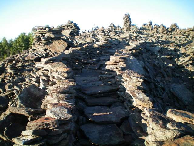
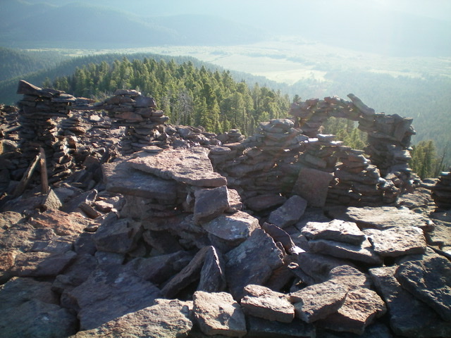
The summit (and the area just north of it) is covered with dozens of cairns, rock shelters, a rock staircase, archways, etc. It is stunning to come upon this area with no idea that it is there. Enjoy the rock art and take some pictures. You’ll probably never see anything quite like it again. The summit high point is at the south end of the talus-covered summit area and has a massive cairn. Not the tallest cairn I’ve ever seen, but probably the one with the most girth. From the open summit of Peak 8382, the view of Lookout Point to the west is amazing.
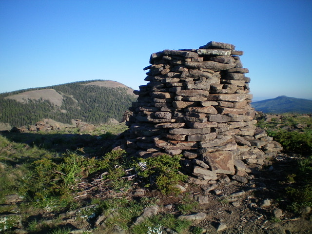
The massive summit cairn atop Peak 8382 with Lookout Point in the distance. Livingston Douglas Photo
Southwest Ridge, Class 1
The Descent
From the summit, walk a short distance south to reach FST-005 (an ATV trail/road that is not shown on the USGS topo map) that crosses the south edge of the summit area. Follow FST-005 southwest then west as it descends the southwest ridge to a broad saddle at 7,980 feet. This is the connecting saddle with Lookout Point and marks the conclusion of the first leg of today’s 3-peak journey. Lookout Point is next.
Additional Resources
Regions: Centennial Range->EASTERN IDAHO
Mountain Range: Centennial Range
Longitude: -112.02039 Latitude: 44.43449
