Elevation: 8,386 ft
Prominence: 406
This peak is not in the book.
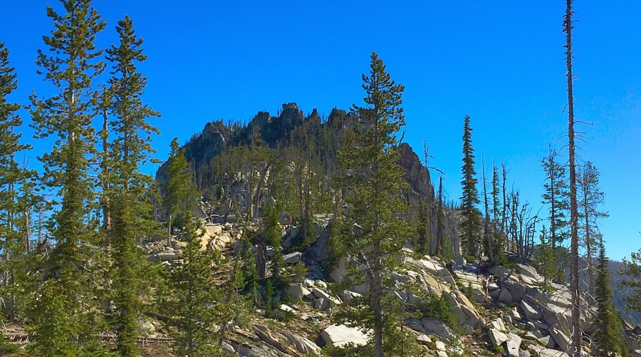
Peak 8386 sits above Trail Lake on Diamond Ridge and is due north of Storm Peak. Diamond Ridge runs from Peak 8552 northeast to a peak identified by the USGS as Diamond Rock. Peak 8386 is the gnarliest of the 4 peaks on the ridge. It is crowned by several granite towers. USGS Victor Peak

Peak 8386 as viewed from the pass between it and Peak 8525.
Peak 8386 is most impressive on its West Side. Climbing the West Ridge involves a lot of scrambling around the maze of blocks that clutter the ridge. It’s not difficult but it takes some time. Climb the peak’s Class 4 summit block from its East Side. This is a short Class 4 scramble around and over numerous granite boulders. I climbed this peak as part of a ridge traverse with John Platt in 2015. For additional details, see my Diamond Ridge Traverse page and John’s trip report.
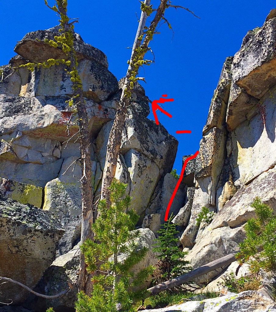
The West Side of the summit block. The Class 4 route is shown in red. Climb the lower section on the right. Once you reach the shelf at the top of the first move, step across to the higher block to the left and then scramble to the top. You can also climb the equally-airy lower summit from the shelf.
Diamond Ridge is located northeast of Upper Payette Lake on the East Side of [paved] Warren Wagon Road which leaves McCall on the West Side of Payette Lake. The best access currently is to follow Warren Wagon Road north for 21.1 miles and then turn right/east onto FS-431 and follow this decent dirt road to its end. A fair trail leaves the East End of the parking lot and climbs roughly 750 vertical feet in a mile to the base of the ridge at Deep Lake. You can hike cross-country to all 4 of the ridge’s peaks from the trailhead. Be forewarned that this area is heavily burned and, in places, cross-country travel requires crossing acres of downed trees. The Victor Creek Trail traverses this country and crosses the ridge between Peak 8386 and Peak 8525. As of 2014, the trail was blocked by numerous downed trees. I don’t recommend it.
Additional Resources
Mountain Range: Western Salmon River Mountains
Year Climbed: 2015
First Ascent Information:
- First Ascent Year: 2015
- Season: Summer
- Route: East side of the summit block.
- Party: John Platt and Tom Lopez
Longitude: -115.93329 Latitude: 45.15459