Elevation: 8,387 ft
Prominence: 407
This peak is not in the book. Livingston Douglas added a new route description with a different starting point and additional photos. Updated November 2024
This peak is located northeast of Massacre Mountain and south of Buck Springs. USGS Short Creek
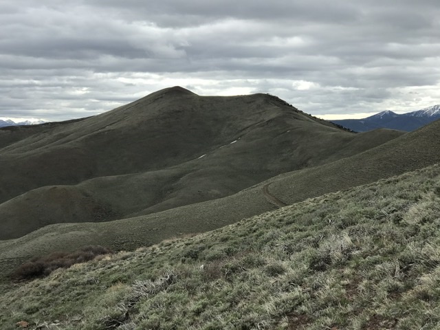
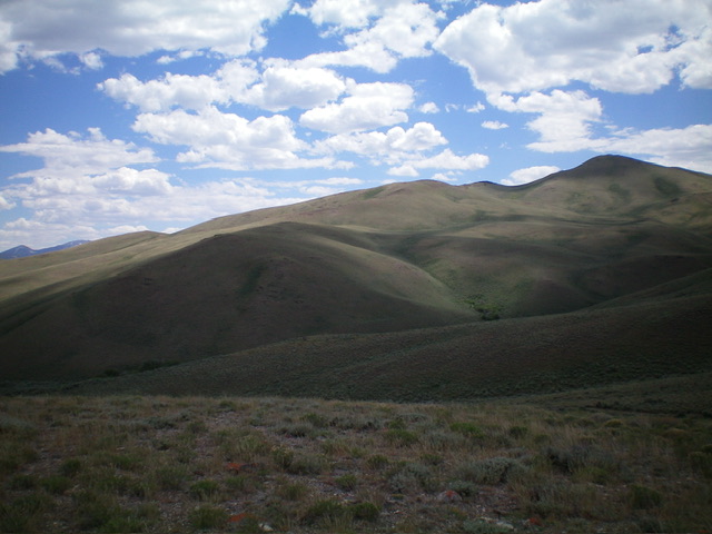
Peak 8387 as viewed from the north
Access
Dry Creek Cutoff Road/Buck Springs Road [(A)(6.1 alt.) on Page 290]. Drive the 4WD Buck Springs Road until it forks at the 8,000-foot contour. Take the left fork and drive up to the saddle on the peak’s west ridge. Park here.
West Ridge, Class 2
The drive to the saddle is the crux of this climb. The west ridge is an easy ascent from the saddle with no obstacles along the way. My GPS recorded 1.04 miles with 450 feet of elevation gain round trip.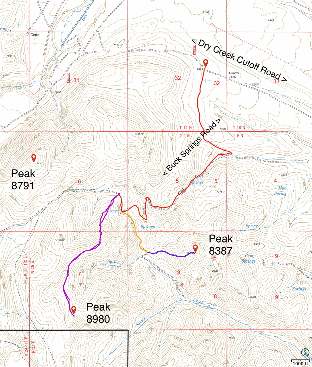
Northeast Ridge and South Ridge by Livingston Douglas
Peak 8387 as viewed from the north. Livingston Douglas Photo
Access
From Dry Creek Road at Junction 7493, head south on a 2-track road that goes up over a shoulder then drops steeply to a road junction just northeast of Buck Springs. Park in a large open area just west of this junction or drive 0.3 miles east down a narrow BLM road to reach official BLM land and park there as I did (7,200 feet and 44⁰08’33”N, 113⁰29’22”W). This is the first leg of a 3-peak adventure that includes Peak 8387, Peak 8992, and Peak 8986. It covers 8.3 miles with 3,475 feet of elevation gain round trip.
Map/Informational Errors
LOJ fails to show the BLM road heading east from just north of Buck Springs and down a drainage that leads to Squaw Creek. LOJ shows the HP of Peak 8986 as the west summit hump but the east summit hump is five feet higher and has a large summit cairn. The NF map shows a block of private land in the Buck Springs area. However, it appears to now be BLM land and seems to be open to the public.
Northeast Ridge, Class 2
The Climb
From the improvised pullout, cross to the south side of the BLM road and scramble southwest up a rounded ridge in short grass/scrub. The ridge narrows and bends left/south at just over 7,700 feet. Continue climbing southward to reach a small saddle just northwest of Point 8262. Descend southwest and drop 25 vertical feet to reach this saddle. From the saddle, scramble west up the scrub-and-rock/scree ridge to the small summit of Peak 8387. The summit has a modest cairn.
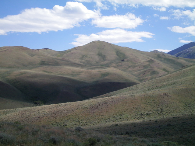
Peak 8387 as viewed from the west. Livingston Douglas Photo
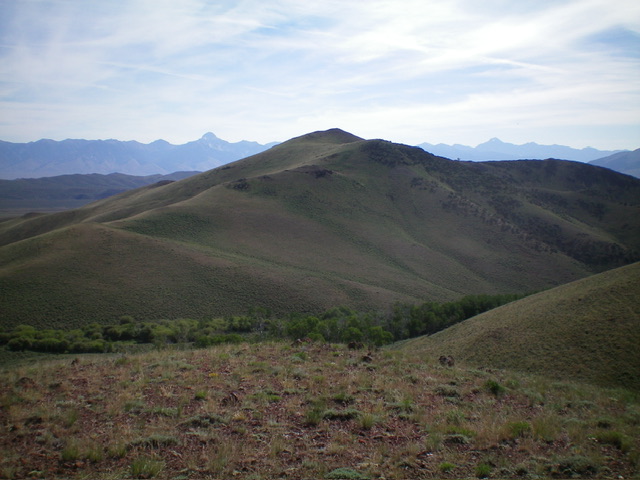
Peak 8387 (summit is right of center) and its north and northeast aspects. My ascent route climbs one of the shoulders left of center, diagonally up to the false summit then right/west to the high point. Livingston Douglas Photo
South Ridge, Class 2
The Descent
From the summit, descend south on an open ridge of scrub that soon has rocky outcrops to navigate and a steep-ish drop to Squaw Creek. Descend to the fork in the creek through scrub and rocky outcrops. This fork sits at the base of the north ridge of Peak 8992. Bushwhack across both the northwest fork of Squaw Creek and the main fork of Squaw Creek by using cattle trails through the dense willows. This is the low point in the traverse from Peak 8387 to Peak 8992. It concludes the first leg of today’s 3-peak journey. Peak 8992 is up next.
Additional Resources
Regions: EASTERN IDAHO->Lost River Range
Mountain Range: Lost River Range
Year Climbed: 2020
Longitude: -113.50301 Latitude: 44.12859