Elevation: 8,401 ft
Prominence: 781
This peak is not in the book. Published September 2019
Peak 8401 is located northeast of McCall and Payette Lake near Cougar Lake. It is another remote Lick Creek Subrange summit. Like many Lick Creek Subrange peaks, this peak is capped by a granite formation that raises the difficulty of reaching the highest point. USGS Blackmare
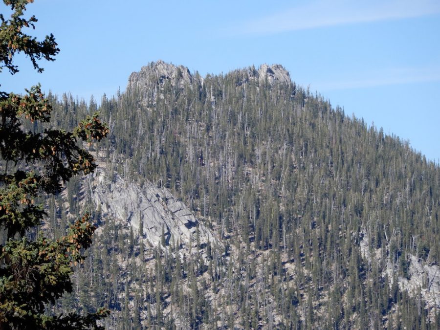
Peak 8401 as viewed from near Cougar Saddle. John Platt Photo
Access
The long journey to this peak begins at the Kennally Creek trailhead [(B)(5) on Page 138]. From the trailhead, follow FS-102 north up Kennally Creek to the junction with FS-310/097. Turn east and follow the trail up and over Cougar Saddle. From the saddle, you can either drop down to Cougar Lake or traverse northeast toward Peak 8401’s Southwest Ridge. See John Platt’s trip report which is linked below.
Southwest Ridge, Class 4
John Platt and Dave Beck climbed this ridge from Cougar Lake. The ridge involves a lot of dodging around granite outcrops and then eventually ends at the summit block with a short 10-foot Class 4 climb.
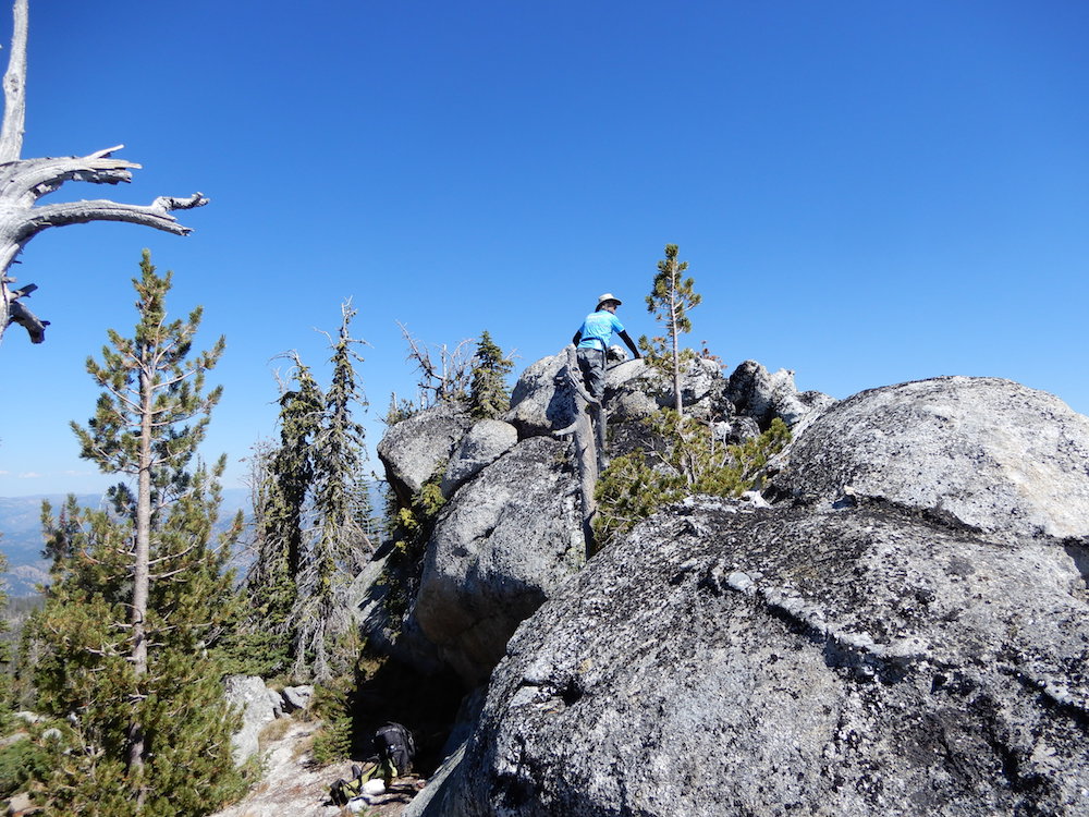
The summit block. John Platt Photo
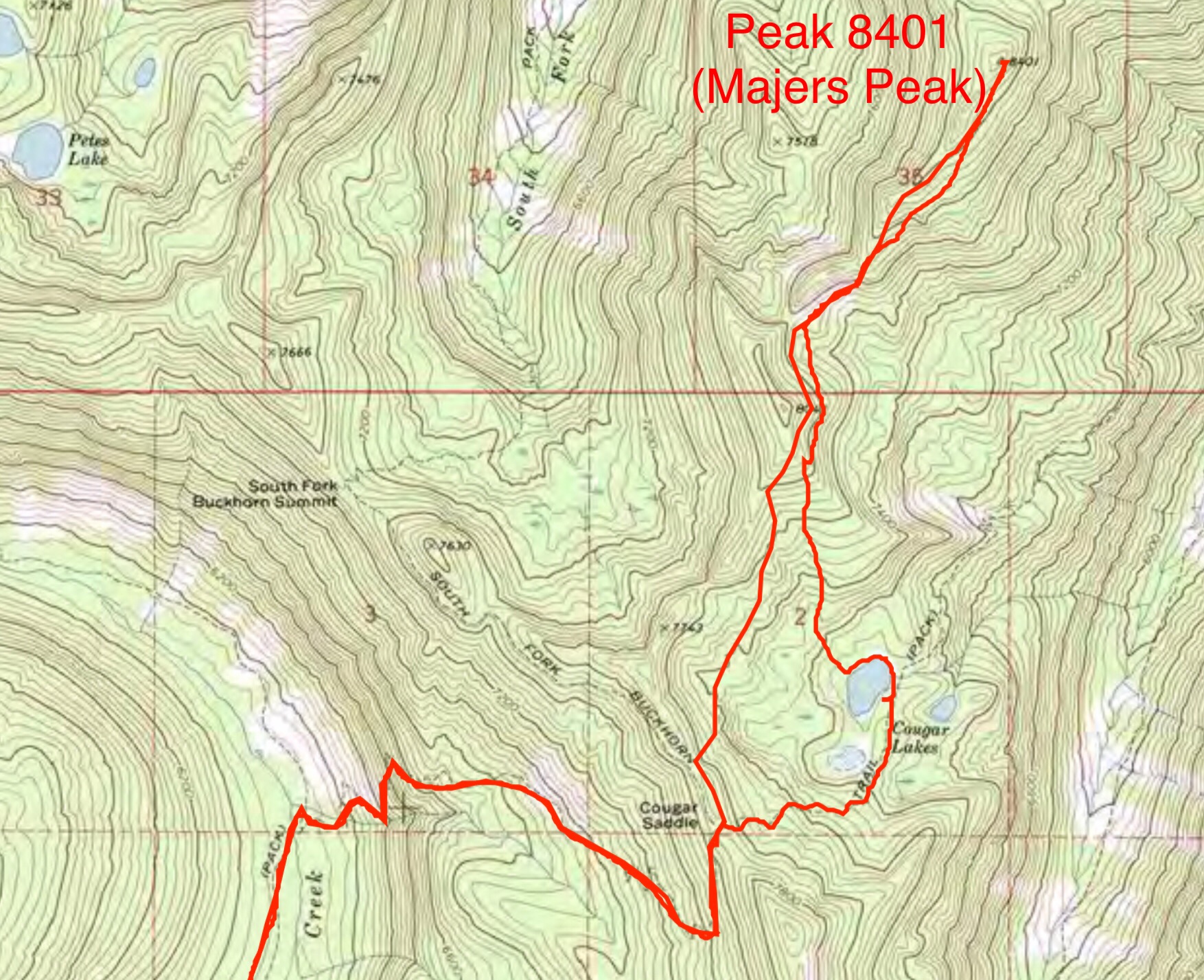
John’s GPS track for the last portion of the trip. John and Dave covered 18.0 miles round trip with 4,600 feet of elevation gain, including 10 miles of mountain biking.
Additional Resources
Mountain Range: Western Salmon River Mountains
Longitude: -115.80609 Latitude: 44.85839