Elevation: 8,420 ft
Prominence: 1,440
This peak is not in the book. Published August 2019
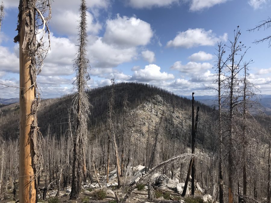
Peak 8420 is located just north of Whitehawk Mountain. It is the highest point on the ridge that divides the Deadwood River drainage from the Bear Valley Creek drainage. This peak is a victim of the Pioneer Fire which burned much of the surrounding area. The summit is formed by a small granite outcrop. USGS Whitehawk Mountain
Peak 8420 as viewed from the south.
Access
The best access to this peak is from Whitehawk Mountain via the rough road that leads to the Whitehawk Mountain fire lookout. The road is gated 0.9 miles below the lookout. From Lowman, take Clear Creek Road/FS-582 [(E)(1.1)] from Lowman north to Big Meadows. At 12.0 miles, there is a junction. If you go straight you will eventually reach the trailhead for Red Mountain. Take a hard left and follow the now steep and narrow road up and over Clear Creek Summit and then down into Big Meadows after another 7.6 miles. The junction for the Whitehawk Mountain Road/FS-569 is festooned with signs discussing the Meadow’s interesting history. Turn onto FS-569 and follow it to the summit. A 4WD vehicle is recommended. There is poor parking just before the gate.
South Ridge, Class 2
From the road’s end at the lookout, follow the open ridge north to the high point of Whitehawk Mountain and then continue north to the next hump. The tread of an old trail can be followed much of the way. The distance from the lookout to the high point is roughly 0.6 miles with minimal ups and downs. From the final hump on Whitehawk Mountain’s summit ridge, continue north.
The tread of an old trail descends Whitehawk’s North Ridge to the saddle below. Elk have heavily used this old tread but downed timber blocks the way in a few places. From the 7,980-foot saddle, climb up Peak 8420’s North Ridge to the summit. There are steep game trails most of the way. The burned timber was still standing in 2019. The route will be a bit more difficult when the dead trees fall.
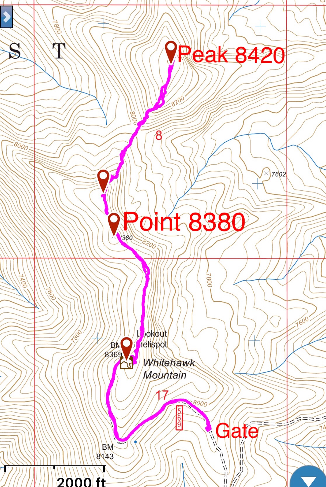
My GPS track. It is 0.9 miles with 460 feet of elevation gain from the gate to the lookout and another 0.6 miles to the high point. Round trip stats (from the gate to Peak 8420): 4.8 miles with 1,300 feet of elevation gain.
Additional Resources
Regions: Central Salmon River Mountains->Johnson Creek - Middle Fork Divide Peaks->Salmon River Mountains->WESTERN IDAHO
Mountain Range: Central Clearwater Peaks
Year Climbed: 2019
Longitude: -125.52769 Latitude: 44.30479