Elevation: 8,445 ft
Prominence: 1,065
This peak is not in the book. Published November 2022
Peak 8445 is the high point on a massive ridgeline that separates Dry Gulch from North Fork Deer Creek. It is most easily climbed via its northeast ridge from the North Fork Deer Creek Trail/FST-157. USGS Buttercup Mountain
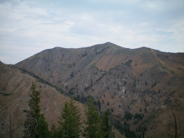
Double-humped Peak 8445 as viewed from the south. Livingston Douglas Photo
Access
From Albertson’s at the north end of Hailey, drive north on ID-75 for 1.9 miles to a signed junction with Deer Creek Road/FSR-097. Turn left/west onto Deer Creek Road and drive 9.9 miles to the end of the road at the Deer Creek trailhead (6,030 feet). The Deer Creek trailhead has a bathroom and ample parking. GPS coordinates: 43⁰31’44”N, 114⁰30’18”. Please note that the USGS map shows a Deer Creek Picnic Area (which no longer exists), fails to show the trailhead, and shows Deer Creek Road continuing much farther up Deer Creek than it actually does.
South Rib/Southeast Ridge, Class 2+
The Climb
[Please note that a less-steep way to climb the southeast ridge is from its base at the signed junction of Deer Creek Road and North Fork Deer Creek Road/FSR-103. This junction is located 0.3 miles before the end of Deer Creek Road. This route avoids the steep south rib.]
From the Deer Creek trailhead, bushwhack directly north up a STEEP shoulder of loose gravel/scree and scrub. The slope eases after the first 400 feet or so and the terrain is easier scrub with less scree/gravel. Reach the merger with the southeast ridge and head left/northwest on gentler grade of scrub and scree/gravel with rocky ridge outcrops. The ridge bends left/west at 7,600 feet then bends back to the right/northwest at a ridge point/hump at 7,920+ feet. Continue climbing up the endless ridge to the east summit (Point 8380). The ridge traverse west-northwest to the true summit is on easy, open terrain (short scrub and broken rock). The summit has a modest cairn and is at a ridge corner.
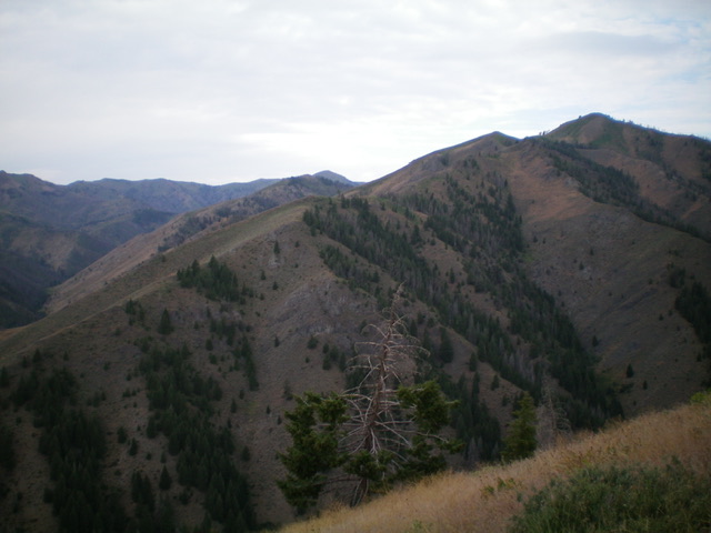
Peak 8445 (summit is well right of center) and its magnificent southeast ridge (descending diagonally left from the summit), my ascent route. Livingston Douglas Photo
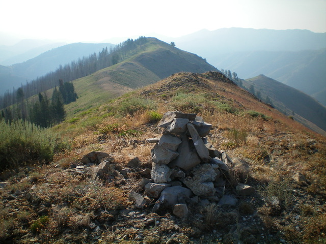
The large summit cairn atop Peak 8445, looking down the southeast ridge. Livingston Douglas Photo
Southwest Ridge, Class 2
The Descent
From the summit, descend southwest on easy gravel and short scrub (decent for boot-skiing) then bash through some thick-ish scrub to reach Saddle 7589, which connects Peak 8445 to Peak 7903. This concludes the first leg of today’s 2-peak adventure. Peak 7903 is up next.
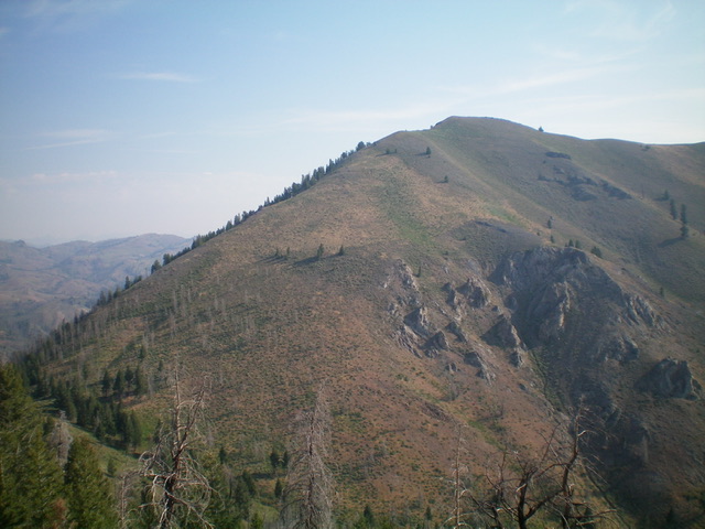
Peak 8445 (summit is just right of center) and its easy southwest ridge (left skyline), my descent route. Livingston Douglas Photo
Additional Resources
Regions: Smoky Mountains->WESTERN IDAHO
Mountain Range: Smoky Mountains
Longitude: -114.53049 Latitude: 43.54829