Elevation: 8,500 ft
Prominence: 280
This peak is not in the book. Published November 2021
Peak 8500 is located at the head of Upper Brown Canyon in the White Knob Mountains. USGS Shelly Mountain
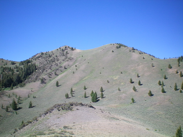
Peak 8500 and its double-humped summit. The true summit is the right/west hump. Livingston Douglas Photo
Access
Same as for Peak 8714. This is the second leg of a 2-peak adventure that includes Peak 8714 and Peak 8500. This journey covers 7.0 miles with 2,650 feet of elevation gain round trip.
Southeast Ridge, Class 2
The Climb
From the 8,220-foot connecting saddle, follow a game/cattle trail steeply northwest in very loose sand/gravel as it switchbacks up toward the false summit. The trail ends before reaching the false summit. Follow the rocky, narrow ridge crest to the false summit then drop 35 vertical feet to a minor saddle of short scrub. Continue northwest up the short scrub on the ridge crest to reach the summit of Peak 8500. Surprisingly, the unranked summit has a decent cairn and a triangulation post/wiring.
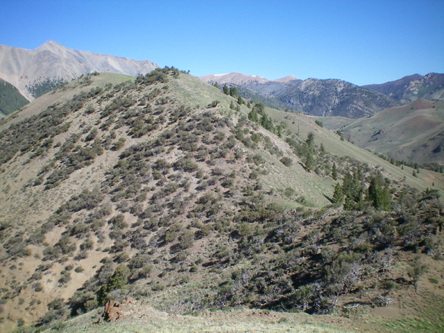
Peak 8500 as viewed from the southeast (ascent route). The true summit is the open hump left of center, not the forested hump in dead center. Livingston Douglas Photo
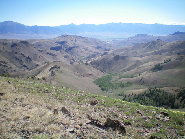
View of Upper Brown Canyon (forested in dead center) and the northeast ridge (left of center) from the summit. The northeast ridge was my descent route. Livingston Douglas Photo
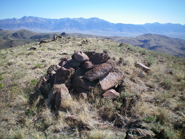
The summit cairn atop Peak 8500. Livingston Douglas Photo
Northeast Ridge, Class 2
The Descent
From the summit, descend northeast then north on a narrow ridgeline that is actually the north ridge. Leave the north ridge and drop northeast down a sagebrush face to reach a “saddle” at the top of the northeast ridge proper. Follow the open ridge up to a rocky ridge point. Skirt the point on its left/west side and continue along the undulating ridge going over (or just skirting) a few more rocky ridge outcrops. Scramble up to Point 7792 then descend east to a saddle of sorts.
Turn sharply left/north here and follow the narrow ridge crest, which is now a mix of rocky outcrops and mountain mahogany. Skirt the clogged crest on short scrub and loose gravel/scree as the ridge heads northward down toward Trail Creek and the old jeep road/trail. Make a final descent right/east then bend left/north to intercept the visible road below. Follow the road 1.5 miles down Trail Creek and back to Alder Creek Road and your parked vehicle. You must cross the small creek a few times on this road descent.
Additional Resources
Regions: EASTERN IDAHO->White Knob Mountains
Mountain Range: White Knob Mountains
Longitude: -113.67719 Latitude: 43.80119