Elevation: 8,540 ft
Prominence: 480
This peak is not in the book. Published February 2020
Peak 8540 is located east of the main Lick Creek Range Crest between North Fork Buckhorn and Fitsum Creeks. This peak is in the middle of nowhere. USGS Fitsum Peak
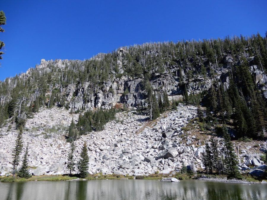
The West Face of Peak 8540 as viewed from Lake 7195. John Platt Photo
Access
East Fork Lake Fork trailhead [(B)(3)(b) on Page 136]. Hike up the East Fork Lake Fork Trail to the junction with the Idler Creek Trail. The Idler Creek Trail is not shown on recent Forest Service maps. John Platt found that it was maintained for a short distance in 2018. Leave the trail and climb to Fitsum Summit. Hike down from the pass to the small lake at 7,195 feet at the base of the Peak 8540’s West Face.
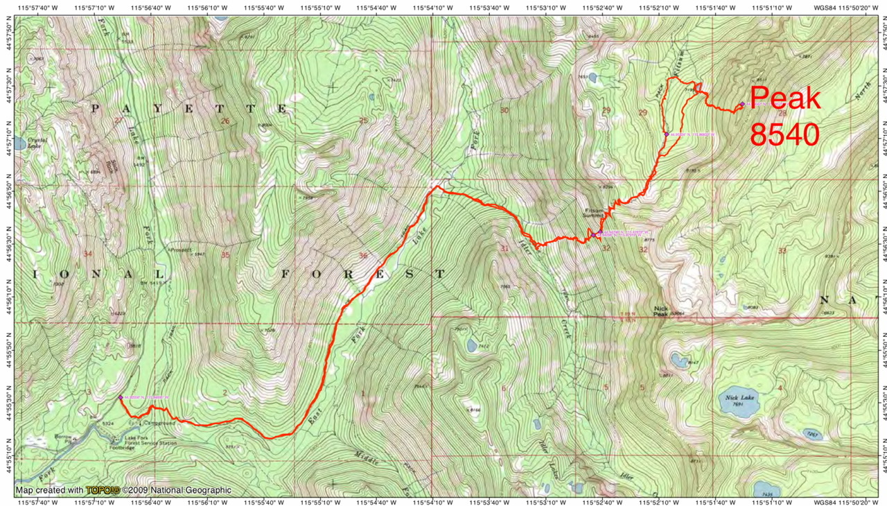
John Platt’s GPS track for the West Face Route.
West Face, Class 3 with Class 4 Blocks
Climb up the broken West Face, skirting cliffs as necessary. Once on the summit ridge, there are numerous granite obstacles to work around. Use the link below to read John Platt’s narrative of his climb up the route. John’s overnight journey to climb this route covered 15.3 miles with 6,248 feet of elevation gain round trip.
Additional Resources
Mountain Range: Western Salmon River Mountains
First Ascent Information:
- First Ascent Year: 2018
- Season: Summer
- Route: West Face
- Party: John Platt
Longitude: -115.85709 Latitude: 44.95659