Elevation: 8,547 ft
Prominence: 287
This peak is not in the book. Published November 2023
Peak 8547 is a rocky hill that overlooks the small hamlet of Nicholia. It is most easily climbed via old mining roads and the northeast ridge. This area is a mix of private and public land, so be careful. The initial access road legally crosses through private land for a short distance. The remainder of the climb is on a combination of BLM land, State of Idaho Land, and National Forest Land. USGS Italian Canyon
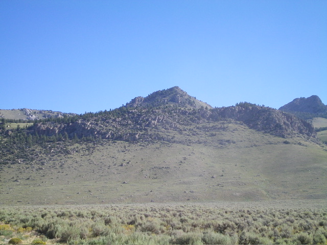
Peak 8547 (dead center) as viewed from Nicholia Road to its southwest. Livingston Douglas Photo
Access
From ID-28 at virtual MM57.5, turn right/north onto [signed] Nicholia Road and drive 3.1 miles north then north-northeast to an unsigned road junction. Bear left/northwest at this junction to stay on Nicholia Road. At 3.6 miles, reach a signed junction for the Viola Mines jeep road. Park at the base of this road in the confines of Nicholia. This junction is at 6,945 feet and 44⁰21’35”N, 113⁰00’31”W).
West Face/Northeast Ridge, Class 3
The Climb
From the road junction, hike north up a BLM road that follows the right/east side of Smelter Gulch. Reach an unsigned junction with a meadow and nearby split-rail fence to the left/west. Head right/east up an old, rocky mining road that is steep in spots. This road goes up the west face of Peak 8547 crosses to the south side of Viola Gulch. In gaining elevation, the road does a few switchbacks. At the road bend of the third south-heading switchback (where the road turns hard left), leave the road and bushwhack south up through a thick pine forest to reach the rocky, open northeast ridge.
Scramble southwest up the narrow ridge in a tedious mix of steep ridge rock/boulders and sagebrush (Class 3) to reach the small, rock-and-sagebrush summit. The summit has a decent cairn with a tree branch stuck in it. The other sides of this peak are ugly mixes of steep rock, pine forest, and scrub. The climb can be shortened by cutting the long road switchbacks in open grass and easy scrub up the west face.
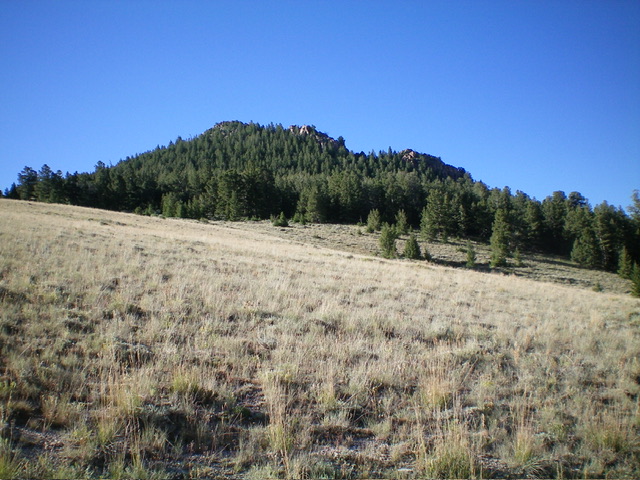
Forested Peak 8547 as viewed from the north. Livingston Douglas Photo
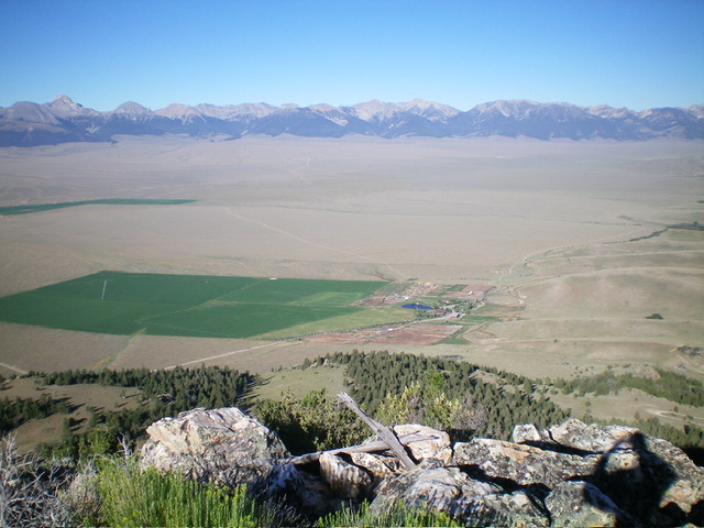
View of Nicholia from atop Peak 8547. The Lemhi Range is in the distance. Livingston Douglas Photo
Additional Resources
Regions: Beaverhead Range->EASTERN IDAHO
Mountain Range: Beaverhead Range
Longitude: -112.9850 Latitude: 44.3638