Elevation: 8,580 ft
Prominence: 320
This peak is not in the book. Published November 2023
Peak 8580 is located at the mouth of Clear Creek Canyon in the Beaverhead Mountains. It is a hump on the long southwest ridge of Peak 10780. Peak 8580 is most easily climbed from Clear Creek Road to its south. USGS Morrison Lake
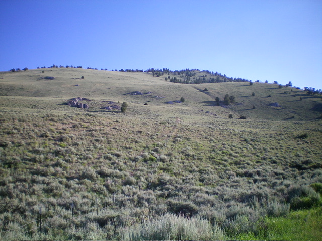
Peak 8580 (forested hump in center) as viewed from the south (start of climb). Livingston Douglas Photo,
Access
From the signed junction of ID-28 and ID-29 in Leadore, drive 0.2 miles northeast on ID-29 to a signed junction. Reset your odometer here. Turn right/east onto Hawley Gulch Road (which begins as a county road and eventually becomes FSR-275). At 3.8 miles, reach a signed road junction. Go straight onto Eighteenmile Road. Drive another 9.4 miles southeast then east on Eighteenmile Road to an unsigned 4-way road junction. Go left/east onto Clear Creek Road (which has deteriorated into a 2-track road) and drive 3.6 miles to a grassy pullout on the left/northwest side of the road after crossing Clear Creek on a bridge and just before reaching a cattle gate/fence. Park here (7,370 feet; 44⁰32’51”N, 113⁰07’11”W).
South Face/Southwest Ridge, Class 2
The Climb
From the parking pullout, scramble directly north up the south face through sagebrush (initially) then up an easy mix of short grass and broken rock. Reach the crest of the southwest ridge and head right/northeast to the summit. The terrain on the southwest ridge is a mix of field grass and a few scattered pines and junipers. The rounded ridge becomes more forested and has some deadfall and sagebrush higher up. The summit area is small and open. It had a small cairn which I built up a bit. The summit offers nice views of the higher Beaverheads in the area.
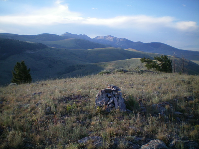
Summit view from Peak 8580, looking south. Livingston Douglas Photo
Additional Resources
Regions: Beaverhead Range->EASTERN IDAHO
Mountain Range: Beaverhead Range
Longitude: -113.1143 Latitude: 44.5573