Elevation: 8,561 ft
Prominence: 341
This peak is not in the book. I added my GPS track and two photos to this page. As Livingston points out this peak is protected by large stretches of downfall. Updated June 2025
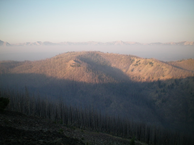
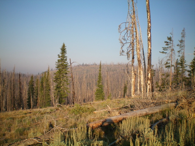
Peak 8561 is overshadowed by its big brother to the northeast, Basin Butte (8,854 feet). Consequently, this peak is overlooked and is rarely climbed. It is in a massive burn area and requires an unpleasant bushwhack from Basin Butte Road to its east. USGS Basin Butte
Peak 8561 as viewed from Basin Butte to its northeast. Livingston Douglas Photo
Access
From ID-21 west of Stanley, turn right/east onto [signed] Stanley Creek Road/FSR-653. At 1.3 miles, go left at a signed junction to stay on FSR-653. At 1.5 miles, reach an unsigned “T” junction. Go left/northwest onto Basin Butte Road/FSR-432. Reset your odometer here. At 3.9 miles, reach a signed junction with the Little Basin Cutoff Trail/FST-4042 (an ATV trail). Go straight to stay on FSR-432. At 5.7 miles, reach a pullout at the base of a steep, rocky road section (7,980 feet). Park here (GPS coordinates: 44⁰18’57”N, 114⁰58’58”W) or continue up the rough road to a saddle at 8,220 feet.
Southeast Face, Class 2
The Climb
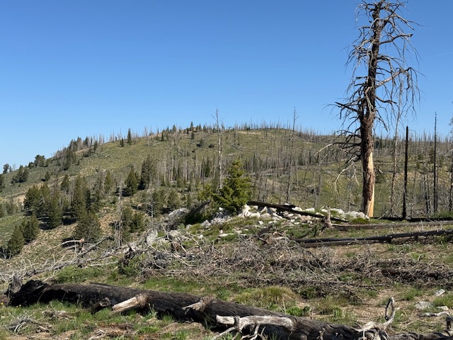
From the parking pullout at 5.7 miles, hike up the steep, rocky road to a saddle at 8,220 feet and a signed trail junction with FST-4037. Leave the road and hike briefly west on FST-4037 then bushwhack through a miserable mess of downed trees and snags in a burn area. Bushwhack left/southwest up onto a semi-open ridge for much less deadfall. Head west on the open ridge then drop 50 vertical feet to a saddle. From the saddle, scramble northwest up a slope of burnt logs (stay left/west for less deadfall) to reach the summit plateau in semi-open terrain.
Head right/north up the tilted plateau to reach the high point of Peak 8561 at the north end of the plateau. There was no summit cairn so I built a minimal one with the only two loose rocks that I could find. From the summit, return to the high saddle then scramble east up over the semi-open ridge hump and bushwhack east through charred forest to intercept Basin Butte Road just above, and south of, the 8,220-foot road saddle. This descent route has much less blowdown and difficulties than the ascent route.
The summit ridge of Peak 8561 viewed from the east. The summit is on the north/right side of this photo.
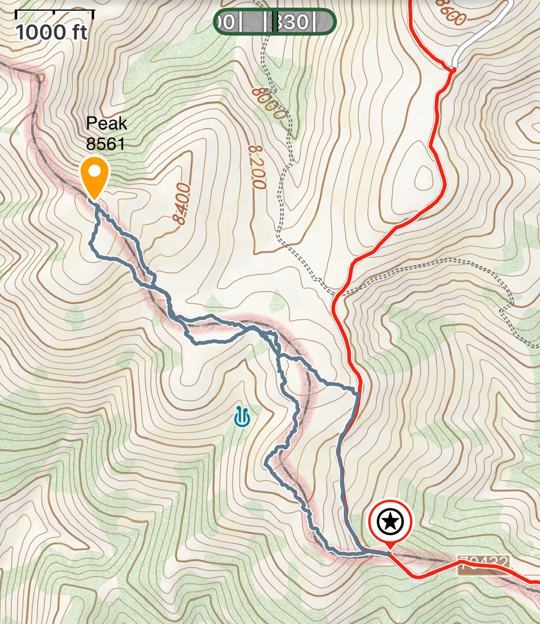
My GPS attack for Peak 8561. My route was 2.9 miles round trip with 542 feet of elevation gain. On the return route we dropped down to the road to avoid a long stretch of downfall.
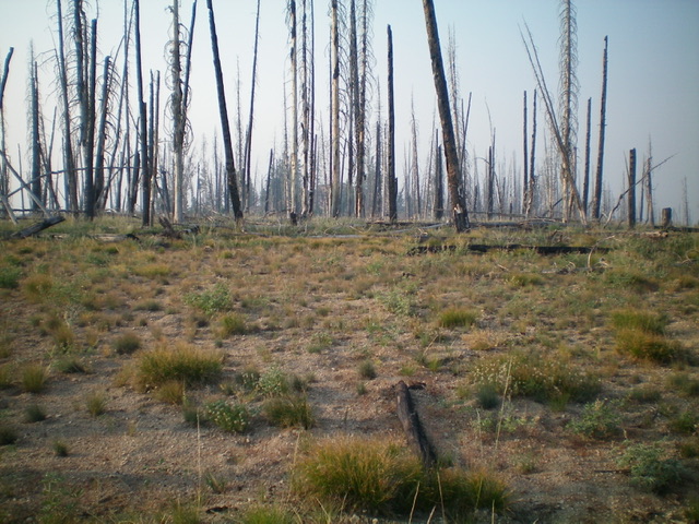
The burnt summit of Peak 8561. Livingston Douglas Photo
Peak 8561 (forested hump in distance) as viewed from the east. Livingston Douglas Photo
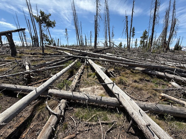
The downfall along the route can be discouraging at times.
Additional Resources
Regions: Eastern Salmon River Mountains->Salmon River Mountains->Southeast Corner Peaks->WESTERN IDAHO
Mountain Range: Eastern Salmon River Mountains
Year Climbed: 2025
Longitude: -114.99671 Latitude: 44.32691