Elevation: 8,563 ft
Prominence: 303
This peak is not in the book. Published November 2023
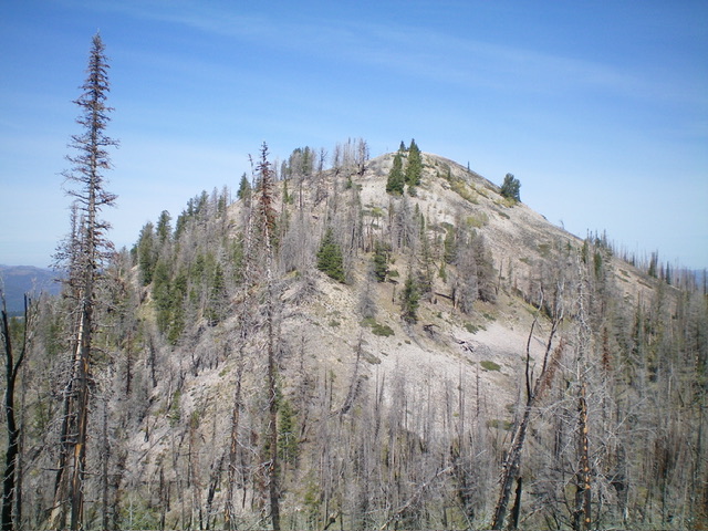
Peak 8563 is a talus heap that sits above the headwaters of Weasel Creek in the Eastern Salmon River Mountains. It is a ridge hump on the north ridge of Peak 9351. It can either be climbed via its northwest ridge from Opal Lake or via its west ridge from Panther Creek Road. USGS Opal Lake
Peak 8563 (dead center) as viewed from the west. Livingston Douglas Photo
Access
Park along Panther Creek Road/FSR-055 either at the mouth of Weasel Creek (small, improved pullout) or in a nice turnout about 0.1 miles to the north (my choice). The turnout is at 6,685and 44⁰53’20”N, 114⁰18’26”W. This nice turnout is 0.6 miles south of [signed] Opal Creek Road/FSR-252 and 4.2 miles north of Morgan Creek Summit. This is the first leg of a 2-peak adventure that includes Peak 8563 and Peak 9351. It covers 8.5 miles with 3,400 feet of elevation gain round trip.
West Ridge/Northwest Ridge, Class 2
The Climb
From the roadside turnout, walk 0.1-0.2 miles south to the mouth of Weasel Creek. Scramble up the steep, open sagebrush/grass ridge crest from its toe on the left/north side of Weasel Creek. Contrary to the USGS topo map, this is open terrain with a few scattered pines. It is a magnificent ridge scramble from the valley floor. The ridge bends right-ish/northeast and the slope eases. The terrain is easy, open scrambling in sagebrush and grass. But that is about to change for the worse. The ridge flattens and pine forest takes over at about 7,450 feet. The pine forest is semi-open but the deadfall is wicked and endless.
This misery continues up to about 7,800 feet where the slope steepens and the pine forest is much easier. At about 7,950 feet, reach the burnt crest of the northwest ridge. Follow the burnt ridge crest southeast to a ridge hump. Descend 30 vertical feet from this hump to a ridge saddle. From the saddle, scramble east then southeast in a mix of live and burnt pines to reach a talus slope. Scramble up this slope to reach a final slope of boulders and talus. Climb up this rocky section to reach the open, rocky, gentle summit of Peak 8563. There is a large quartzite talus cairn on the high point.
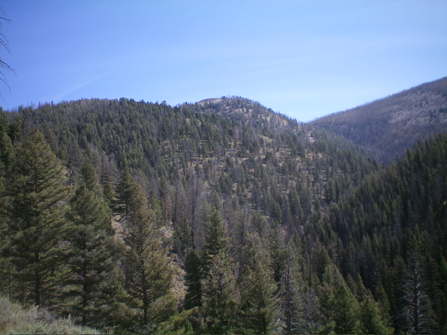
Peak 8563 as viewed from the southeast. Livingston Douglas Photo
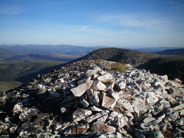
The summit cairn atop Peak 8563. The summit hump is a talus heap. Livingston Douglas Photo
Southeast Ridge, Class 2
The Descent (then Ascent)
From the summit, descend southeast on a narrow ridge of pines and scree, avoiding a steep talus slope on the east face. At about 8,350 feet, head sharply left/north and descend to cross the head of a dry gully in an area of live pine trees. Scramble southeast across a minor forested ridge to reach the 8,260-foot connecting saddle with Peak 9351. This concludes the first leg of today’s 2-peak adventure. Peak 9351 is up next.
Additional Resources
Mountain Range: Eastern Salmon River Mountains
Longitude: -114.2758 Latitude: 44.8962