Elevation: 8,565 ft
Prominence: 425
This peak is not in the book. Published November 2022
Peak 8565 is somewhat overwhelmed by higher peaks in the Baker Creek area but it is, nonetheless, a handsome summit with a magnificent south ridge that makes for a beautiful scramble in mostly open or semi-open terrain. Crossing [raging] Baker Creek is the crux of this climb but, thankfully, there are fallen trees to help overcome this problem. USGS Boyle Mountain
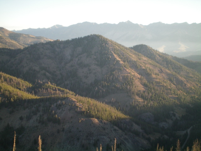
Peak 8565 (in mid-ground, dead center) as viewed from the south. Livingston Douglas Photo
Access
From ID-75 north of Ketchum, turn left/south onto [signed] Baker Creek Road/FSR-162. Reset your odometer here. At 2.9 miles, reach a signed junction with East Fork Baker Creek Road/FSR-168. At 3.8 miles reach a pullout on the right side of the road. Park here (7,060 feet). GPS coordinates: 43⁰44’03”N, 114⁰34’39”W. This pullout is 0.1 miles before reaching [signed] Badger Gulch, from which this climb begins. There are no parking pullouts at Badger Gulch.
South Ridge, Class 2
The Climb
From the roadside pullout, walk 0.1 miles up Baker Creek Road to a meadow with a sign for Badger Gulch. Badger Gulch is on the opposite side of the road (the left/east side). Peak 8565 is on the right/west side of Baker Creek Road and, unfortunately, is on the other side of Baker Creek. From the Badger Gulch sign, descend in semi-open forest to reach the forested surroundings of Baker Creek. Bushwhack downstream for about 75-100 yards to find a solid, fallen tree to cross the raging creek.
Once across Baker Creek, climb steeply northwest through scrub to reach the forested ridge crest. Climb the steep ridge north then make a final jog left/northwest to reach the semi-open summit. The summit has a decent cairn. The ridge terrain is a mix of scattered pines, scree/gravel base, sagebrush and other veg, and a few minor rocky ridge outcrops. A few sections of the south ridge are very steep. All of that said, the ridge offers some magnificent views and is a challenging, but pleasant, scramble.
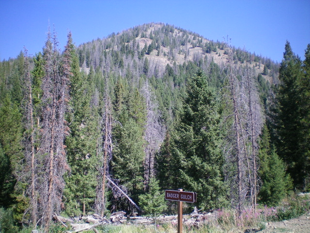
Peak 8565 and its south ridge (dead center) as viewed from Baker Creek Road to its south. The south ridge was my ascent route. The summit is not quite visible. Livingston Douglas Photo
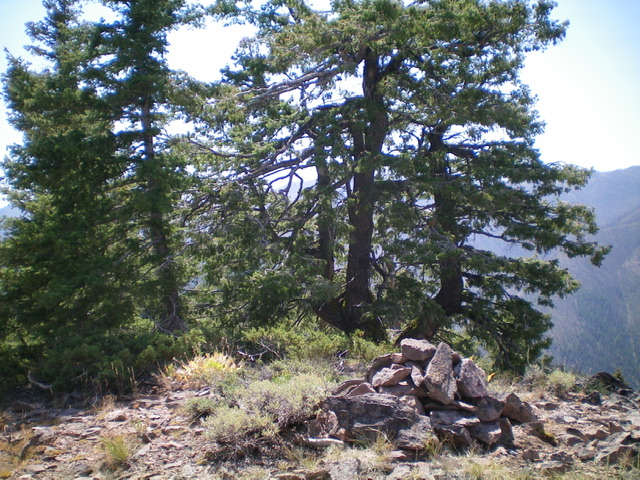
The summit of Peak 8565. Livingston Douglas Photo
Additional Resources
Regions: Smoky Mountains->WESTERN IDAHO
Mountain Range: Smoky Mountains
Longitude: -114.58429 Latitude: 43.74249