Elevation: 8,569 ft
Prominence: 389
This peak is not in the book. In 2018, John Platt led a group across the ridge. Read his trip report at this link: Profile Loop 2018. The next peak along the ridge is Parks Peak. Published June 2018
Peak 8569 is located a little more than a mile east of Parks Peak on the Profile Gap/Parks Peak Ridge. This peak has a long North/South summit ridge. The peak can he reached from either Profile Gap via a long multi-peak traverse or from the Parks Peak Trail after a strenuous hike out of the East Fork South Fork Salmon River Canyon. USGS Parks Peak
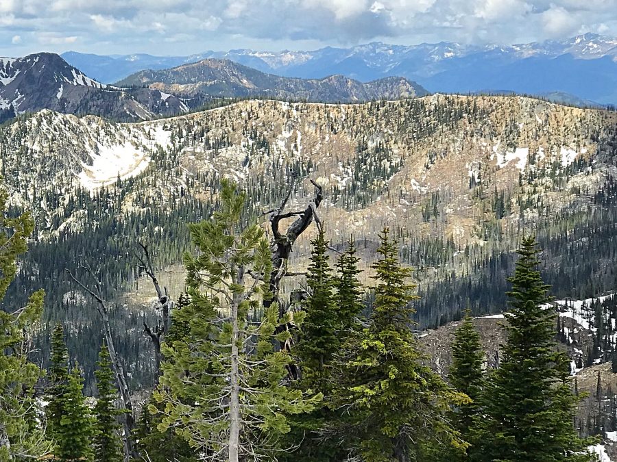
Peak 8569 as viewed from the east.
Access
For the East approach, start on Profile Gap. This pass is on Big Creek Road/FS-340 [(B)(3.2) on Page 137]. Use the Peak 8615 page to reach the start of the traverse.
To climb from the West, use the Parks Peak Trail [(B)(3)(i) on Page 136].
Peak 8608/Peak 8569 Ridge Traverse, Class 2+
The easiest way to reach this peak is via a traverse from Peak 8615. The traverse between the two peaks is a ridge walk and there are sections of old trail in places. The best line stays on the North Side of the ridge in the saddle and then on the ridge crest as you climb to the summit.
Parks Trail/Southwest Ridge, Class 2+
The traverse from the Parks Peak Trail is a bit convoluted. The GPS track shows the line I followed, but there are other options available. Leave the trail at the 8,400-foot contour, drop off the ridge and descend to the saddle shown below. The track shown below detours around some deep, rotten snow I encountered. In dry conditions, this detour is not necessary. Drop into the drainage and stay along the base of Parks Peak’s Northeast Ridge as much as you can, aiming for the pass between the two peaks. There are a couple of large boulder fields to navigate over or around, depending upon your preference. Once on Peak 8569’s Southwest Ridge, it is an easy walk to the top.
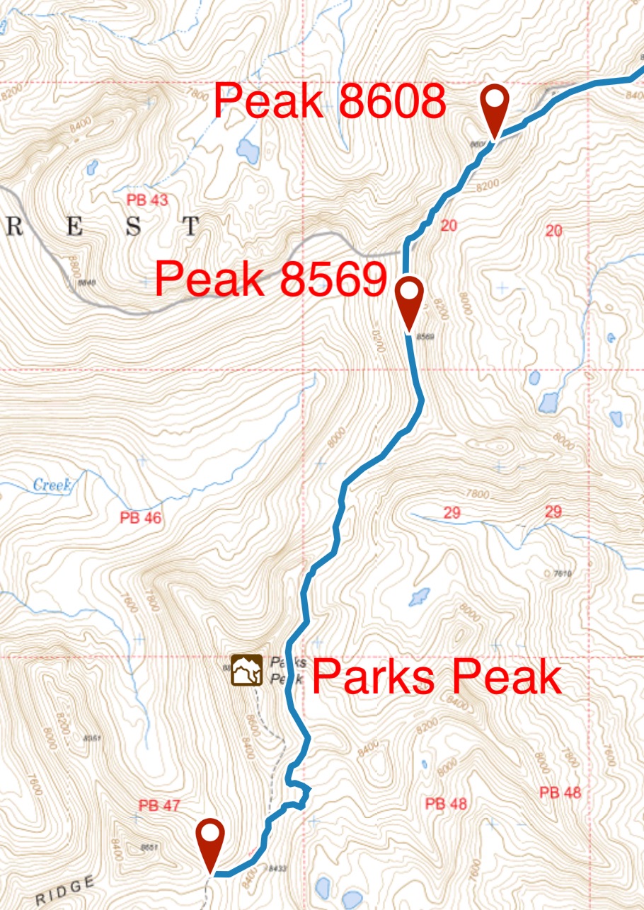
My GPS track showing the traverse line over Peak 8569.
Additional Resources
Regions: Big Creek to Red Ridge Peaks->Central Salmon River Mountains->Salmon River Mountains->WESTERN IDAHO
Mountain Range: Central Salmon River Mountains
Year Climbed: 2018
Longitude: -115.50801 Latitude: 45.05109