Elevation: 8,580 ft
Prominence: 720
This peak is not in the book. Livingston Douglas added the Northwest Face Route and photos to Derek’s entry. Updated November 2022
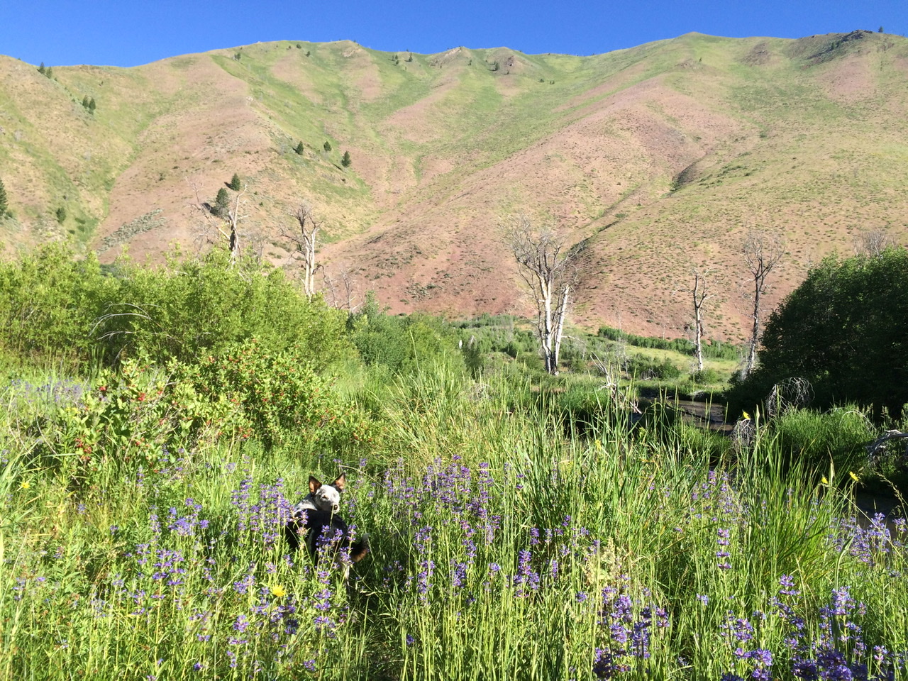
This peak is locally known as “Big Mama,” undoubtedly named for its massive South Face that wraps around the northern side of Sun Valley’s Bald Mountain. The east side of the summit sees daily visitors via a ridge hike dubbed “Stairmaster.” It’s a local favorite for fit hikers who want the most bang for their buck, since it gains 1,800 vertical feet in a mile. A large cairn sits at the top of this ridge. The actual summit of “Big Mama” is two miles away and sees almost no visitors outside hunting season.
The entire south face of this mountain is off-limits during Winter to allow for elk grazing. I lived at the base of this mountain for a few years so I climbed it from multiple directions (including unlisted routes that required permission from my neighbors). If you’re interested in taking the grand tour, you can park a bicycle or second vehicle at the base of the south ridge then start your hike at “Stairmaster.” Parking is available at all of the starting points shown on the map. USGS Griffin Butte
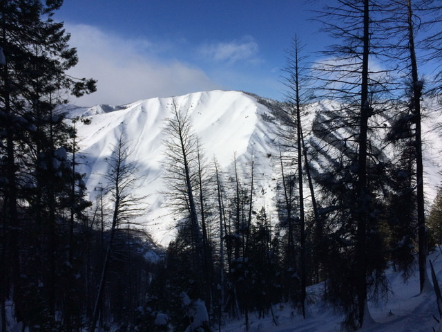
The summit of “Big Mama” in Winter as viewed from North Face of Bald
Mountain. Derek Percoski Photo
Access
FS-217/Warm Springs Creek Road [(A)(7) on Page 214]
South Ridge, Class 2
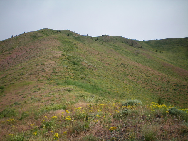
The south ridge can be approached from various spots. My preferred variation starts just past the small bridge located a mile past the end of the pavement. This section of the road is well maintained. The crux of the hike is the first 100 vertical feet since the bases of the ridges roll off in steep Class 2 terrain.
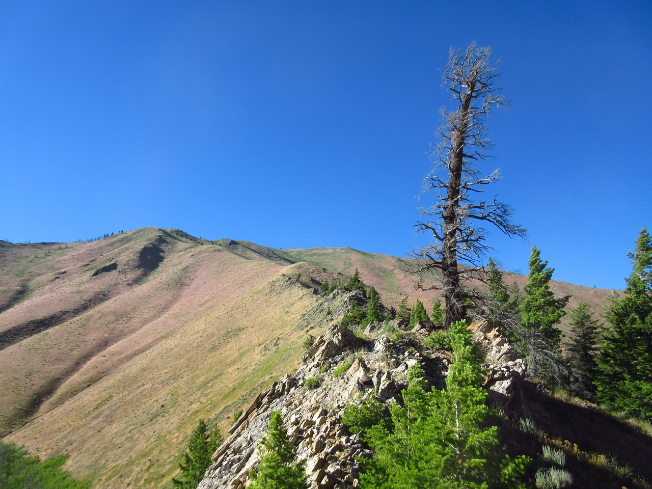
Once you get past the steep start, the ridge hike on
the south ridge is pleasant. The east variation is shown in the photo. Derek Percoski Photo
Sunset view of “Big Mama” from above the summit of Baldy (paragliding
photo). Derek Percoski Photo
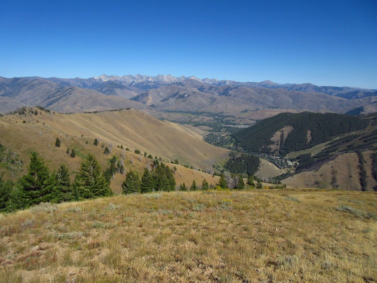
View from the summit: Ketchum, Sun Valley, and the Pioneer Mountains. Derek Percoski Photo
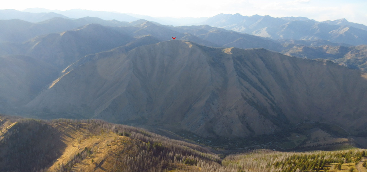
The south face of Big Mama in rare form. It is green for about two
weeks in late Spring before the hot sun dries out the vegetation. Derek Percoski Photo
Northeast Face, Class 2
This is certainly not the most aesthetic way to the summit but if you have a solid 4×4 vehicle, it is the most efficient. The West Fork Warm Springs Road gets progressively more rugged but it’s possible to drive to 7,900 feet on the south ridge of Peak 8445. At this point, the road meets the single-track Eve’s Gulch Trail. You can also get there by mountain biking or motorcycling up Eve’s Gulch Trail from the Adam’s Gulch trailhead [(A)(6) on Page 214].
Northwest Face by Livingston Douglas
Northwest Face, Class 2
The Descent
The summit of Allen Mountain is rarely visited by climbers. I rebuilt the torn-down summit cairn. From the summit, bushwhack northwest down through a burn area to reach a saddle and FST-146 that passes through the saddle. This bushwhack is brutal. The terrain is a mix of snags, downed burnt timber, and very loose gravel. In some areas, there is thick vegetation. The 7,860-foot saddle is the connecting saddle between Allen Mountain and nearby Peak 8445. This concludes the first leg of today’s 2-peak adventure. Peak 8445 is up next.
Allen Mountain and its charred northwest face (my descent route). Livingston Douglas Photo
Looking up the south ridge about midway up. The summit is just right of center but is not yet visible. Livingston Douglas Photo
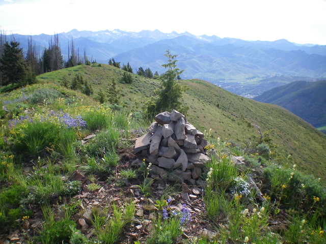
The large, rebuilt summit cairn atop Allen Mountain. Livingston Douglas Photo
Additional Resources
Regions: Smoky Mountains->WESTERN IDAHO
Mountain Range: Smoky Mountains
Longitude: -114.44549 Latitude: 43.68689