Elevation: 8,595 ft
Prominence: 335
This peak is not in the book. Livingston Douglas added his variation of the route that I followed to this page. Updated November 2023
This peak is southeast of Dollarhide Summit on the main crest of the Smoky Mountains. This summit has one of the best 360-degree views in all of Idaho. In addition to the neighboring Smoky Mountain peaks, the view includes the Soldier Mountains, Boise Mountains, Bounder Mountains, Pioneer Mountains, and the eastern end of the Bennett Mountain Hills. Hiking the trail-less east side ridge is for the most part across easy, open slopes. The peak is accessible from by trail either from Dollarhide Summit or from the Middle Fork Warm Springs Creek. The loop route set out below melts out earlier than the northern routes. USGS Dollarhide Mountain
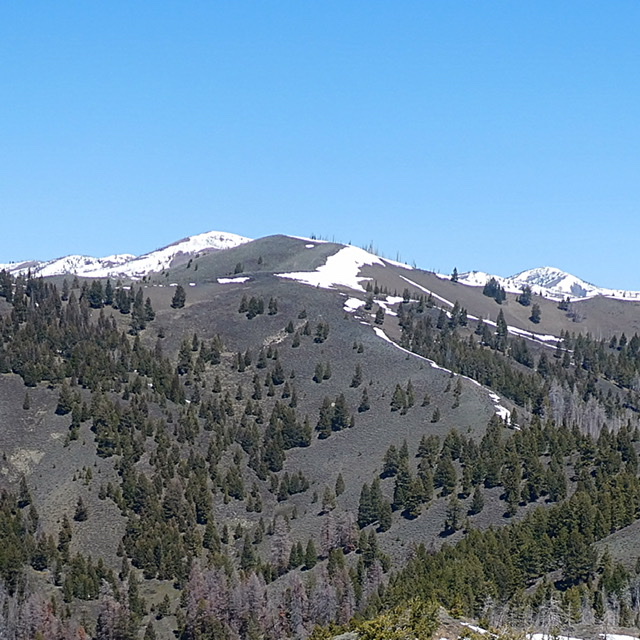
Trouble Peak as viewed from Peak 8100. South Dollarhide Peak is the snow-covered summit behind Trouble Peak.
Access
FS-017/Willow Creek Road [(B)(1) on Page 214]. FS-017 is located 10 miles east of Fairfield, Idaho on US-20. Google Maps provides directions if you search for Willow Creek (Camas County) Idaho. The Willow Creek Road is well-maintained and is suitable for 2WD vehicles when dry. There are a lot of blind corners in the last couple of miles. The road forks at 5.9 miles past the Sawtooth National Forest boundary. At this point, take the left fork a short distance to a parking spot near where the West Fork Willow Creek Road is gated. Park here.
Willow Creek Ridges Loop, Class 2
This route can be hiked either clockwise or counterclockwise. This entry describes the route counterclockwise. Follow the deteriorating, closed road up the West Fork Willow Creek to the point where it turns up the western side of the canyon. Leave the road and bushwhack up to the ridge top on the east side of the canyon. Once on the ridge top, follow the ridge over Peak 8100 to the summit in 4.3 miles. Some maps show trails along this route. I found no evidence of a maintained trail until meeting up with FST-199 just southeast of the summit.

Hiking the trail-less east side ridge is mostly across easy, open slopes.
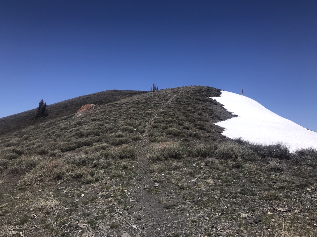
The final stretch to the summit follows this unofficial trail.
To descend the ridge on the west side of the West Fork Willow Creek, follow FST-084 south-southwest to Point 8035. This trail is occasionally maintained and is easy to follow. From Point 8035, descend southeast over Point 7879 to the valley. This is a steep descent.
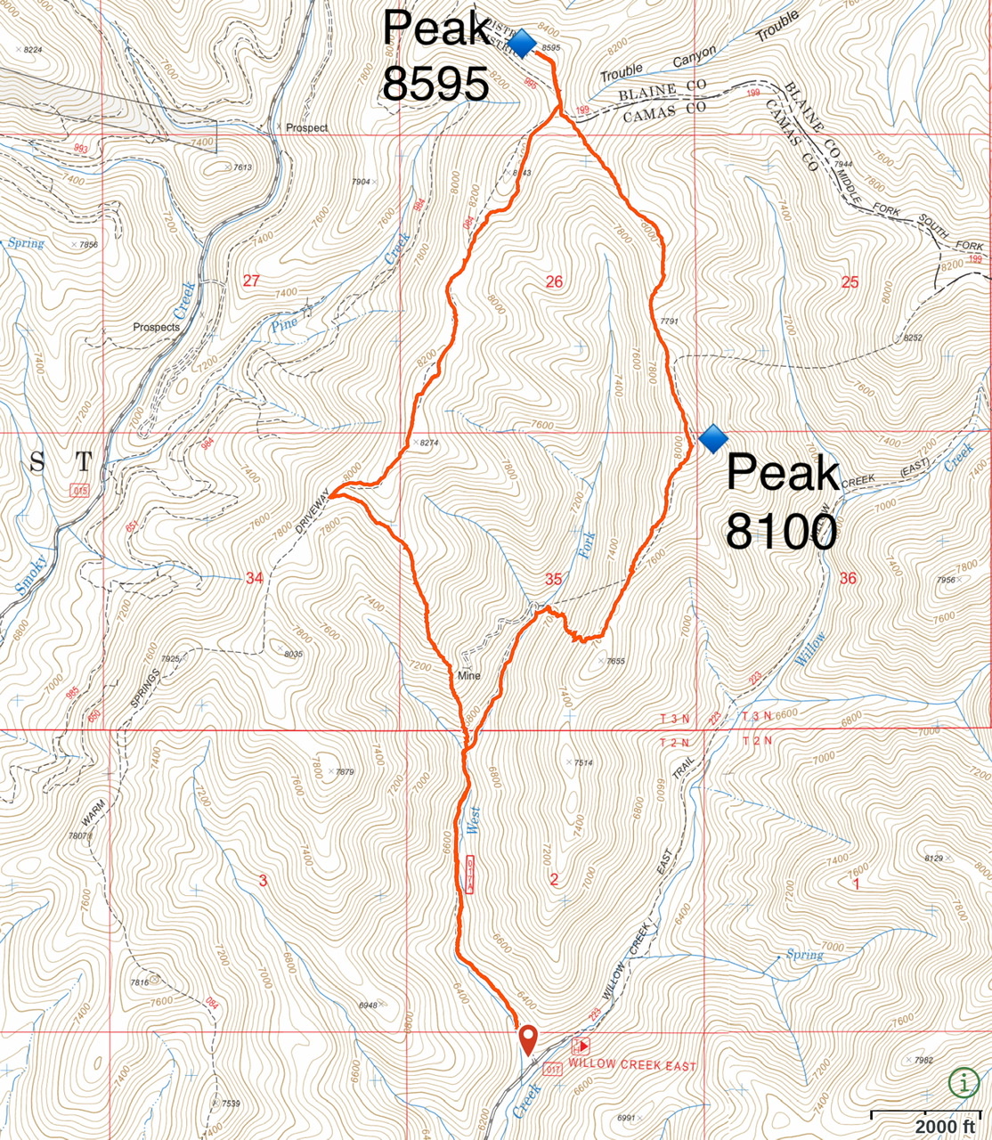
My GPS track for Willow Creek Ridges Route. The route covers 8.4 miles with 2,636 feet of elevation gain.
Livingston Douglas’ Route Description and Descent Route Variation
Access
This is the second leg of a 2-peak adventure that includes Peak 8100 and nearby Peak 8595/Trouble Peak. This journey covers 8.5 miles with 3,180 feet of elevation gain round trip. It has a few minor variations when compared to the Lopez route so it is of similar length. However, the elevation gain is over 500 feet more than the Lopez route so I believe that Tom’s elevation gain figure is a bit understated.
Map Errors
The entire West Fork Trail (shown on the USGS topo map as a road) is not shown on the Sawtooth National Forest Map. There is an unofficial trail (not shown on any maps) on the south ridge of Peak 8595/Trouble Peak. There is an unofficial trail (not show on any maps) coming up the southeast ridge of Peak 8595/Trouble Peak to the ridge juncture with the south ridge.
Southeast Ridge, Class 2
The Climb
From the 7,791-foot connecting saddle between Peak 8100 and Peak 8595/Trouble Peak, scramble north up over a bare ridge hump then drop 65 vertical feet to a final saddle at 7,980 feet. Pick up an unofficial ridge trail here and follow it northwest to the juncture with the south ridge of Peak 8595. Follow another unofficial trail up the south ridge for its final segment to reach the open summit of Peak 8595. There was no summit cairn so I built one.
Peak 8595/Trouble Peak (in dead center) and its southeast ridge (just left of center), my ascent route. Livingston Douglas Photo
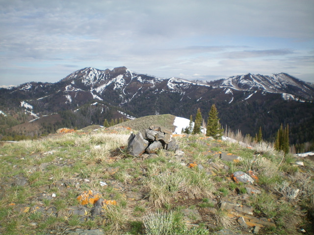
The newly-built summit cairn atop Peak 8595/Trouble Peak. Livingston Douglas Photo
South Ridge/South Shoulder, Class 2
The Descent
This descent differs from the Lopez route in that it leaves the south ridge at an earlier point and offers a more direct line back down to the West Fork Trail. From the summit of Peak 8595/Trouble Peak, descend briefly south on an unofficial trail to a fork in the ridge. Head right/southwest at this fork and continue along the ridge on the unofficial trail. The ridge undulates southwest then south-southwest over Point 8443 and Point 8274. Once atop Point 8274, the ridge once again forks. Descend southwest from Point 8274 to remain on the main ridge crest. After a brief jog southward, the ridge forks yet again. At this fork, the main ridge goes hard right/west.
Leave the main ridge at this fork and head south-southeast down a prominent shoulder that leads directly down to the West Fork Trail at the mouth of a gully. The south shoulder is magnificent. It is open, is not too steep overall, but does have a few steep-ish sections. The sagebrush requires some weaving and the underlying scree/gravel is a bit loose and tedious. There are a few ridge outcrops lower down but nothing serious. They can be skirted easily, albeit on steep, loose shale. The toe of the south shoulder reaches the West Fork Trail at a major feeder stream crossing. Once on the trail, follow it south then southeast for about a mile to return to the West Fork Trailhead and your parked vehicle.
The long south ridge of Peak 8595/Trouble Peak (in mid-ground), my descent route. The summit is at far right. Livingston Douglas Photo
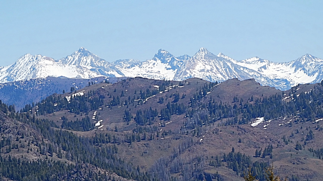
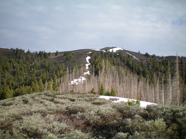
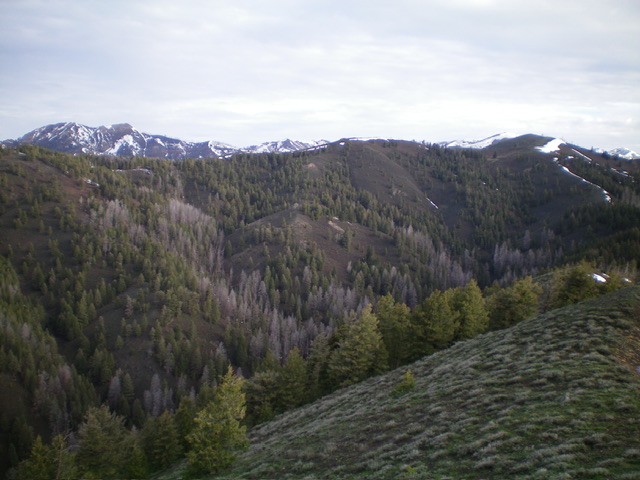
This is a small teaser of the magnificent view from the summit.
Additional Resources
Regions: Smoky Mountains->WESTERN IDAHO
Mountain Range: Smoky Mountains
Longitude: -114.63789 Latitude: 43.57679