Elevation: 8,605 ft
Prominence: 1,305
This peak is not in the book. Published January 2023
Peak 8605 is the highest peak in the menagerie of humps in the Stump Peak area of the Webster Range. It is most easily climbed via its forested, weaving west ridge from the Lander Cutoff Road. Be aware that the ridges in this area can be confusing. The gullies narrow and thick with brush. USGS Stump Peak
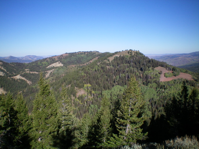
Peak 8605 (just left of center) as viewed from near the summit of Stump Peak to its southeast. Livingston Douglas Photo
Access
From ID-34 east of Wayan, turn left/south onto [signed] Lanes Creek Cutoff Road. This road is a smooth, well-maintained dirt/gravel county road. Head south on Lanes Creek Cutoff Road for 3.1 miles to an unsigned junction with the Lander Cutoff Road/FSR-107. Turn left/east onto FSR-107 and drive a short distance, cross a small creek on a bridge, and reach BLM land (a short patch) then enter the Caribou National Forest. After driving 3.4 miles on FSR-107, the road reaches a signed junction on a ridge crest with FSR-261 (left). Park at this junction or at the nearby dispersed campsite in the pine forest (7,290 feet). GPS coordinates: 42⁰54’50”N, 111⁰15’18”W. FSR-107 is a decent, but narrow, road with potholes and some ruts. It is not “well-graded” as some suggest.
Map Errors
The USGS topo map fails to show FSR-261.
West Ridge, Class 2
The Climb
From the road junction, hike (or drive) east on FSR-261 (a narrow, rutted road with lots of mudholes) for just over ½ mile to a sharp right bend in the road where the road moves away from the west ridge. Leave the road here (7,350 feet) and follow a use trail that heads diagonally left/northeast up onto the forested west ridge. The use trail crosses the ridge crest and contours to the left/north side of the ridge and ends well below the ridge in a forested area. Either leave the trail where it crosses the ridge crest or bushwhack right/south from the end of the trail up onto the ridge.
The west ridge is a narrow, forested ridge with an on-and-off game trail. Higher up, the ridge bends left/northeast after crossing a ridge hump and dropping 35 vertical feet to a flat ridge section. High up, follow a good game trail in the forest and start seeing parallel ridges to the right/east. Ignore them. Continue northeast then cross an open gully to reach the summit ridge just south of the summit hump. Scramble up an open sagebrush slope to reach the sagebrush-covered summit. There was no cairn on top so I built a nice one on the high point amidst the thick sagebrush. The summit offers magnificent views of surrounding peaks, including Stump Peak (8,603 feet) to its southeast.
The bushwhack up the west ridge is tedious in sections and relatively easy in others. Overall, it’s not too bad as bushwhacking goes. The difficulty of the west ridge is staying on course on the descent. The ridge wiggles a bit, has some ups and downs, is forested (limiting visibility), and loses its definition in a few sections. Thankfully, the ridge isn’t overly lengthy so if you get off course, you can typically correct your mistake in reasonably short order.
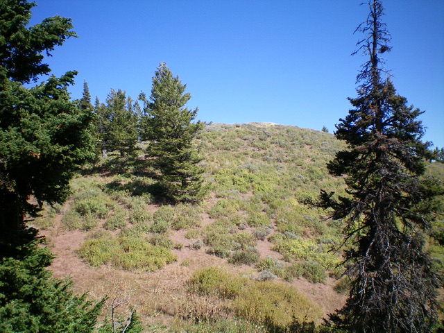
The hidden summit hump of Peak 8605 as viewed from the southwest. Livingston Douglas Photo
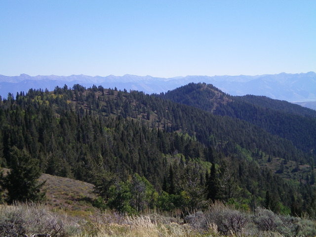
Summit view from the top of Peak 8605. Stump Peak is the hump right of center in the distance. Livingston Douglas Photo
Additional Resources
Regions: Peale Mountains->SOUTHERN IDAHO->Webster Range
Mountain Range: Peale Mountains
Longitude: -111.2202 Latitude: 42.9175