Elevation: 8,605 ft
Prominence: 1,585
This peak is not in the book. Published November 2018
Canyon Creek Peak is located in the Salmon River Mountains directly west of ID-21. The East Slopes of the peak contain the majority of the avalanche chutes that frequently close ID-21 in Winter. Aside from the Idaho Transportation Department (ITD) avalanche-control staff, Canyon Creek Peak is seldom climbed. USGS Grandjean
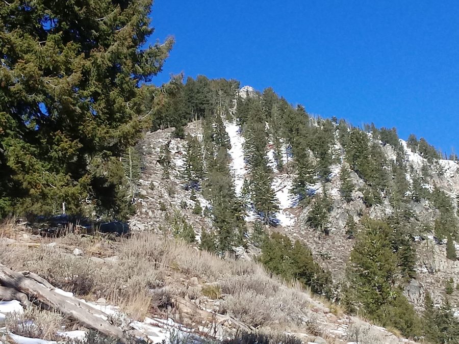
Canyon Creek Peak. Brett Sergenian Photo
Access
Access this peak from ID-21. The turnoff is on the left, 3.9 miles past the Grandjean turn. If you are coming from Stanley, the turn will be on the right in 33 miles. Look for a short side road at the base of the peak’s South Ridge. This road dead-ends in less than one-quarter mile. Park just off this side road.
South Ridge, Class 2
Hike uphill for about 600 vertical feet to reach the South Ridge. Follow the ridge for about 2 miles and 2,700 vertical feet, to the summit. On the summit, you will find a weather station operated by ITD. Most of the route has decent game trails but some bushwhacking is necessary. Climb this peak between May 15th and November 15th, as parking is prohibited for safety reasons between Grandjean and Banner Summit during Winter. The views of the surrounding Salmon River and Sawtooth Mountains are excellent.
The [lower] North Summit looks like it is a Class 3 scramble. Canyon Creek Peak can also be climbed from Banner Summit by following the ridge over North Spring and Spring Peaks for 6 miles (one way). The ITD avalanche-control staff use another route during Winter that is a bit more gradual than the South Ridge.
Canyon Creek Peak as viewed from an ascent of Mount Zumwalt. This view makes it pretty clear that there is a lot of avalanche terrain on the peak. The South Ridge is on the left. John Platt Photo
Additional Resources
Regions: Central Salmon River Mountains->Johnson Creek - Middle Fork Divide Peaks->Salmon River Mountains->WESTERN IDAHO
Mountain Range: Central Salmon River Mountains
Longitude: -115.2447 Latitude: 44.2301