Elevation: 8,700 ft
Prominence: 720
This peak is not in the book. Published November 2021
Peak 8700 is located due east of Jerry Peak. It sits above Howell Canyon. Due to private land in Howell Canyon, access is limited. This climb is entirely on BLM land and covers 8.5 miles with 2,150 feet of elevation gain round trip. An alternate route is to climb Peak 8700 from Trail Creek Road and its undulating south ridge. That route is also entirely on BLM land. Do not confuse this Peak 8700 with the Peak 8700 that is located a few miles southwest along Trail Creek Road near Garden Creek. USGS Jerry Peak
Access
From the junction of US-93 and [signed] Trail Creek Road (15.3 miles north of Main Street in Mackay), turn left/southwest onto Trail Creek Road. Drive 4.6 miles on Trail Creek Road to a signed junction with Walker Way. Turn right/north onto Walker Way and drive 1.3 miles to an unsigned junction with Howell Canyon Road (labeled “Coates Road” on the USGS topo map). Go straight/west onto Howell Canyon Road and drive 2.5 miles to a road junction and cattle guard/fence row. There are “Private Property/No Trespassing” signs here and you cannot drive farther up Howell Canyon Road. Park in a large pullout at this junction (6,776 feet).
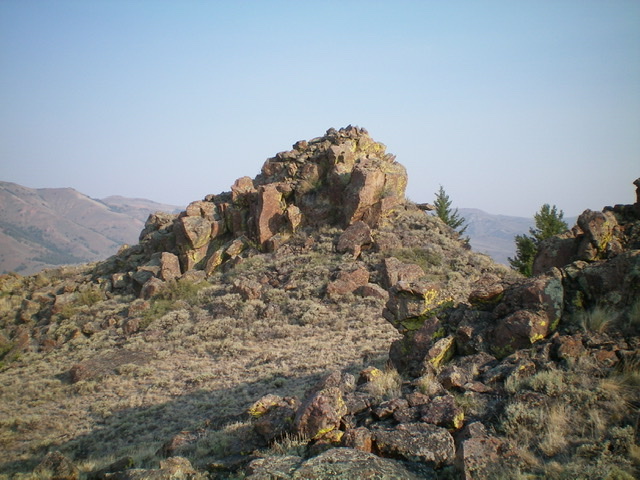
Peak 8700 as viewed from the southeast. Livingston Douglas Photo
East Spur/Northeast Ridge, Class 3
The Climb
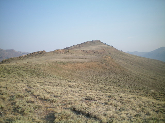
From the road junction in Howell Canyon, hike southwest up a 2-track road on the left/southeast side of a fence row to reach a 7,060-foot saddle on the east spur. Leave the road at this saddle, cross the cattle fence, and scramble west up through easy scrub to reach a minor saddle just west of Point 7344. Continue west up a scrub slope (initially on an old 2-track road) to reach a ridge junction at 7,400 feet where the north spur joins the northeast ridge. Follow the ridge southwest up to Point 7961 (cairn here) and another ridge juncture.
From Point 7961, head south to a narrow saddle to find a well-beaten cattle trail (and perhaps a hidden coyote trap as I did).Follow this trail southwest up the ridge crest to intersect a fence row (shown on the USGS topo map). Hike along a cattle trail that follows the fence row up the ridge. The fence row skirts the right/northwest side of a large ridge hump (Point 8544) to reach a saddle. Leave the fence row here and follow a cattle trail west to skirt the north side of Point 8615 to reach yet another ridge saddle.
From this final saddle, follow the fence row north-northwest on the right/east side of the ridge crest then back up onto the ridge crest to reach the lateral, rocky summit ridge area. Leave the fence row and scramble to its right/east to find a grassy chute leading up onto the summit crest. Follow the rocky crest north-northwest to reach the true summit of Peak 8700, which is a pile of boulders/blocks at the north end of the elongated summit ridge area. Scramble up the east face of the summit block (Class 3) on its left side then diagonally right up the center to reach the small, airy high point of Peak 8700. There is a decent cairn on top.
The summit block of Peak 8700, a Class 3 scramble. Livingston Douglas Photo
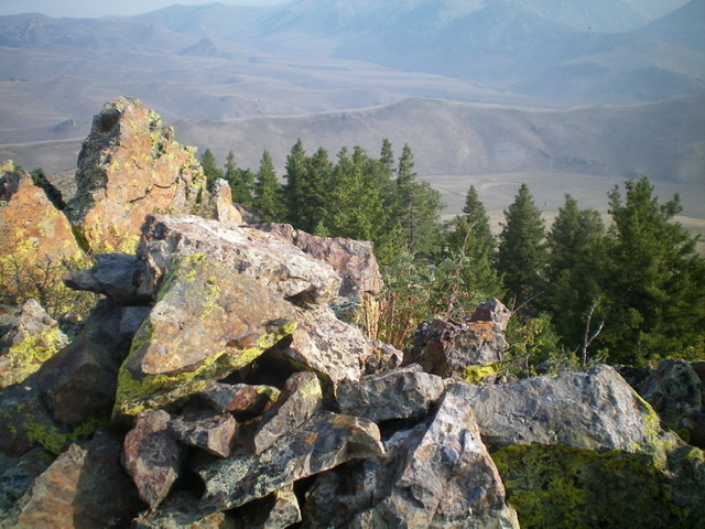
The rocky summit of Peak 8700 with a patch of pines nearby. Livingston Douglas Photo
Note: Have you ever stepped on a hidden coyote trap and had a trap pulling on your boot? This was a first for me and it happened on this peak. It was superbly hidden. The trap fell off my large boot pretty quickly. Good thing I wasn’t wearing light hikers.
I provided a photo of the trap. All of that metal was hidden under the gravel on a ridge with a cattle/use trail. The trap was right underneath the trail, which is how it caught me. It was illegally placed there by a local rancher trying to trap a coyote.
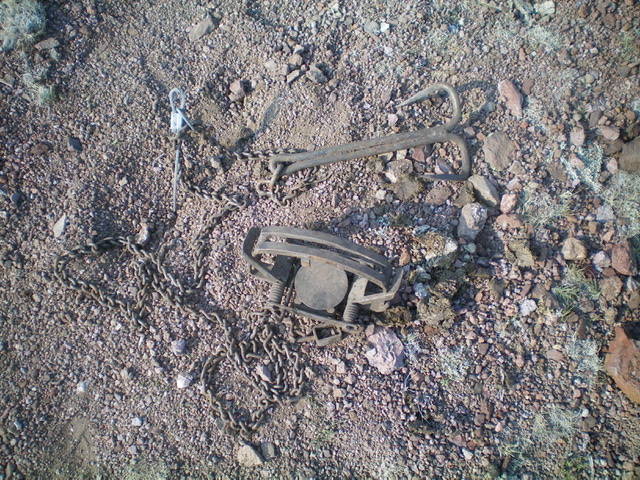
A live, illegal foot trap (for coyotes) that was hidden on a use trail on the northeast ridge. It caught my left boot but quickly fell off. Good thing I have big feet. Livingston Douglas Photo
Additional Resources
Regions: Boulder Mountains->EASTERN IDAHO
Mountain Range: Boulder Mountains
Longitude: -114.0501 Latitude: 44.0556