Elevation: 8,714 ft
Prominence: 374
This peak is not in the book. Published November 2021
Peak 8714 is located between Upper Brown Canyon and Lower Brown Canyon in the White Knob Mountains. USGS Shelly Mountain
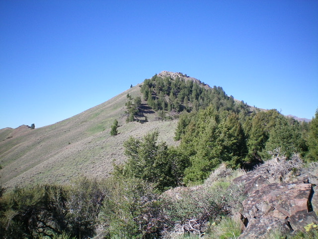
The rocky summit cap of Peak 8714. Livingston Douglas Photo
Access
This is the first leg of a 2-peak adventure that includes Peak 8714 and Peak 8500. It covers 7.0 miles with 2,650 feet of elevation gain round trip.
From the junction of Main Street and US-93 in Mackay, drive 2.4 miles south on US-93 to a signed junction with Houston Road. Turn right/south onto Houston Road and drive 2.0 miles to an unsigned junction with Alder Creek Road. Turn right/south onto Alder Creek Road and drive 1.6 miles to an unsigned junction at a private ranch and a sharp right/southwest turn in the road. Reset your odometer here. From the unsigned junction, drive southwest on Alder Creek Road. At 2.9 miles, reach the Challis National Forest boundary. At 5.0 miles, reach a signed road junction with FSR-590 (which is actually FST-4347/Cherry Creek ATV Trail). Park in a pullout at this junction (6,745 feet).
Northeast Ridge, Class 2
The Climb
From the road junction, hike up FSR-590 for a short distance to a gate where the road becomes a poorly-maintained ATV trail (FST-4347). FST-4347 goes way up the Trail Creek drainage; however, the USGS topo map shows only the first 0.4 miles of FSR-590/FST-4347. This trail is signed as “Cherry Creek Trail” but is actually Trail Creek Trail. At about 0.5 miles up the road (then ATV trail), go right at an unsigned junction to cross to the right/west side of Trail Creek. After hiking about 0.7 miles up FSR-590/FST-4347, reach the base of the northeast ridge. Leave FST-4347 here and bushwhack south across the dense willows and aspens in the Trail Creek drainage.
Scramble southeast up a steep sagebrush slope to reach the crest of the northeast ridge of Peak 8714. The northeast ridge is a weaving, undulating ridge that leads directly to the summit of Peak 8714. Follow a weak 2-track southwest up the ridge until it leaves the ridge. Continue south up the sagebrush-covered ridge to reach a prominent rocky outcrop. Skirt the right/west side of this outcrop and regain the ridge crest immediately above it. Continue south then southwest then right/west on the ridge crest to where it joins the north ridge at a juncture at about 8,100 feet.
Contrary to what the USGS topo map shows, the ridge area above the ridge juncture is forested. Scramble southwest then south then southwest up the meandering ridge through a mix of ridge trees, open sagebrush, and other brush to reach the rocky, open summit of Peak 8714. The summit of Peak 8714 has a modest cairn. The final push to the top is on crumbly lava rock. The summit itself is small and rocky. It provides an excellent view of the ridge traverse to Peak 8500, the next objective of today’s adventure. The climb up the northeast ridge of Peak 8714 is a real grind and is not easy. It includes a few ups and downs.
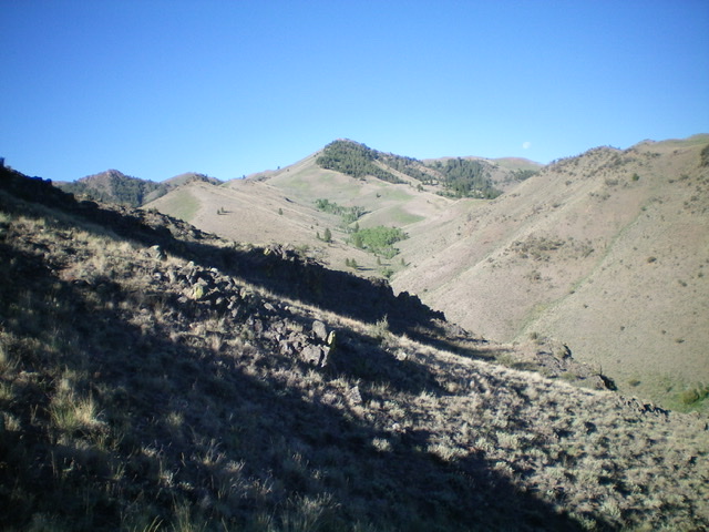
Peak 8714 (forested hump in center at distance) as viewed from low on the northeast ridge (my ascent route). Livingston Douglas Photo
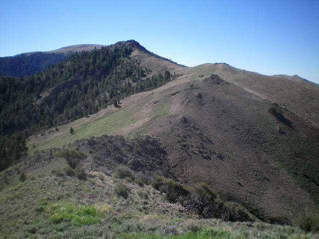
Looking back up the northwest ridge of Peak 8714 (my descent route). The summit is the forested hump left of center. Livingston Douglas Photo
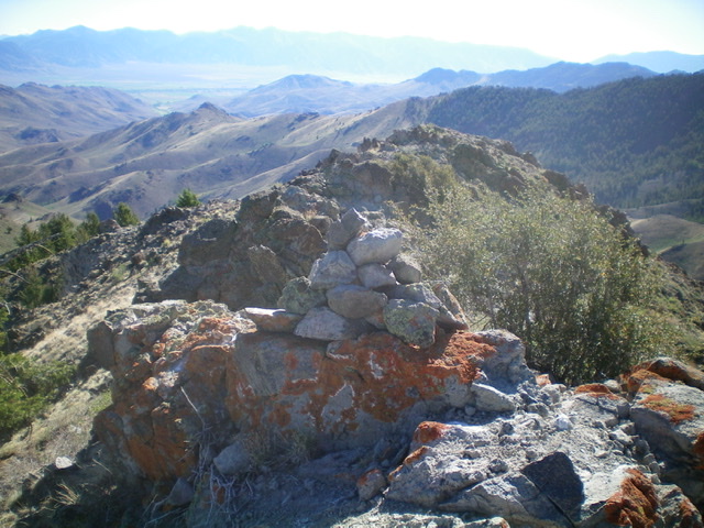
The summit cairn atop Peak 8714. Livingston Douglas Photo
Northwest Ridge, Class 2
The Descent
From the summit, descend northwest down the ridge to a narrow saddle. The initial descent is on crumbly ridge outcrops and minor chutes on the right/north side of the ridge crest. The terrain then becomes short scrub and, lower down, an elk trail. The connecting saddle is at 8,220 feet and concludes the first leg of today’s 2-peak journey. Peak 8500 is up next.
Additional Resources
Regions: EASTERN IDAHO->White Knob Mountains
Mountain Range: White Knob Mountains
Longitude: -113.66569 Latitude: 43.79419