Elevation: 8,750 ft
Prominence: 560
This peak is not in the book. Published November 2023
Peak 8750 is an elusive, forested hump that is located west of the Continental Divide in the Beaverhead Mountains. There are hidden roads and trails in this area that will help you reach the summit. Otherwise, you will have a difficult forest bushwhack and potential navigational challenges. USGS Kitty Creek
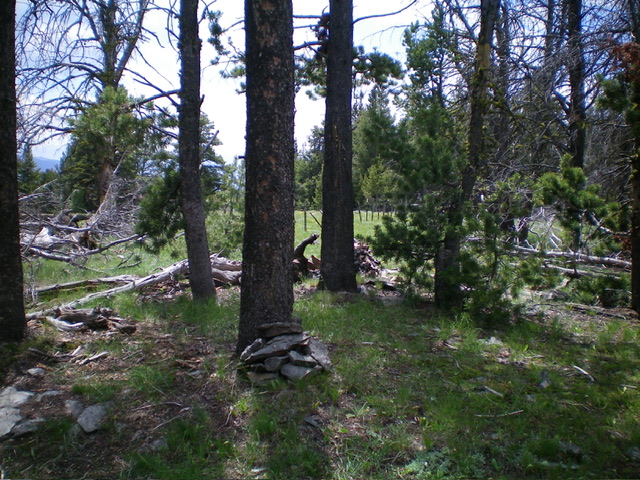
The semi-open summit of Peak 8750 with the fence row in the background. Livingston Douglas Photo
Access
From ID-28 at Tendoy, drive east on [signed] Tendoy Lane for 0.1 miles to a “T” junction. Go left/north onto the [signed] Lewis and Clark Backcountry Byway and drive 2.7 miles to a signed junction. Go right/east here to continue on the Byway. This junction is also 1.9 miles south of 17 Mile Lane which goes 0.4 miles west to reach ID-28 north of Tendoy. Reset your odometer at this junction. Drive 13.1 miles up the curving switchbacks of the Byway to a signed junction with a gated, closed road. Park in a large roadside pullout at this junction(8,280 feet; 45⁰02’51”N, 113⁰27’59”W). The closed road is a logging road and is the former Byway. It is shown incorrectly on the USGS topo map as the current Byway.
Map Errors
The Lewis and Clark Backcountry Byway skirts the northeast side of Point 8605. This is a major error on the USGS topo map, which has not been updated to reflect the current road position here. The old Byway is now a logging road that DOES go around the west side of Point 8605. The USGS topo map fails to show an old road that follows a fence row and heads from the 8,460-foot saddle southwest then west up to the summit area.
Northeast Ridge, Class 1-2
The Climb
From the road junction, leave the Byway and hike southwest then south up the gated/closed logging road. Reach an open area of active firewood cutting where the road flattens out. Look for a foot trail in the forest on the right/west side of the road about 100 yards before the road crosses a cattle guard/fence. It is difficult to see but is well worth the effort to find it. If you cannot find it, then continue south on the road to the cattle fence and follow the fence row right/west into the forest and down to a saddle at 8,460 feet.
If you successfully find the trail, follow it through the thick pine forest as it heads west then southwest down to a forested saddle at 8,460 feet. It turns into an old road as you approach the saddle. There is a split-rail cattle fence in the saddle. Follow this fence row via an old road (not shown on maps) southwest then west all the way to the semi-open summit of Peak 8750. Please note that the split-rail fence dies out about halfway up to the summit then reappears near and at the summit area as a barbed-wire fence. Both the old and the split-rail fence are left/south of the high point and the ridge crest in the summit area. I built a small cairn at the high point (which is in the pine forest), which is a pine tree on the ridge crest, just east of a large open area.
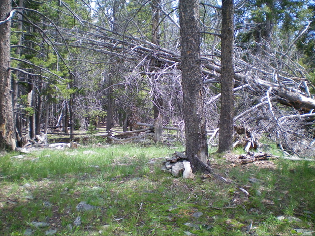
The summit of Peak 8750 with its newly-built “tree cairn.” Livingston Douglas Photo
Additional Resources
Regions: Beaverhead Range->EASTERN IDAHO
Mountain Range: Beaverhead Range
Longitude: -113.4990 Latitude: 45.0382