Elevation: 8,762 ft
Prominence: 342
This peak is not in the book. Published November 2023
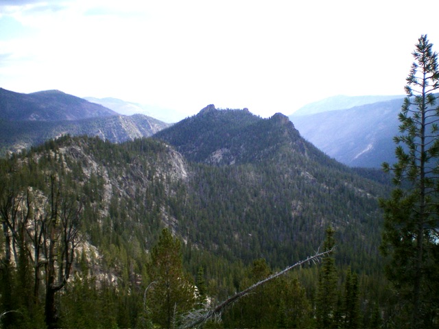
Peak 8762 is a rock-and-forest crag located just north of Golden Trout Lake in the Bighorn Crags. It is overlooked by climbers probably due to the bushwhack required to reach the summit area. The summit is a surprising block of rock that is hiding in the forest. It requires a Class 4 effort to reach the top. USGS Hoodoo Meadows
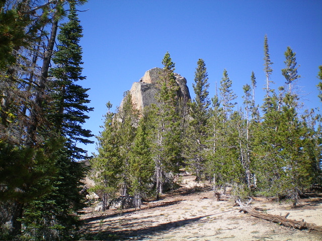
Peak 8762 as viewed from the southwest. The summit block is just left of center. Livingston Douglas Photo
Access
From the 4-way road junction, drive north then west then south up FSR-113 for a rugged, rutted 8.3 miles to a signed junction with FSR-114/Yellowjacket Lake Road. Turn right/northwest to stay on FSR-113/Bighorn Crags Road and drive 2.1 miles to a signed junction for “Golden Trout Lake.” Turn right/north and drive 0.1 miles to the trailhead loop for the Golden Trout Lake Trail/FST-070. Park along the loop (8,510 feet; 45⁰06’22”N, 114⁰31’17”W). The trail is unsigned at the trailhead turnaround loop. This trail is popular with fishermen but not with climbers.
Southeast Shoulder/South Ridge, Class 4
The Climb
From the trailhead, hike down the rocky, steep switchbacks to reach Golden Trout Lake in just under ½ mile. The trail ends at the southeast corner of the lake. Follow a use trail on the east side of the lake to reach a marshy outlet stream. Leave the trail and bushwhack northeast near the stream/marsh then cross to its left/west side to begin the steep scramble up to the south ridge of Peak 8762. This low valley is very marshy. It has thick field grass, pines, and some deadfall. It is not fun and has unusual changes in the terrain, which can be confusing.
But one thing IS clear—the massive ridge cliff face on the east side of Peak 8762 (to your left). You must find a way to climb up to the ridge crest. This is the first crux of this climb and it is not easy. From the marshy valley floor, scramble north then diagonally left/northeast below the cliffs to intercept the steep southeast shoulder. You can see this shoulder on the USGS topo map. This is difficult, steep terrain with loose gravel and lots of deadfall (Class 2+). Once on the shoulder, climb directly up it for a short section (Class 2+). Leave the shoulder to scramble north across steep, angled gravel (loose and difficult) to reach the [obvious] ridge saddle that sits just right/north of a massive ridge tower.
From the ridge saddle, cruise up the south ridge in an easy pine forest with a bed of granite gravel to reach the ominous summit block. Climb around the east side of the block to reach its north side. Find a 30-40 foot chute that leads left/south to the top of the massive blocks of rock. This chute is the peak’s only weakness. Once in the narrow chute, climb it to reach a narrow slot/chimney and climb it (the second crux of this climb) to reach the top of that slot (Class 4 or low Class 5). This chimney requires only about 10 vertical feet of climbing. An easy jump puts you on the highest two boulders. There are stunning views from the top. There were no signs of previous ascent.
On the descent, I returned down the southeast shoulder and descended directly to the marshy valley floor to avoid a diagonal descent of the east face. Once on the valley floor, follow the left/south side of the outlet stream westward up over a headwall of forest/brush/grass. Once atop the headwall, quickly return to the use trail alongside Golden Trout Lake and then back to FST-070. Hike about ½ mile up the steep switchbacks to return to the trailhead.
The Class 4 summit block is hiding behind the pine forest of the easy Class 2 approach. Livingston Douglas Photo
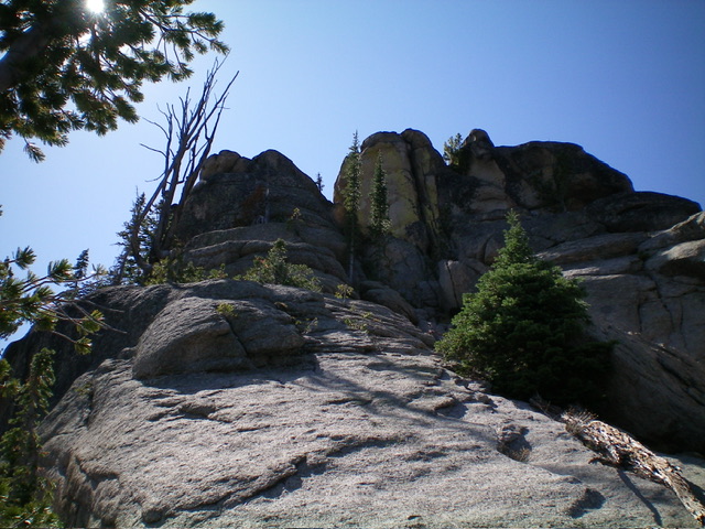
Looking up the Class 4 chute on Peak 8762. The summit block is in dead center. Livingston Douglas Photo
Additional Resources
Mountain Range: Eastern Salmon River Mountains
First Ascent Information:
- First Ascent Year: 2023
- Season: Summer
- Route: Southeast Shoulder/South Ridge
- Party: Livingston Douglas
Longitude: -114.5158 Latitude: 45.1202