Elevation: 8,762 ft
Prominence: 582

This peak is not in the book. Livingston Douglas supplied the detailed route descriptions found below. Updated November 2018
Pomerelle Peak is the highest point in the Pomerelle Ski area. Its summit can be reached either from the ski area lodge by walking up the runs or from the Mount Harrison Road by following a 4WD road up from the Twin Lakes Campground. Of course, you can also ride the ski lifts almost to the summit. USGS Connor Ridge
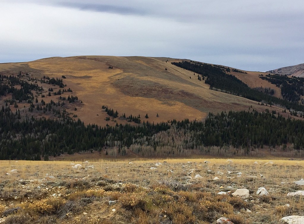
Peak 8762 as viewed from Connor Ridge.
2018 Update by Livingston Douglas
While most folks probably reach the summit of Pomerelle Peak via the ski lifts or ski runs, the northeast ridge is a magnificent scramble on easy, open scrub—arguably the BEST in the Albion Mountains. Yes, IT’S THAT DAMN GOOD.
Northeast Ridge, Class 2
Access
From ID-77, drive up Mount Harrison Road/FSR-549 for 6.9 miles to a hairpin turn in the road at the entrance to the Pomerelle Ski Area. Turn left/south and drive 0.1 miles into the ski area parking lot and park near its northeast corner. The elevation here is 7,650 feet.
The Climb
This route is part of a ridge traverse from Connor Ridge to Pomerelle Peak. From Connor Flat, bushwhack southwest up through a short section of forest (mostly pines + a few aspens) for just over 100 vertical feet to reach the wonderful open slope of the northeast ridge/shoulder of Pomerelle Peak. The forest bushwhack is not fun (too much deadfall and brush) but it goes quickly.
The northeast ridge is so gentle that it will often feel like a face climb. Call it what you will, this is a truly enjoyable experience. The scrub is short and scattered, the base is broken rock, the slope is not too steep, and there are no obstructions like mountain mahogany to circumvent. You must, however, stay to the left/east of thicker scrub to keep this a pleasant experience. After just over 20 minutes of an uphill grind, you reach the summit ridge. Make a hard right/northwest turn here and follow a cattle fence up the ridge. It is best to cross to the right/northeast side of the fence and hike up a 2-track jeep road that runs next to the fence. The 2-track road eventually morphs into a decent footpath.
Higher up, the cattle fence bends left/northwest and no longer follows the ridge crest. Leave the fence footpath here and bushwhack up through a mix of ground talus/boulders and scrub, which is a bit tedious. The summit is a massive ground boulder that is located almost directly above the top of a ski lift. Surprisingly, there was nothing on top, not even a cairn—there is almost no loose rock to work with.
North Shoulder, Class 2
Access
Same as for the northeast ridge
The Descent
This route is part of a ridge traverse from Connor Ridge to Pomerelle Peak with a descent back down to the Pomerelle Ski Area parking lot. From the summit of Pomerelle Peak, follow the ridge crest northwest (briefly) then north to reach an ill-defined shoulder on the west side of a large gully that cuts the north face of the peak. This gully is just west of the primary ski lift. Bash your way through some thick scrub to reach the short veg of the ski slopes. There is a service road traversing across the top of the ski slopes here.
Walk left/west on the service road (briefly) to reach the north shoulder. Be careful here. There are two shoulders—one heading northwest and one heading north. You want the one heading north. Otherwise, you will end up at the Twin Lakes picnic area and have a long walk down Mount Harrison Road to get back to the ski area parking lot. Your objective in descending the north shoulder is to AVOID THE FOREST. Descend the north shoulder on cattle trails, then a mountain bike trail, then down the left-hand edge of a ski run. Finish the descent by following a weak footpath below the secondary ski lift, which follows the right-hand edge of the north shoulder lower down. Once you reach the base of the ski lift, walk across the parking lot to your vehicle.
Additional Resources
Regions: Albion Range->SOUTHERN IDAHO
Mountain Range: Albion Range
Year Climbed: 1998
Longitude: -113.61509 Latitude: 42.30579