Elevation: 8,767 ft
Prominence: 522
This peak is not in the book. Published November 2021
Peak 8767 is located at the head of Armison Gulch on a ridgeline that separates West Fork Creek from Challis Creek. It sits south-southeast of North Twin Peak (10,196 feet) and South Twin Peak (10,340 feet) and provides outstanding views of both peaks. Peak 8767 is most easily reached from FSR-537, a rugged 4WD road that becomes an ATV trail. USGS Twin Peaks
Peak 8767 (forested, right of center) as viewed from high on the northeast ridge. Livingston Douglas Photo
Access
From US-93 at the north end of Challis, turn left/west onto [signed] Clinic Avenue. Follow Clinic Avenue as it goes west briefly, then jogs north briefly, then heads west to a “T” junction with [unsigned] Challis Creek Road. This junction is 0.4 miles from US-93. Turn right/north onto Challis Creek Road and drive 9.7 miles to a signed junction. Go left for Mosquito Flat Reservoir (7 miles) and go straight/northwest for Bear Creek Road and Twin Peaks. Go straight here.
This road heads northwest briefly then turns sharply left/southwest to cross some private property and reach the Bear Creek drainage. The road bends right-ish/west to follow Bear Creek upstream. It is labeled as “Sleeping Deer Road.” From the signed junction on Challis Creek Road, drive 4.6 miles on Sleeping Deer Road/FSR-086 to a signed junction with FSR-537 at a sharp right bend in the road. Park here (7,320 feet). The final 1.9 miles of Sleeping Deer Road is rocky and narrow.
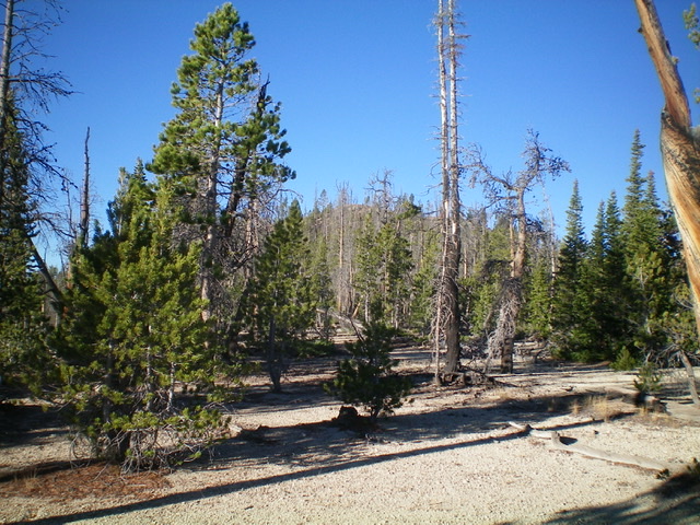
Looking back up at the summit through the semi-open forest on the northeast ridge. Look closely. The summit hump is in dead center. Livingston Douglas Photo
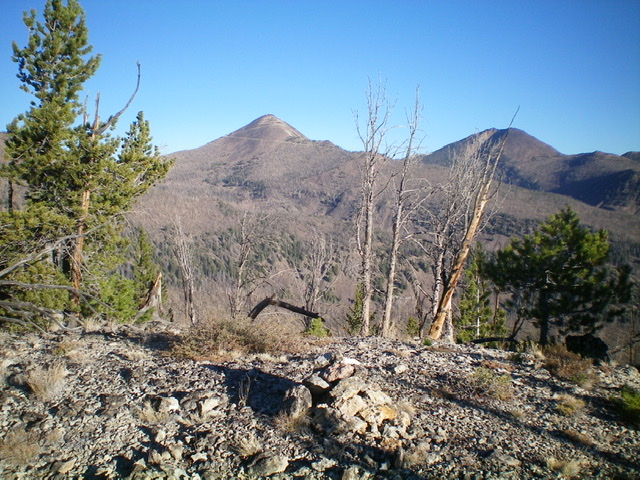
The summit of Peak 8767 with South Twin Peak (left) and North Twin Peak (right) in the distance. Livingston Douglas Photo
Northwest Ridge, Class 2
The Climb
From the road junction, follow FSR-537 west then south as it crosses two creeks (with pipes underneath the road) and passes an unsigned junction with FSR-536 early on. After passing that junction, the road bends left-ish/southeast to cross a shoulder. The road then bends sharply right/south to enter a drainage. This area is a massive burn area so take appropriate precautions. After hiking about two miles up FSR-537, the road reaches a sharp right/northwest bend at the mouth of a narrow gully on the left/south side of the road.
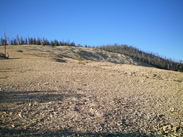
Leave the road here and scramble southeast up an obvious ridge. Stay to the left/east of the aforementioned gully. The terrain here is a steep-ish slope of snags, downed trees, and somewhat loose scree and gravel. Higher up, the blowdown is more tedious and there are a few live pines that join the mix. The high point of Peak 8767 is at the west end of the summit crest. It has a summit cairn. There is another hump to the east of almost equal height. The point estimate on the USGS topo map is not clear on which hump is the measured one, so stand on both just to be sure.
Northeast Ridge, Class 2
The Descent
From the west summit, head east to the east summit. From there, descend northeast (briefly) then north through a tedious burnt forest (with ample blowdown) to quickly reach easy semi-open pine forest with a nice gravel base. Head north down a wide ridge of open, stable scree (whitish in color). Enter burnt forest lower down where the ridge bends right-ish/northeast. Leave the ridge at about 7,800 feet and descend left/northwest to intercept FSR-537 in the dry drainage. Follow FSR-537 back to its junction with Sleeping Deer Road and your parked vehicle.
Additional Resources
Regions: Eastern Salmon River Mountains->Salmon River Mountains->Southeast Corner Peaks->WESTERN IDAHO
Mountain Range: Eastern Salmon River Mountains
Longitude: -114.44009 Latitude: 44.56289