Elevation: 8,780 ft
Prominence: 550
This peak is not in the book. Published January 2023
Peak 8780 is the high point on ridgeline that sits above, and north of, the headwaters of both Smoky Canyon and Timber Creek. It is most easily climbed via the Webster Ridge Trail/FST-101 and a short bushwhack to the top. USGS Stewart Flat
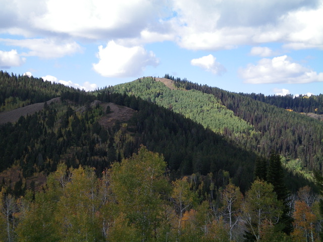
Peak 8780 (dead center) as viewed from Peak 8312 to its east-northeast. Livingston Douglas Photo
Access
From the signed junction of Smoky Canyon Road/FSR-110 and the Smoky Canyon Phosphate Mining Road (7,196 feet), drive 1.3 miles west up FSR-110 to a saddle and a trailhead with a large parking area. This is the signed trailhead for FST-101/Webster Ridge Trail, an ATV trail (7,765 feet).
Map Errors
The USGS topo map fails to show FST-101/Webster Ridge Trail, a big oversight. The USGS topo map shows a loop trail on the north side of Smoky Canyon Road at the saddle. That trail does not exist. The USGS topo map fails to show a spur road on the south side of Smoky Canyon Road exactly 0.2 miles east of the saddle. The USGS topo map shows a jeep road heading southeast from Smoky Canyon Road at 0.7 miles from the 7,196-foot mining operation road junction. That old road no longer exists but there is an unofficial foot path in the grassy clearcut roadbed that still exists.
North Face/Northeast Ridge, Class 2
The Climb
From the trailhead, hike up the dirt/mud, weaving ATV trail (FST-101) as it heads north up a forested shoulder then moves left/west to follow the right/east side of a gully to reach the open grass saddle between Point 8724 and Peak 8780. Continue along FST-101 as it heads north then west to skirt Peak 8780. When it seems to crest on the north side of Peak 8780 in an area where the semi-open forest looks easy to bushwhack, leave the trail. Bushwhack south up through a short patch of easy aspens and pines to reach open scrub.
Scramble up the reasonable scrub to reach the crest of the northeast ridge. Once on the ridge, follow it on rock and scrub to reach the ridgeline summit that has three (3) possible high points, all close to each other. The USGS map shows only two (2) possible high points. All three points measure of equal height, according to my altimeter. LOJ assigns the first hump as the high point but the farthest hump (to the southwest) has a USGS benchmark. None of the humps had a summit cairn, so I built one atop the hump with the USGS benchmark.

The summit of Peak 8780. Livingston Douglas Photo
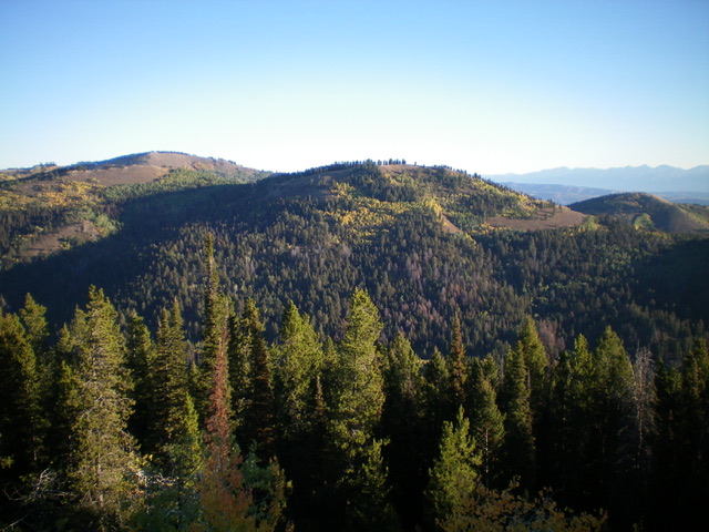
Peak 8780 (left hump) and Point 8724 (center hump) as viewed from the south. Livingston Douglas Photo
Additional Resources
Regions: Peale Mountains->SOUTHERN IDAHO->Webster Range
Mountain Range: Peale Mountains
Longitude: -111.1582 Latitude: 42.7212