Elevation: 8,900 ft
Prominence: 280
This peak is not in the book. I added some additional information to the access section. Updated July 2023.
Peak 8900 is located at the head of Fox Creek, Rooks Creek, and Adams Gulch in the Smoky Mountains. It is most easily reached from East Fork Baker Creek Road, a narrow but drivable road from Baker Creek Road. Forest Service Trails will get you close to the peak. USGS Boyle Mountain
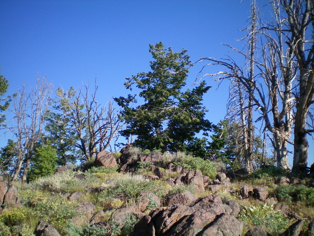
The summit of Peak 8900. Livingston Douglas Photo
Access
Primary access is from ID-75 and Baker Creek Road/ FSR-162 [(A)(4) on Page 213]. Turn onto Baker Creek Road and follow it south for just over 3.0 miles. Just pass the East Fork Campground, turn onto FSR-168/East Fork Baker Creek Road. Drive 7.8 miles up East Fork Baker Creek Road/FSR-168 to a saddle at the signed trailhead for the Fox Peak Connector Trail/FST-938 (8,320 feet). GPS coordinates: 43⁰44’00”N, 114⁰30’28”W. In 2023 this road was in good condition and suitable for high clearance vehicles.
North Ridge, Class 2
The Climb
From the trailhead, hike 0.9 miles on FST-938 south to reach a saddle and a signed trail junction. Go left/east onto the Adams Rib Trail/FST-142 and follow it to where it crosses the north ridge of Peak 8900. Leave the trail and scramble steeply (initially) to reach the semi-open, forested summit area. The high point is a large boulder that is located on a small ridge. There is a small summit cairn atop the boulder.
Northwest Face, Class 2
The Descent
From the summit, descend northwest directly at the connecting saddle with Fox Peak (9,180 feet). The northwest face is forested with field grass and blowdown (much of it charred). Reach FST-142 near the saddle and follow it to the saddle and signed trail junction. This concludes the first leg of today’s 2-peak journey. Fox Peak is up next.
Additional Resources
Regions: Smoky Mountains->WESTERN IDAHO
Mountain Range: Smoky Mountains
Longitude: -114.50489 Latitude: 43.71989