Elevation: 8,923 ft
Prominence: 663

This peak is not in the book. Updated November 2019
This peak is one of seven peaks that surround the Sage Creek drainage in the northern Boulder Mountains. Peak 8923 is located on the west side of Pecks Canyon and has a LONG South Ridge. The easiest ascent route is via Pecks Canyon Road and the east slopes. The Dean Spring drainage is on private land so, though it is easier and has a jeep track in it, avoid it. Combining the south ridge with the east slopes makes for a nice loop route. USGS Jerry Peak
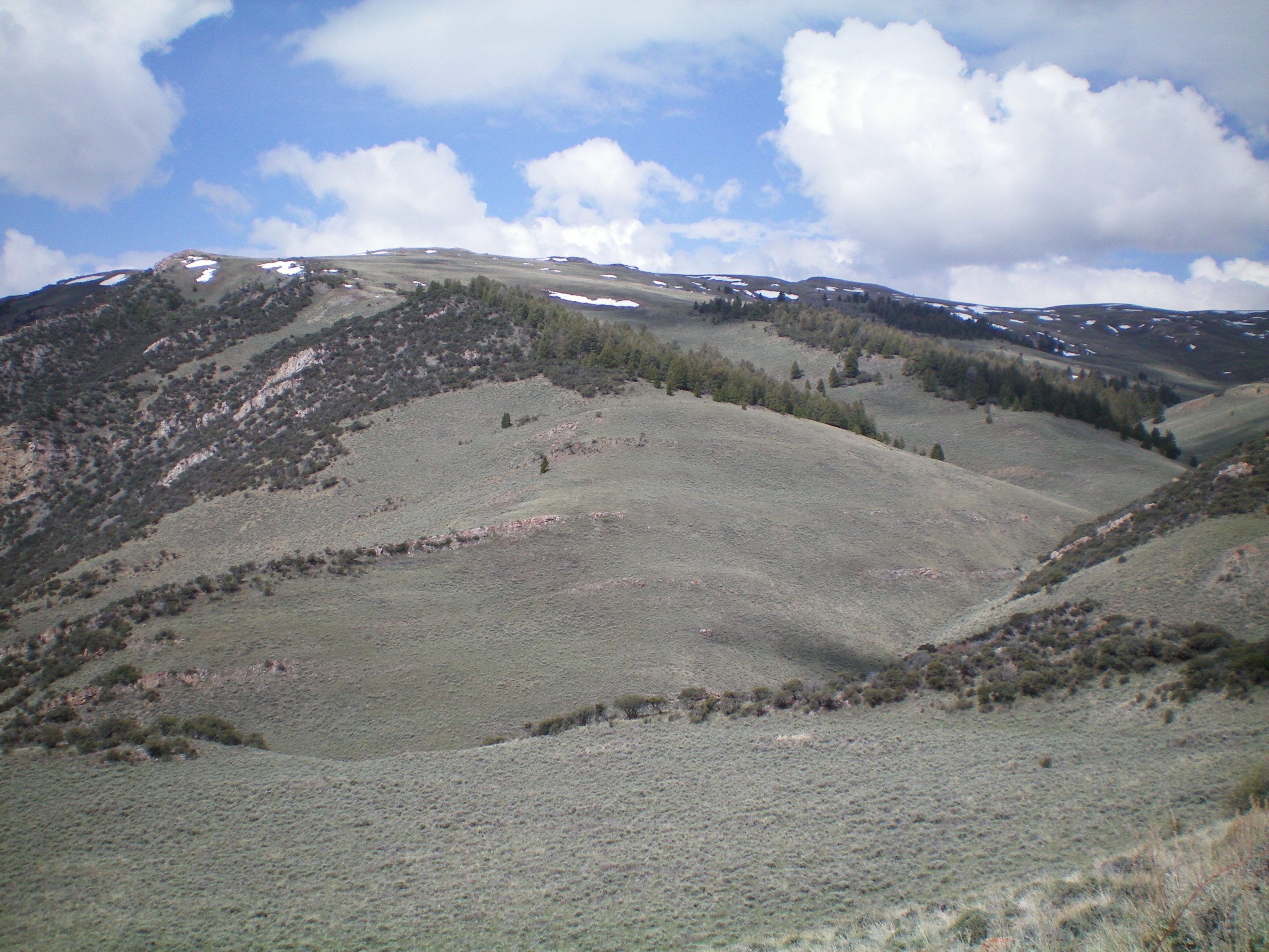
Peak 8932 as viewed from Peak 7442. Tom Lopez Photo
Access
From US-93 north of Mackay, drive west on Trail Creek Road for 4.6 miles. Turn right/northwest onto [signed] Walker Way. Drive 1.3 miles to a signed road junction. Bear right onto BLM Road #300 and drive 4.2 miles to a signed road junction. Turn right onto Pecks Canyon Road and drive 2.5 miles to an unsigned road junction. A steep ATV/jeep road goes right/southeast here. Park at this junction (7,745 feet). This is also the starting point for a climb of the north ridge of nearby Peak 8454.
A view of the east spur and south ridge of Peak 8923 from the parking spot. The east spur is dead center and bends left-ish to join the south ridge. The south ridge is on the skyline and heads right/north to reach the summit. Avoid the gully to the right of the east spur as it is on private land. Livingston Douglas Photo
East Spur/South Ridge, Class 2+
From Pecks Canyon Road, descend westward 200 vertical feet to cross a minor drainage and reach the base of the east spur of the south ridge. Ascend west up through sagebrush and surmount a Class 2+ rock rib. The ridge now bends left/southwest and enters a forested area. Scramble up through the delightful forest (a mix of firs and mountain mahogany) using elk trails to assist you. Once above the forest, you reach open terrain at about 8,150 feet. Follow the spur ridge southwest then west up to the south ridge. The terrain here is an easy mix of short grass, scrub, and scree.
Follow the south ridge northward, passing over a couple of ridge points on the way. Point 8787 is quite rocky and has triangulation posts/wires/cairns but no obvious USGS BM. Cross to the left/west side of a cattle fence high up to reach the gentle, barren summit. The summit showed no signs of previous ascent. I built a small summit cairn on the high point.
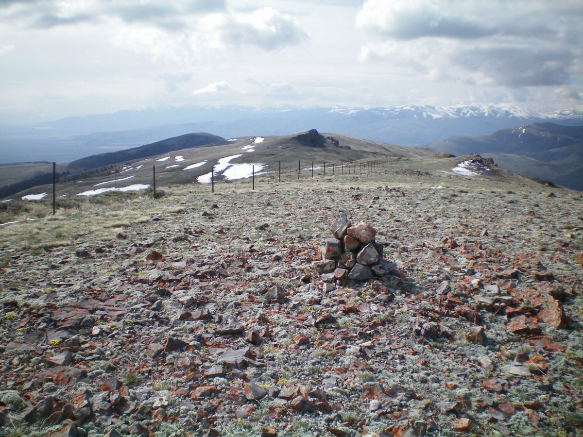
The newly-built summit cairn atop Peak 8923, looking down the long south ridge. Rocky Point 8787 is visible in the dead center. Livingston Douglas Photo
East Slopes, Class 2
Access
Same as for the east spur/south ridge. This is part of a loop route that begins and ends on the southeast side of Peak 8923 on Pecks Canyon Road.
The Descent
From the summit, descend the east slopes, aiming directly at [visible] Pecks Canyon Road. The terrain has some undulations (shoulders and gullies) and lots of pesky sagebrush to contend with, requiring lots of weaving around. When you finally approach Pecks Canyon Road, you must descend about 30 vertical feet to cross a final gully. You will find a cattle trail heading diagonally up to the roadway.
This route requires crossing two cattle fences, one high up and one lower down. Be sure to not accidentally drift southward (or follow a jeep track southward) into a gully near Dean Spring, as that area is private land. Once you reach Pecks Canyon Road, follow the road south for 1.4 miles to your parking spot.
Additional Resources
Regions: Boulder Mountains->EASTERN IDAHO
Mountain Range: Boulder Mountains
Longitude: -114.06339 Latitude: 44.12289