Elevation: 8,954 ft
Prominence: 309
This peak is not in the book. This page was updated based on new LiDAR measurements. Updated December 2024
Peak 8954 is a forested peak that is located just west of Yellowjacket Lake in the Yellowjacket Mountains. It has a north face with a sheer drop of over 400 feet. Peak 8954 is overshadowed by its neighbor to the north, Sugar Loaf (9,045 feet). It can be climbed from FSR-114/Yellowjacket Lake Road in combination with Sugar Loaf for an exciting outing. USGS Hoodoo Meadows
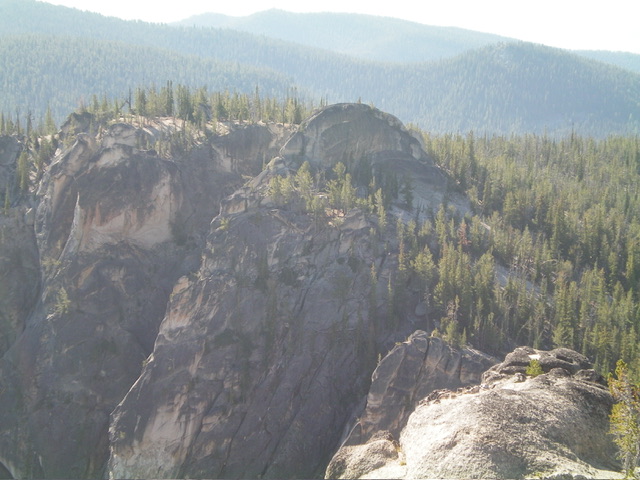
Peak 8954 (left of center) and its southeast ridge (coming at the camera) as viewed from the east. The southeast ridge was my ascent route. Livingston Douglas Photo
Access
From Panther Creek Road, drive west up FSR-112/Porphry Creek Road for 6.8 miles to a signed 4-way road junction. From the road junction, head right/north up FSR-113 for a rugged, rutted 8.3 miles to a signed junction with FSR-114/Yellowjacket Lake Road. The road bends west then south along the way. Go straight/south onto FSR-114. At 4.9 miles, reach the [signed] turnoff for the Yellowjacket Lake Campground.
At 5.6 miles, reach a sharp bend in the road at the base of the southeast ridge of Peak 8940. At 5.8 miles, reach a nice pullout on the west side of the road. Park here (8,300 feet; 45⁰03’30”N, 114⁰33’16”W). This pullout is near the upper end of Hoodoo Meadows. This is the first leg of a 2-peak adventure that includes Peak 8954 and Sugar Loaf (9,045 feet). It covers 4.0 miles with 1,375 feet of elevation gain round trip.
Southeast Ridge, Class 4
The Climb
From the roadside pullout, bushwhack across grassy, marshy Hoodoo Meadows just below its northeast end. From there, scramble north up through a reasonable pine forest to reach the crest of the southeast ridge. Follow the right/northeast edge of the exposed ridge crest to reach the flat summit cap and its scattered, large granite boulders. Climb the highest boulder (Class 4) via its narrow right/east edge.
The southeast ridge begins as pure pine forest. It soon changes to a mix of pine forest and large granite boulders/blocks. Scramble over and around these boulders, staying to the left/southwest of them to keep the difficulty at Class 2-3. There is also a lot of granite gravel between the large boulders. It is akin to climbing in the Eastern Sierra Mountains in California. Higher up, the ridge bends left/southwest to head up to the summit cap. Only the summit boulder/block is Class 4. There were no signs of previous ascent.
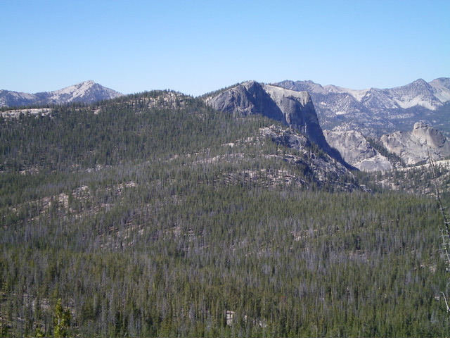
Peak 8954 and its northwest ridge (my descent then ascent route) as viewed from the summit of Sugar Loaf (9,045 feet). Livingston Douglas Photo
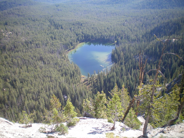
Yellowjacket Lake as viewed from high on the southeast ridge of Peak 8954. Livingston Douglas Photo
Northwest Ridge, Class 4
The Descent (then Ascent)
From the summit boulder, descend back to the gravel and grass in the pine forest. Weave through some other granite boulders and skirt the left/south side of a massive granite block that is just west of the summit boulder. Once past the block, descend some steep slab rock with granite gravel atop it. Move onto either solid ridge crest rock or stay in the pine forest for the easiest going. You will quickly reach the 8,660-foot connecting saddle with Sugar Loaf (9,045 feet). This concludes the first leg of today’s 2-peak adventure. Sugar Loaf is up next.
Additional Resources
Regions: Eastern Salmon River Mountains->Salmon River Mountains->WESTERN IDAHO->Yellowjacket Mountains
Mountain Range: Eastern Salmon River Mountains
First Ascent Information:
- First Ascent Year: 2023
- Season: Summer
- Route: Southeast Ridge
- Party: Livingston Douglas
- Other First Ascent: Northwest Ridge
- Year: 2023
- Season: Summer
- Party: Livingston Douglas
Longitude: -114.5641 Latitude: 45.0656