Elevation: 8,963 ft
Prominence: 383

This peak is not in the book. Published December 2019
Peak 8963 sits at the head of Goddard Canyon. In reality, it is just another point (albeit a ranked one) on the long west ridge of Copper Mountain (10,303 feet). Peak 8963 is a forested peak and is a reasonably easy scramble from the Long Canyon ATV Trail/FST-184 where the trail crosses the west ridge of Copper Mountain. USGS Copper Mountain
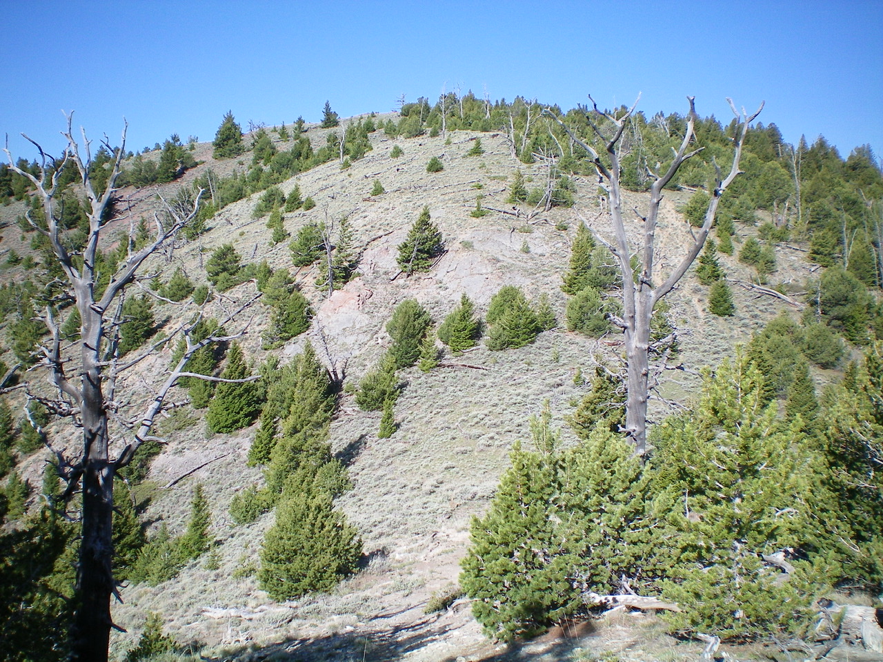
Peak 8963 as viewed from the east. Livingston Douglas Photo
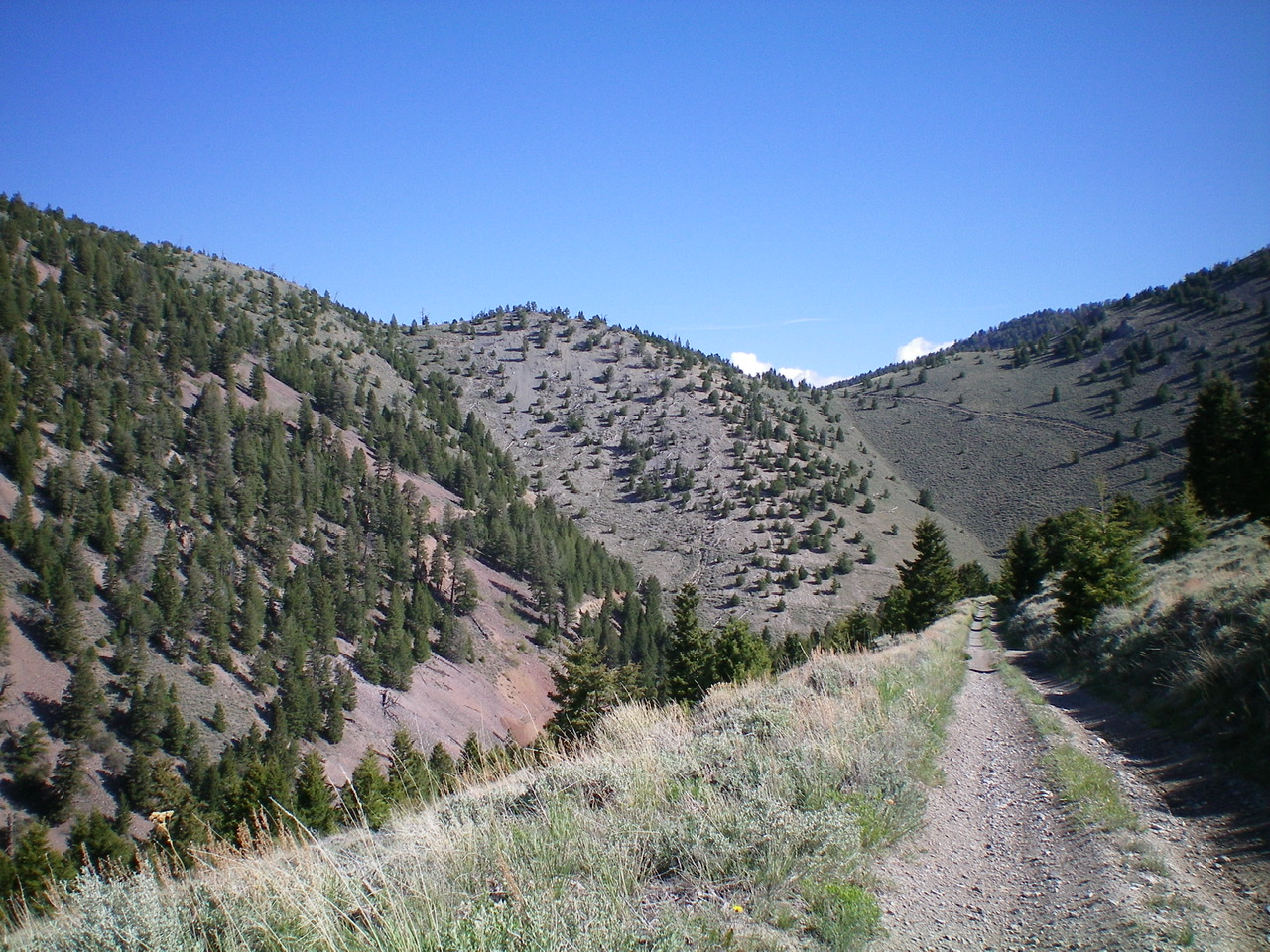
Peak 8963 as viewed from Long Canyon Road/Trail to the south. The summit is just left of center. Livingston Douglas Photo
East Shoulder, Class 2
Access
Long Canyon Road is located along ID-28 in the Birch Creek Valley just north of Mile Marker 42, 8.8 miles north of the INL North Boundary, and 1.7 miles south of the North Entrance to Birch Creek Campground. It is signed with a small street sign so look for it. Drive 2.3 miles up the smooth gravel of Long Canyon Road and park at a signed road junction. The road gets much rougher after this point. The elevation here is 6,520 feet.
The Climb
From the road junction, hike north up Long Canyon Road/FSR-176 until it becomes Long Canyon Trail/FST-184, an ATV trail/road. Both FSR-176 and FST-184 make for good hiking. After four miles of hiking, reach a ridge crossing (the second one) on the West Ridge of Copper Mountain at 8,580 feet. Leave the road here and follow an old 2-track road up the east ridge of Peak 8963.
This old road soon flames out and becomes a use trail. After the use trail dies out, bushwhack through somewhat open terrain with lots of blowdown to navigate over/around. The forested summit of Peak 8963 has a downed tree laying across the summit boulder/outcrop with a small cairn atop it. I built up this cairn quite a bit with the ample loose talus nearby. The summit high point is in semi-open terrain and the views are somewhat limited.
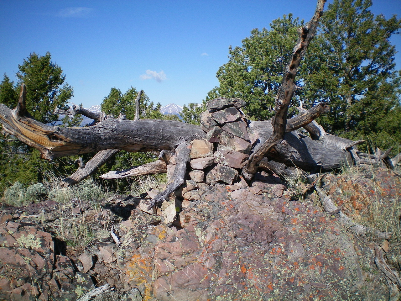
The summit cairn atop the “fallen log/boulder” high point of Peak 8963. Livingston Douglas Photo
Additional Resources
Regions: Beaverhead Range->EASTERN IDAHO
Mountain Range: Beaverhead Range
Longitude: -112.85559 Latitude: 44.17359