Elevation: 8,980 ft
Prominence: 440
This peak is not in the book. Published November 2020
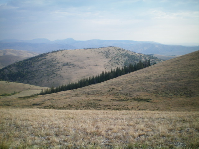
Peak 8980 is located on the Continental Divide southwest of Bannack Pass. It separates the Divide Creek (ID) from Little Deadman Creek (MT). Peak 8980 is most easily climbed via its northeast ridge from Bannack Pass on the CDT. It can be combined with a climb of Peak 9768 to its south on the Continental Divide but that combo is best started from the Divide Creek trailhead. USGS Deadman Lake
Peak 8980 (center, forested) as viewed from the east. Livingston Douglas Photo
Access
From I-15 at Dubois, ID, drive west on ID-22 for 5.9 miles to Medicine Lodge Road. Turn right/north onto [signed] Medicine Lodge Road and reset your odometer. At 21.0 miles, the pavement ends. At 25.7 miles, reach a [signed] road junction with Irving Creek Road. At 27.5 miles, reach a [signed] fork in the road. The left fork is Fritz Creek Road; the right fork is Warm Creek Road. Go left onto Fritz Creek Road/FSR-199. Reset your odometer here.
At 0.2 miles, cross a cattle guard and reach a road junction. Straight/west is Fritz Creek Road and right/north is Bannack Pass Road. Go right/north here onto Bannack Pass Road/FSR-280. At 5.4 miles, reach a road junction with Divide Creek Road/FSR-300. Turn left/west onto Divide Creek Road and drive 0.9 mile up the road to a stiff cattle gate/fence (7,340 feet). If you can manage to open the wiring of the gate, you can drive another 0.5 mile to reach a parking area at the Divide Creek trailhead (signed as “Webber Creek Trail/FST-111”). The road gets a bit rutted in this final 0.5 mile, so you may or may not be able to make it to the trailhead.
Northeast Spur/East Ridge, Class 2
The Climb
Hike up Divide Creek Trail/FST-111 for 1.7 miles to a lush, green meadow at the base of a wide gully on the right/west side of the creek drainage (7,560 feet). The northeast spur is open and obvious from this meadow. It heads southwest from the meadow and the side gully. Leave FST-111 here and drop to the meadow to cross a marsh (of sorts) to reach the toe of the northeast spur. Bushwhack west through sagebrush to reach the rounded spur. Once on it, climb southwest up through sagebrush to reach the pine forest above.
Bushwhack southwest up through the not-too-difficult forest and climb (or skirt) two rocky bands/outcrops hidden in the forest. The uphill naturally bends right-ish/west and exits the forest onto easy grass/scrub at Point 8500. You are now on the east ridge. Follow the easy ridge westward up to the gentle, open summit of Peak 8980. There is a large cairn and an ID/MT boundary post on top.
South Ridge, Class 2
The Descent
From the summit, descend southwest then south to an 8,540-foot saddle. You will find a fence row soon after you leave the summit. This fence row leads south to the saddle. The saddle has a cattle fence, a cattle gate, and an old 2-track road that crosses the saddle. The CDT (signed) goes southwest from this saddle on an old 2-track road (not shown on the USGS topo map). The USGS topo map shows the CDT heading west from this saddle but that is completely WRONG. This saddle connects Peak 8980 to Peak 9768 and is the conclusion of the first leg of today’s two-peak journey. Peak 9768 is up next.
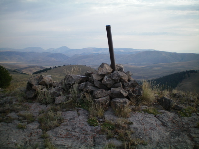
The summit cairn and ID/MT boundary post atop Peak 8980, looking north. Livingston Douglas
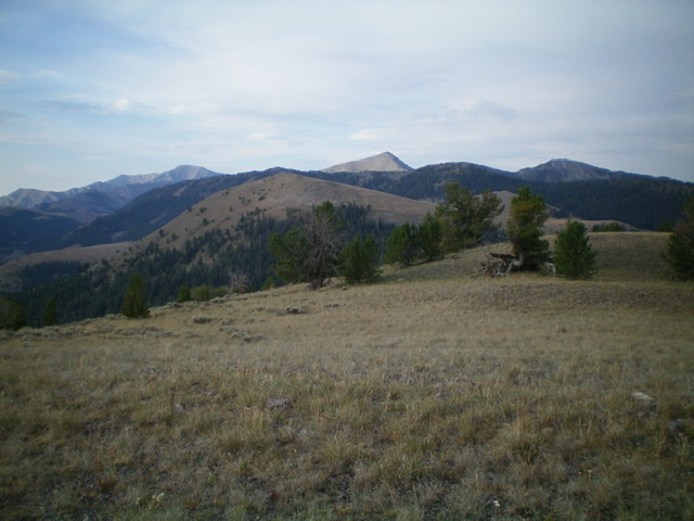
Looking south along the Continental Divide from the summit of Peak 8980. Livingston Douglas Photo
Additional Resources
Regions: Beaverhead Range->EASTERN IDAHO
Mountain Range: Beaverhead Range
Longitude: -112.82529 Latitude: 44.44459