Elevation: 9,001 ft
Prominence: 301
This peak is not in the book. Published November 2022
Peak 9001 is an obscure, forested ridgeline summit that sits well back from ID-75 in the White Cloud Peaks. While it is on National Forest land, it requires a drive through the publicly-accessible Idaho Rocky Mountain Ranch to reach the public land. USGS Casino Lakes
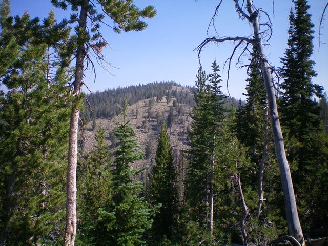
Peak 9001 as viewed from the south. Livingston Douglas Photo
Access
From ID-75 about nine miles south of Stanley, turn right/east into the [signed] Idaho Rocky Mountain Ranch entrance. Drive about ½ mile to the [signed] left/northeast turn for the lodge. Turn left and drive past the lodge. Continue northeast then east along the ranch road for about 0.2 miles (following signs for “ranch loop” and “bikes”) to reach the [signed] Sawtooth National Forest boundary at a cattle gate. Park just inside the gate on an old 2-track road (6,700 feet). GPS coordinates: 44⁰06’27”N, 114⁰50’43”W.
Southwest Spur/South Ridge, Class 2
The Climb
From the cattle gate, follow an old 2-track road right/south along the fence row (that separates National Forest land from the private ranch land) for a short distance to reach a fence corner. Leave the 2-track here and scramble east up through open scrub onto a shoulder that leads up onto the southwest spur. Find a good use/game trail on the ridge and follow it east then northeast up the forested ridge. The trail disappears higher up but continue up through the forested terrain to reach Point 8869. This point is a thick, forested mess of pines/aspens with dense underbrush.
From Point 8869, bushwhack north through dense forest (with copious blowdown and underbrush) across two or three gullies and a few ridge humps to reach the summit ridge. Follow the easy, semi-open summit ridge northeast to reach the semi-open summit of Peak 9001. The summit had no signs of previous ascent, so I built a summit cairn atop a fallen tree log that, with the live pine tree that it leans against, is the clear high point of Peak 9001.
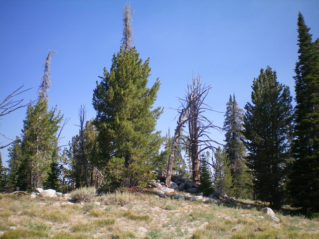
The semi-forested summit area of Peak 9001. Livingston Douglas Photo
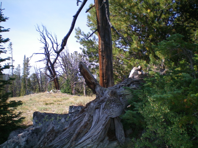
The high point of Peak 9001 is this fallen tree. Notice the newly-built summit cairn atop it. Livingston Douglas Photo
Southwest Ridge, Class 2
The Descent
From the summit, descend the south ridge across the head of a dry gully then up over a ridge hump. From this hump, you can see the critical flattish ridge section at 8,660 feet to the southwest. That ridge section sits at the top of the southwest ridge. Bushwhack southwest through forested terrain and cross the head of another dry gully. Contour southwest and drop slightly to reach the flattish ridge section. Hike to the west end of the flattish ridge section and descend the [obvious] ridge southwest from here. The forested ridge goes quickly and has some open or semi-open areas.
The ridge ends in a confusing, wet gully area at about 7,250 feet. Bushwhack left/south here and cross the gully and its small stream. Follow a game trail diagonally up onto a shoulder from the gully to reach open terrain. Descend southwest down the open scrub shoulder and quickly stumble upon an old 2-track (shown on the USGS topo map). Follow this old road to a signed junction just above the Idaho Rocky Mountain Ranch. Go left/south at this junction and follow it back a short distance to the cattle gate where you are parked at the east edge of the ranch.
Additional Resources
Regions: EASTERN IDAHO->White Cloud Mountains
Mountain Range: White Cloud Mountains
Longitude: -114.80889 Latitude: 44.13049