Elevation: 9,009 ft
Prominence: 629
This peak is not in the book. Published November 2021
Peak 9009 is located west of Summit Rock (9,333 feet) and above the convergence of McKay Creek and Yankee Fork in the Eastern Salmon River Mountains. It is most easily climbed from the Custer Motorway to its east. USGS Elevenmile Creek
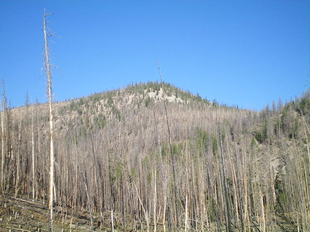
Peak 9009 as viewed from the Custer Motorway to its east. Livingston Douglas Photo
Access
From the junction of US-93 and Main Street in Challis, drive west on Main Street (which becomes Garden Creek Road) for 4.9 miles to a signed junction with the Custer Motorway/FSR-070. Turn right onto the Custer Motorway and reset your odometer. At 1.7 miles, reach the Challis National Forest boundary. At 8.9 miles, reach the Mill Creek Campground. At 12.0 miles, reach Mill Creek Summit. At 14.3 miles, reach a pullout on the left side of the road at the base of the east face. Park here (8,020 feet). GPS coordinates: 44⁰29’26”N, 114⁰31’10”W.
East Face/Northeast Ridge, Class 2
The Climb
From the Custer Motorway, scramble northwest straight up a STEEP open slope of loose scree/gravel with scattered snags and blowdown. Reach the northeast ridge near a small saddle. Scramble west then southwest up to the semi-open, forested summit. The northeast ridge is a combination of scattered pines/snags and blowdown on a loose scree/gravel base plus a short section of steep-ish scree about halfway up. The summit area is open enough to identify the high point area. The summit is a mix of charred and downed trees with a few live pines and some open, gravelly areas. There was no summit cairn so I built a small one.
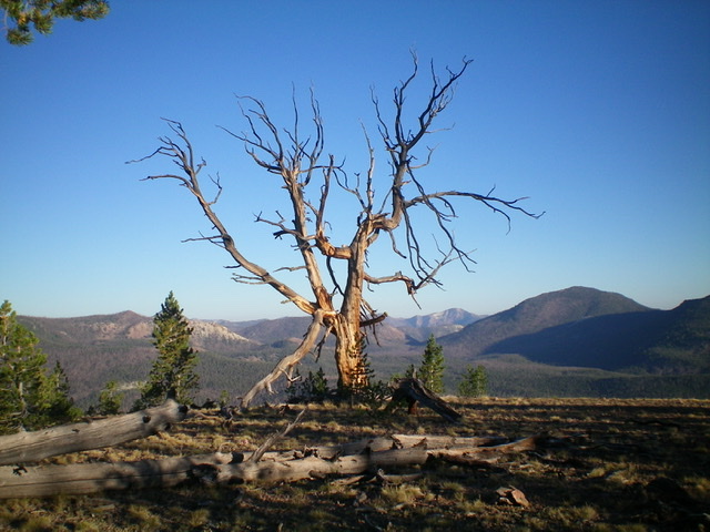
This eerie snag is on the summit. Livingston Douglas Photo
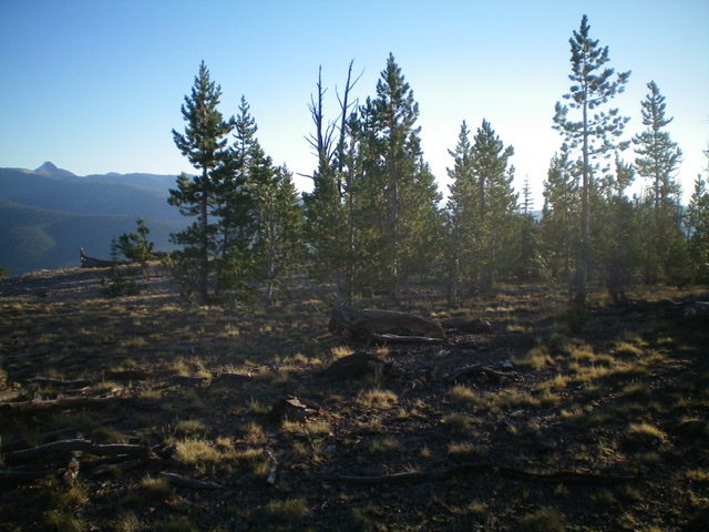
The summit is a semi-open mix of pine forest, gravel/scree, and clumps of grass. Livingston Douglas Photo
Additional Resources
Regions: Eastern Salmon River Mountains->Salmon River Mountains->Southeast Corner Peaks->WESTERN IDAHO
Mountain Range: Eastern Salmon River Mountains
Longitude: -114.52919 Latitude: 44.49029