Elevation: 9,020 ft
Prominence: 280
This peak is not in the book. Published November 2021
Peak 9020 is a ranked bump on the northwest ridge of Peak 10014. It towers over Kane Creek and has a steep west face. This is the first leg of a 2-peak adventure that includes Peak 9020 and Peak 10014. It covers 7.0 miles with 3,050 feet of elevation gain round trip. USGS Phi Kappa Mountain
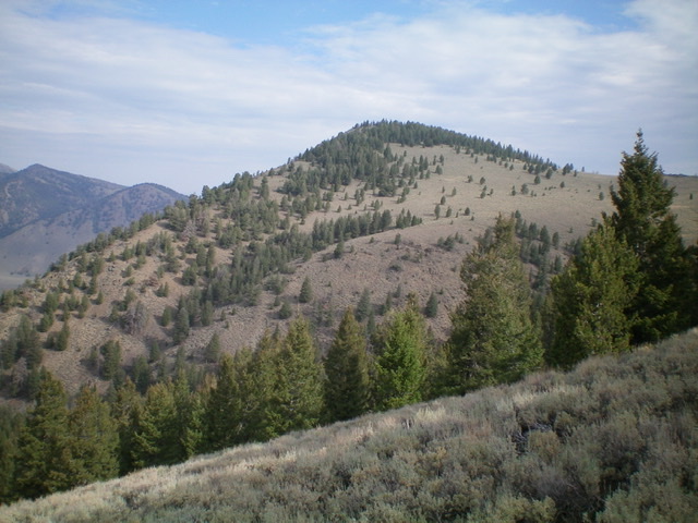
Peak 9020 and its steep south ridge (left skyline). Livingston Douglas Photo
Access
From the junction of US-93 and [signed] Trail Creek Road (15.3 miles north of Main Street in Mackay), turn left/southwest onto Trail Creek Road. Drive 20.9 miles southwest on Trail Creek Road to a signed junction with FSR-134/Kane Canyon Road. Turn left/south onto FSR-134 and drive 1.6 miles to a pullout for a dispersed campsite on the right/west side of the road. Park here (7,275 feet). The Burnt Aspen trailhead is another 0.1 miles up FSR-134 but there is no parking at or near the trailhead.
South Ridge, Class 3
The Climb
From the roadside pullout, walk south along FSR-134 for 0.1 miles to the signed trailhead for the Burnt Aspen Trail/FST-055. This trailhead is just before FSR-134 crosses Kane Creek on a bridge. FST-055 is a MC trail so it is quite narrow, but it is a good trail. Sadly, it is not shown on the USGS topo map. Hike south up FST-055 for about ½ mile to reach a forested, dry gully to the left/east. Leave the trail here and hike east across sagebrush to reach the forest. Bushwhack briefly up the forested drainage.
Leave the drainage and climb left/northeast up onto the crest of the south ridge. This scramble is up steep gravel and boulders/face rock (Class 3) and is the crux of today’s climb. Once on the ridge crest, scramble north-northeast then north up the ridge to the forested summit area of Peak 9020. The ridge is initially steep and narrow with semi-open terrain. Higher up, the ridge is less steep and the terrain is more open. The summit area is flat and is forested with pines, aspens, and blowdown. There is no summit cairn and no obvious high point. Thankfully, the summit area is not too large.
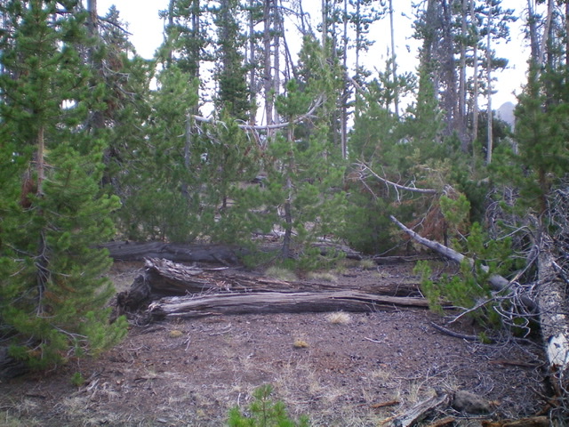
The summit area of Peak 9020. Livingston Douglas Photo
East Face, Class 2
The Descent
From the forested summit cap, descend southeast through easy, open pine forest (not much blowdown) to find the open sagebrush and short scrub of the 8,740-foot connecting saddle with Peak 10014. This concludes the first leg of today’s 2-peak journey. Peak 10014 is up next.
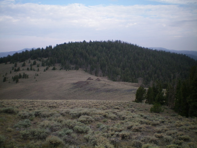
Peak 9020 and its forested east face (descent route). Livingston Douglas Photo
Additional Resources
Regions: EASTERN IDAHO->Pioneer Mountains
Mountain Range: Pioneer Mountains
Longitude: -114.15669 Latitude: 43.87029