Elevation: 9,072 ft
Prominence: 332
This peak is not in the book. Published November 2021
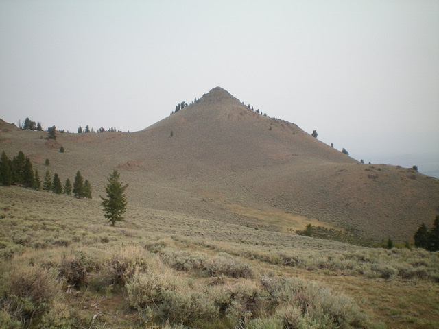
Peak 9072 is a remote summit that is located at the head of Harry Canyon and east-northeast of Wildhorse Peak (9,602 feet). It is a beautiful, pyramidal-shaped hump that offers an outstanding look at nearby Peak 9292, Peak 9380, and Peak 9268, all of which are rugged climbs. Unfortunately, Harry Canyon is blocked by private land, so a long approach from the south side is mandatory. This climb covers 10.5 miles with 3,775 feet of elevation gain round trip. There are a lot of ups and downs on the approach hike (about 1,750 feet round trip). USGS Harry Canyon
Peak 9072 as viewed from the southwest. Livingston Douglas Photo
Access
From the signed junction of FSR-135/Copper Basin Road andFSR-136/Wildhorse Creek Road, drive 0.45 miles east on FSR-135 to a signed junction with FSR-497. Turn left/north onto FSR-497 and drive 0.3 miles on this rocky, narrow, 2-track road (good tires required) to reach the trailhead for FST-4056/Wildhorse Lookout Trail. Park in the large parking area (7,030 feet).
Map Errors
The USGS topo map shows only two side roads heading north from FSR-135 in the first half-mile east from its junction with FSR-136. There are actually three such roads. Ignore the first one. The second one is signed and is the one you want to reach the trailhead for FST-4056. The third side road is just past the second road, is not signed, and is at a cattle guard crossing. Ignore it. The USGS topo map shows none of the 2-track jeep roads that lead from FST-4056 to the base of the southwest face of Peak 9072. There are numerous old 2-tracks on the high ridges in this area, most of which are not shown on the USGS topo map.
Southwest Face
The Approach, Class 1
Hike up FST-4056/Wildhorse Lookout Trail (an ATV trail) for 2.8 miles to an unsigned junction at about 8,900 feet. This junction occurs just after the trail makes a sharp left/west turn to climb up to the Wildhorse Fire Lookout. There are two trail signs here for FST-4056 (one in each direction). Leave the trail here and follow an old 2-track (signs for “No Motorized Vehicles” lay on the ground) right/northeast up to a saddle on the ridge crest. Follow the meandering, undulating ridge crest on this 2-track road east then northeast then north to reach the small saddle (8,860 feet) at the base of the southwest face of Peak 9072. You can also follow another 2-track road that heads east in the final section to reach a crossing of the south ridge and climb that route instead.
The Climb, Class 2
From the 8,860-foot saddle at the base of the southwest face, scramble up the slope of sagebrush and ground boulders/talus to reach a final climb up boulders to reach the small, rocky summit perch of Peak 9072. The conical-shaped summit has a decent cairn.
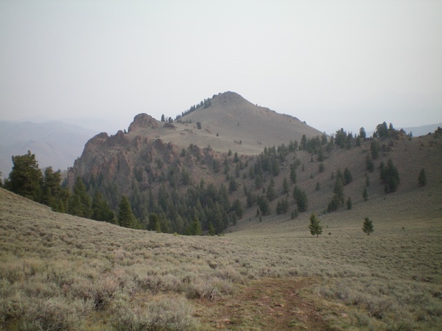
Cone-shaped Peak 9072. The southwest face (ascent route) is the left skyline. Livingston Douglas Photo
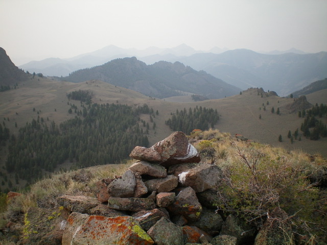
The summit cairn atop Peak 9072. Rugged Peak 9268 is in the distance (mid-ground). Livingston Douglas Photo
Additional Resources
Regions: EASTERN IDAHO->White Knob Mountains
Mountain Range: White Knob Mountains
Longitude: -114.04379 Latitude: 43.94319