Elevation: 9,115 ft
Prominence: 375
This peak is not in the book. Published December 2019
Peak 9115 is a forested ridgeline hump amid four ranked 9,000ers in the immediate vicinity (Peak 9115, Peak 9319, Peak 9523, Peak 9785). It is a relatively meaningless ranked point on the north ridge WEST of Mogg Mountain. The bushwhack from Carol Creek Pass is somewhat tedious and the views from the summit are poor. This summit is rarely visited. USGS Mogg Mountain

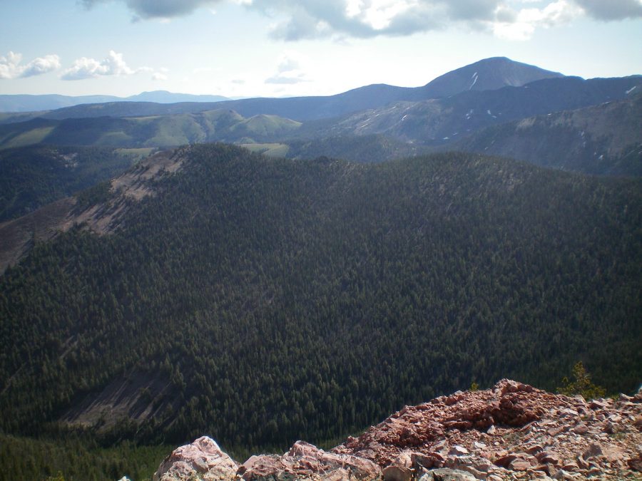
The thickly forested, ridgeline hump that is Peak 9115 (in mid-ground). The summit is left of center. Point 9097 is right of center. Livingston Douglas Photo
South Ridge, Class 2
Access
Morse Creek Road/FSR-094 is located exactly 10.2 miles south of US-93 on the [paved] Pahsimeroi Highway. From the signed turnoff on the east side of the highway, drive 4.3 miles to the Challis National Forest boundary. At 6.5 miles, reach the end of Morse Creek Road at a trailhead parking area (6,290 feet). This is the trailhead for the Morse Creek Trail/FST-4072.
The Climb
Hike up FST-4072 (an old jeep road) on the left/northwest side of raging Morse Creek for about 1-1/2 miles to a fording of Cold Creek. There are some wet logs and rocks to help you cross this on foot, but bring hiking poles in order to maintain your balance for this crossing. Soon after, the road ends at a crossing of Morse Creek. At this crossing, the creek is braided and can be crossed by jumping the first braid and crossing a cut log over the second braid.
Once on the southeast side of Morse Creek, the old road is now a weak 2-track road in tall field grass. The road quickly turns left/northeast and follows the right/southeast side of Morse Creek up through open field grass. In about ½ mile, reach a signed trail junction. The Left Fork is FST-073 and follows Morse Creek on its way to Carol Creek. The Right Fork is FST-072 and goes up a hillside then drops to Falls Creek (the trail, however, is signed for Patterson Creek). Go left here onto FST-073 and continue to follow the right/southeast side of Morse Creek.
About 0.2 miles past the trail junction, you must ford Morse Creek. The crossing is wide and shallow. It can be done in gaiters. After crossing to the northwest side of Morse Creek, the trail is now a foot path. The trail heads north up out of the Morse Creek drainage to climb a shoulder. Look closely in this area in order to not lose the trail. It is weak here but it soon gets much better and easier to follow. The key is to get up and out of the drainage immediately.
After just over an hour of hiking, you will reach a pass at the head of the Carol Creek drainage. Let’s call it Carol Creek Pass (8,500 feet). From the pass, bushwhack east then northeast through pine forest to reach the south ridge. Follow the ridge crest (or just right/east of it) to reach Point 9097, the [false] south summit. The forest is semi-open but has a lot of deadfall to work through. From Point 9097, continue north along the ridge, descending just over 100 vertical feet to a densely-forested saddle with copious amounts of blowdown.
Just north of this saddle, skirt the left/west side of a large rocky outcrop/buttress that barely shows up on the USGS topo map. It is an unpleasant surprise. Once past this ridge obstruction, the going is relatively easy to the north summit, the true summit of Peak 9115. The summit had a torn-down cairn, so I rebuilt it. The views from the top are obstructed by both live pines as well as burnt snags. This is probably the most unimpressive summit in the May Mountain/Mogg Mountain area. Yes, it is a ranked summit, but so what??
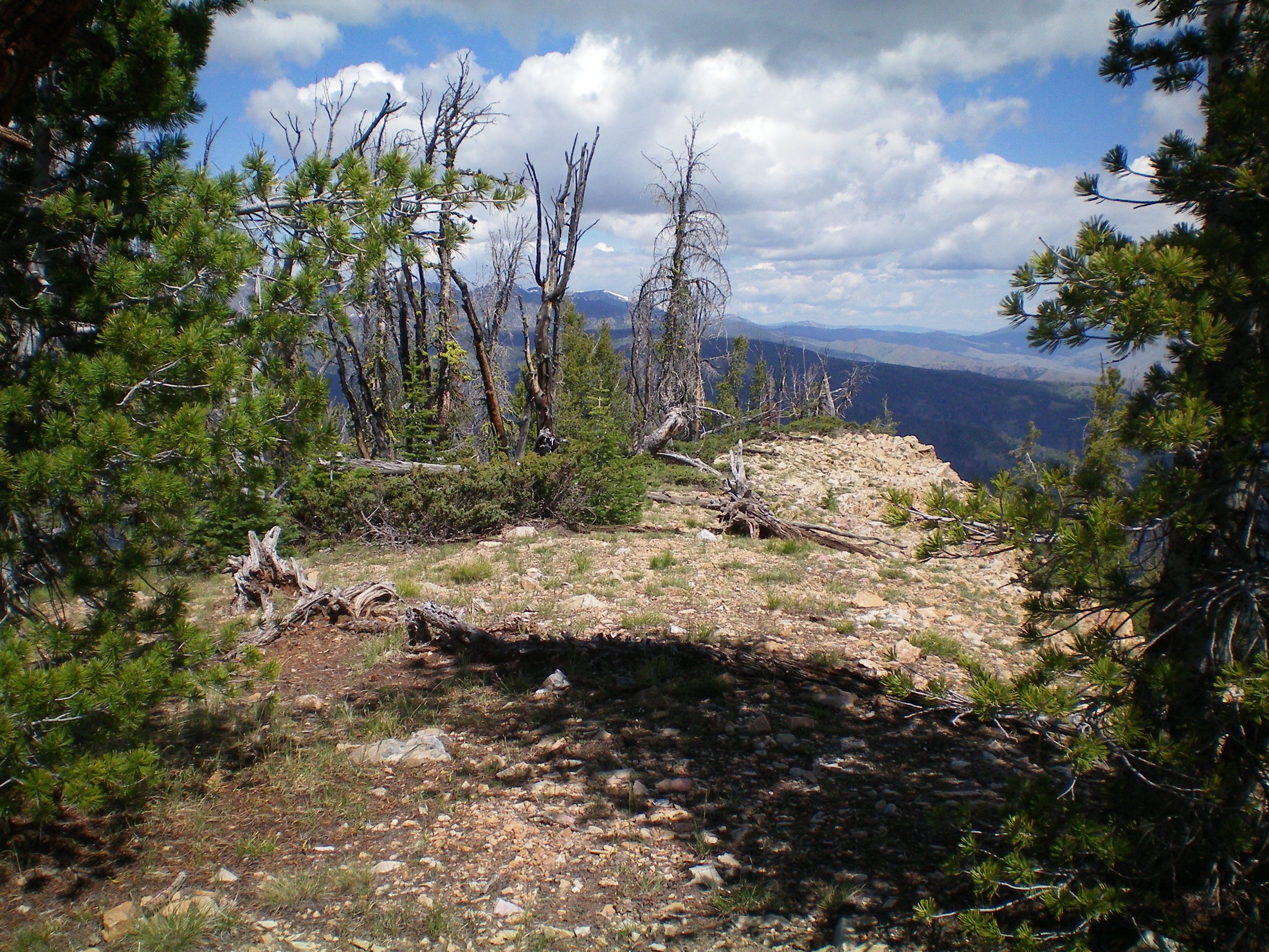
The summit area of Peak 9115. Livingston Douglas Photo
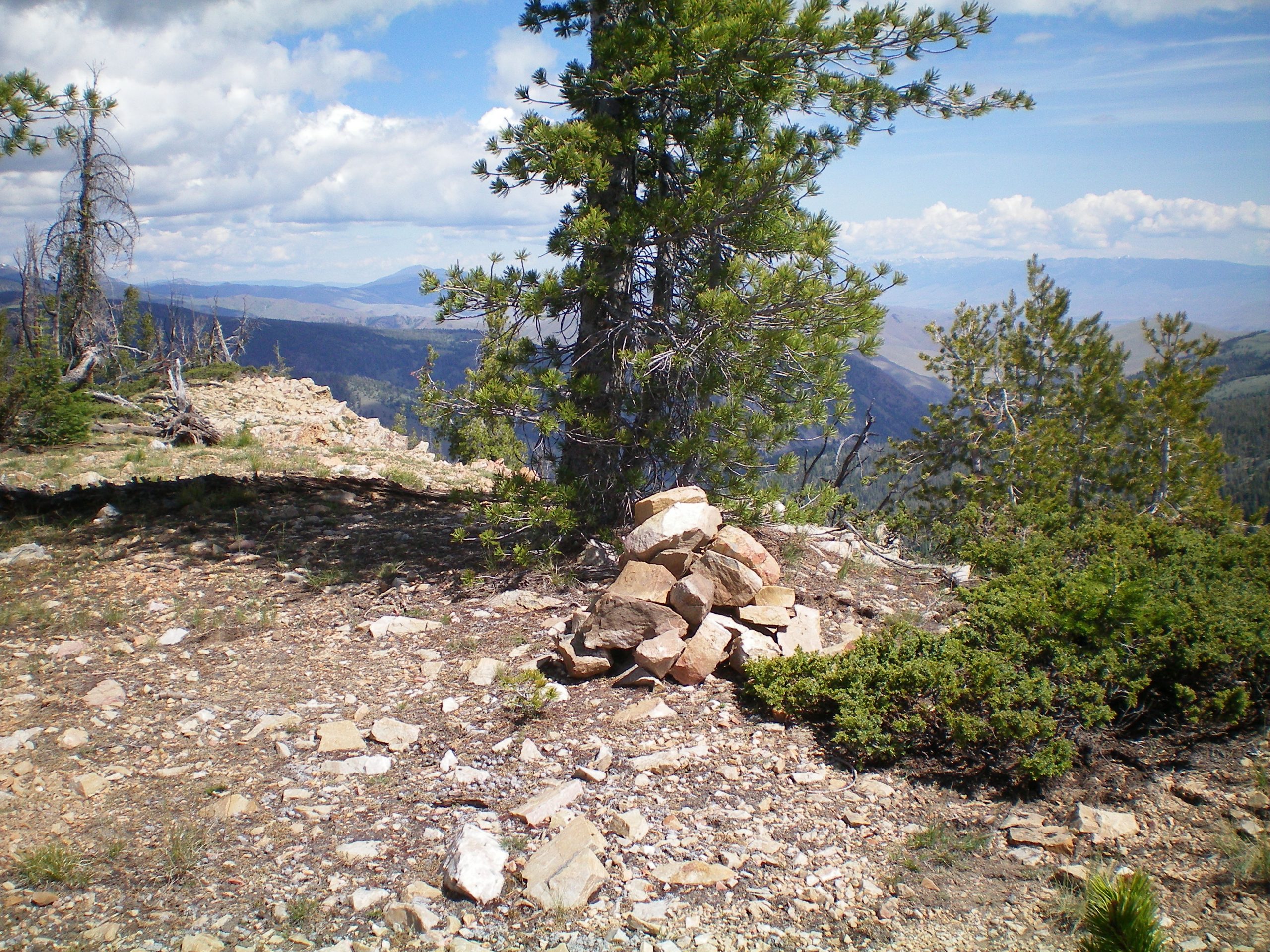
The newly rebuilt summit cairn atop Peak 9115. Livingston Douglas Photo
Additional Resources
Regions: EASTERN IDAHO->Lemhi Range
Mountain Range: Lemhi Range
Longitude: -113.72449 Latitude: 44.68329