Elevation: 9,140 ft
Prominence: 520
This peak is not in the book. Published November 2023
Peak 9140 sits on the Continental Divide at the head of both the Short Creek and Poison Creek drainages. It is most easily climbed via its west ridge from Reservoir Creek Road/Trail. The USGS topo map mislabels this peak as Peak 9118 but the contour lines give it an elevation of 9120+. USGS Tepee Mountain
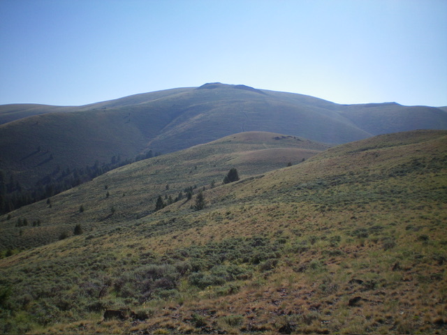
Peak 9140 (dead center) as viewed from midway up the west ridge. Livingston Douglas Photo
Access
From the signed junction of ID-28 and ID-29 in Leadore, drive 0.2 miles northeast on ID-29 to a signed junction. Reset your odometer here. Turn right/east onto Hawley Gulch Road (which begins as a county road and eventually becomes FSR-275). At 3.8 miles, the pavement ends at a signed road junction. Go left/southeast here to stay on Hawley Gulch Road. At 6.9 miles, reach an unsigned 3-way road junction. Go left/east here.
At 8.0 miles, cross Hawley Creek on a bridge just after entering the National Forest. At 10.4 miles, reach a signed 3-way road junction. Go left here onto Reservoir Creek Road. Park in a large pullout just past the road junction. The parking pullout is at 6,915 feet (44⁰40’32”N, 113⁰09’06”W). Depending upon road conditions, you may be able to continue driving 1-1/4 miles farther up Reservoir Creek Road to shorten the hiking distance required for this climb. At that point, the road is gated/closed and there is a large parking area.
West Ridge, Class 2
The Climb
From the roadside pullout, follow Reservoir Creek Road northeast as it drops 45 vertical feet to cross Big Bear Creek (culvert underneath the road). Continue up Reservoir Creek Road until it reaches a road closure gate at about 1-1/4 miles up from the roadside pullout. The old road now crosses to the left/west side of Reservoir Creek via a culvert and continues to a cattle gate crossing where the 2-track road heads left/north up a shoulder. Leave the road here and follow a good cattle/horse trail along the west side of Reservoir Creek. This trail soon crosses to the right/east side of the creek. Find a spot to jump across the creek.
From the east side of Reservoir Creek, continue along the cattle trail for about ¾ mile (from the cattle gate crossing) to reach the base of the west ridge of Peak 9140 at a small meadow and a fork in the canyon where the creek bends sharply left/north and a dry gully comes in from the right/south. Bushwhack east up a steep, thick slope of sagebrush and scattered pines. Stay right-ish to be on a ridge of sorts then angle left/north higher up to reach the open crest of the west ridge at a rocky buttress/outcrop.
Scramble east up the easy, short scrub on the ridge crest over a ridge hump. Descend 50 feet to a minor saddle and find an old 2-track road at this saddle (not shown on maps). Follow the 2-track road as it heads east then northeast up the open, rounded ridge. Higher up, the road heads up a steep, rocky section just above a road junction in a flattish ridge area. The old 2-track road now shows up on the USGS topo map. The rocky road meanders a bit as it heads up to reach the Continental Divide near a fence row. Leave the road here in a flat, grass/scrub area. Scramble northeast across short scrub and cross an easy cattle fence. Bend left-ish/north to pass a ridge hump to reach the official west summit, which has a CDT post and an ID/MT border steel marker.
This is the official summit and shows up as Peak 9118 on the USGS topo map. However, the nearby east summit hump is slightly higher. Scramble east and descend 15 feet to a minor saddle and cross a 2-track, north-south ridge road. Continue east up onto the east summit hump. The east summit looks, and measures by altimeter, about 5 feet higher than the official/west summit. I built a summit cairn on the high point, though there is another cairn just to the south on a slightly lower point. The east summit is at 44⁰42’32”N, 113⁰06’00”W. Stand on both the east summit and the west summit just to be sure.
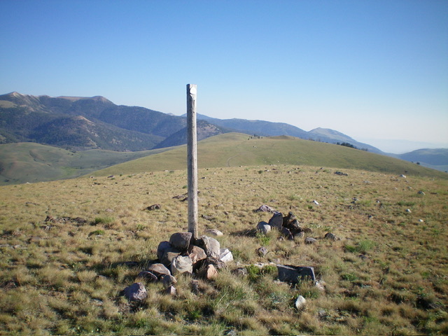
The west/official summit of Peak 9140, looking north along the Continental Divide. A CDT post and steel ID/MT survey marker are here. Livingston Douglas Photo
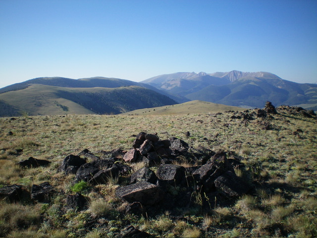
The east summit of Peak 9140, looking south along the Continental Divide. Livingston Douglas Photo
Additional Resources
Regions: Beaverhead Range->EASTERN IDAHO
Mountain Range: Beaverhead Range
Longitude: -112.8907 Latitude: 44.3647