Elevation: 9,140 ft
Prominence: 520
This peak is not in the book. Published January 2023
Peak 9140 is an unnamed hump located due north of Blizzard Mountain (9,313 feet). It is most easily reached via the Iron Mine Creek Trail to its northwest. A cautionary note: Mine Creek Trail is no longer maintained and is in poor shape with a few areas of avalanche debris (large trees and tree branches) covering the foot path. This is a long hike. USGS Blizzard Mountain North

Peak 9140 as viewed from near the saddle to its southwest. Livingston Douglas Photo
Access
Fish Creek Road is located along US-20 several miles east of Carey, Idaho and 25.1 miles east of the junction of US-20 and ID-75. Turn left/north onto [signed] Fish Creek Road and reset your odometer. At 5.4 miles, pass the left turnoff for West Fork Fish Creek Road (signed for “Boat Ramp”). At 6.6 miles, pass the right turnoff for East Fork Fish Creek Road (unsigned). At 9.8 miles, go right at an unsigned junction.
At 12.0 miles, go right at an unsigned junction. At 14.8 miles, reach the Mine Creek Trailhead (right side of Fish Creek Road) at a sharp left/north turn in Fish Creek Road. Park here (6,155 feet) in a large parking area just below the beginning of Mine Creek Trail. The trail begins as an old jeep road with a gated road closure and an “Access Yes” sign since the old road/trail initially crosses through a section of private property.
West Face/Northwest Ridge, Class 2
The Climb
Mine Creek Trail initially heads southeast up an old jeep road for about two miles. The road becomes a narrow foot path (unmaintained) and crosses Iron Mike Creek three times. Continue up the Mine Creek drainage as it weaves its way up through a pine forest with three areas of substantial avalanche debris covering the trail. Stay left on the main road/trail when it reaches an unsigned junction with Lake Creek Road to the right. The Mine Creek drainage is quite narrow in areas and it heads southeast, then northeast, then south, then east, and then makes a final jog south to reach tree line. The trail (now an old road again) turns sharply left/north here. Continue straight/south on a spur road for a short distance.
Leave this spur road and hike up a weak 2-track to reach a lateral mining road. Go left/north on this old mining road to quickly reach an old mine in a gully on the west face of Peak 9140. From here, scramble east up the steep face on a combination of sagebrush, loose scree, and downed tree logs. This section is tedious. High up, reach another lateral mining road. Go left/north on this old road to reach the northwest ridge and, soon after, another old mine. Leave the road here and scramble southeast up easy tundra to the summit of Peak 9140. The summit has a modest cairn and a magnificent view of nearby Blizzard Mountain.
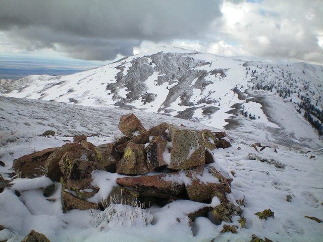
The summit cairn atop Peak 9140 with Blizzard Mountain in the background. On this day, Blizzard Mountain certainly earned its name. It is often snow covered. Livingston Douglas Photo
Southwest Ridge, Class 2
The Descent
From the summit, descend southwest along a fence row on tundra and loose scree to quickly reach the 8,580-foot connecting saddle with Blizzard Mountain. From the saddle, descend an old mining road northwest then north toward the Iron Mine Creek drainage. Leave the road (to save time and avoid long switchbacks) and drop west down to the spur road which leads back to the Iron Mine Creek Road/Trail. Follow the Iron Mine Creek Trail back to the trailhead and the parking area.
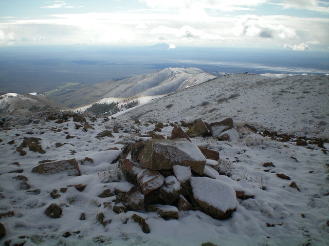
Looking southeast toward Craters of the Moon National Monument from the summit of Peak 9140. Livingston Douglas Photo
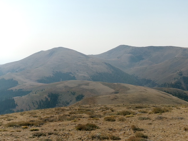
Peak 9140 (left) and Blizzard Mountain (right) as viewed from Peak 9102 to the north. Livingston Douglas Photo
Additional Resources
Regions: EASTERN IDAHO->Pioneer Mountains
Mountain Range: Pioneer Mountains
Longitude: -113.66591 Latitude: 43.51251