Elevation: 9,149 ft
Prominence: 609
This peak is not in the book. Published November 2023
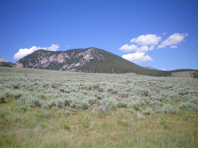
Peak 9149 is a rugged, rocky affair that sits in the shadow of nearby Rainbow Mountain (10,162 feet). The shortest route to the summit is from nearby Coal Kiln Canyon and its northeast ridge. However, the easiest climbing route is via its west ridge from a high saddle above Coal Kiln Canyon. USGS Coal Kiln Canyon
Peak 9149 and its rugged south face. Livingston Douglas Photo
Access
From ID-28, drive west on Coal Kiln Road/FSR-188 (signed for the Coal Kilns) for 5.1 miles to reach the parking/picnic area and bathroom for the Coal Kilns. The road junction is at MM61 on ID-28 and is 3.4 miles north of [signed] Nicholia Road. Park at the Coal Kilns parking area (7,365 feet; 44⁰18’37”N, 113⁰10’48”W). The road gets much rockier, overgrown, and primitive past this point.
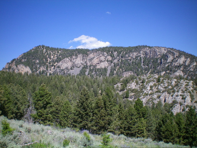
Peak 9149 as viewed from the coal kilns to its southeast. Livingston Douglas Photo
East Face/Northeast Ridge, Class 2
The Climb
From the Coal Kilns parking lot, hike north briefly on the main road (FSR-188) to reach a signed road junction. Go straight/north onto an unsigned Forest Service Road. Go straight at another unsigned junction (where another 2-track heads right/east). Follow the road as it bends left/west and descends 80 vertical feet to intersect a weak 2-track road in Coal Kiln Canyon. Walk a short distance left/southwest up the road (perhaps 100 yards) to a patch of short grass on the right/north side of the road.
Leave the road and bushwhack diagonally west up through sagebrush onto an obvious ridge that is initially in open terrain. Head northwest up the rounded ridge which becomes semi-open and is a mix of pines and sagebrush. Continue bushwhacking northwest to reach a semi-open saddle at 7,900 feet that is just southwest of a minor hump (Point 7940+). This wide saddle sits on the northeast ridge of Peak 9149.
From the saddle, scramble southwest directly up the rounded ridge into an easy pine forest to reach Point 8814. The terrain gets a bit rockier and has more deadfall as you go higher, but is not difficult. From semi-open Point 8814, bushwhack west then southwest along the semi-forested ridge crest. This section of the ridge is rockier with more deadfall. Reach a final saddle then push up the narrower ridge crest in a mix of rock, pines, and deadfall to reach the semi-open summit of Peak 9149. The summit had no cairn so I built one.
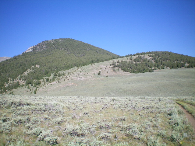
Peak 9149 (left of center) and the intervening ridge that leads up to its forested east face. This was my ascent route. Livingston Douglas Photo
Additional Resources
Regions: EASTERN IDAHO->Lemhi Range
Mountain Range: Lemhi Range
Longitude: -113.2132 Latitude: 44.3162