Elevation: 9,180 ft
Prominence: 600
This peak is not in the book. Published November 2023
Peak 9180 is on the Continental Divide and on the ID/MT border in the Beaverhead Mountains. It sits at the head of both Little Eightmile Creek (ID) and Black Canyon Creek (MT). It is most easily climbed from FST-3906 on the Montana side and an old 2-track road on the crest of the southeast ridge. USGS Goat Mountain
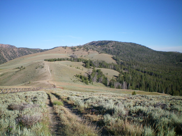
Peak 9180 (in distance right of center) as viewed from the Continental Divide to its southeast, early in the ridge traverse. Livingston Douglas Photo
Access
From the signed junction of ID-28 and ID-29 in Leadore, drive northeast on ID-29 for 13.5 miles to reach the crest of the highway at Bannock Pass (7,681 feet). Leave ID-29 and drive southwest on [signed] FSR-012. At 5.0 miles, reach an unsigned junction with FSR-3906. Go right/north on FSR-3906 for 3.0 miles to a meadow and an unsigned junction with a weak 2-track road heading left/west. Park/camp here (8,420 feet; 44⁰48’56”N, 113⁰21’00”W). FSR-3906 is a narrow, rocky 2-track road. It is not steep and does not require high clearance but you will need to have good tires.
Map Errors
The 2-track road heading west from FSR-3906 up to the Continental Divide is not shown on any maps. The ridge crest road (on the Continental Divide) shown on the USGS topo map does not exist south of the saddle/meadow where the 2-track road comes up from FSR-3906. The USGS topo map fails to show the CDT, which meanders near the Continental Divide on the southeast ridge of Peak 9180.
Southeast Ridge, Class 2
The Climb
This climb is mostly Class 1. From the unsigned road junction, follow the weak 2-track road west as it goes through a patch of forest to reach an open meadow. The road disappears here so follow its remnants in short grass on the left/south edge of the pine forest to reach a split-rail fence row on the Continental Divide near an old corral. The road reappears here and heads right/north-northwest up the CD on the right/east side of the fence row. The old 2-track crests at open Point 8640+ and heads right/east (this short right segment is not shown on maps). There is a fence corner here.
Leave the road here and jump the fence to head left/northwest along the ridge crest on the right/northeast side of the fence row. Contrary to the USGS topo map, there is no road that heads from the top of Point 8640+ along the ridge crest heading northwest. After heading downhill for a short distance, angle right/north across easy grass/scrub to intercept a 2-track road that comes in from the east. This road becomes the continuation of the ridge road that preceded the summit of Point 8640+. The ridge road now appears correctly on the USGS topo map from here to the summit of Peak 9180.
Follow the 2-track ridge road northwest as it undulates and wiggles a bit to approach Peak 9180. Ignore the CDT as it is sometimes on (or is crossing) the ridge road. The CDT would only add needless mileage to the climb. High up on the final push to the summit, the CDT heads right/east from the ridge road into the forest. Stay on the road even though it is now almost impossible to follow. It is temporarily buried in veg and deadfall. Bushwhack north then northwest up its remnants to quickly find it reappear. Hike up the 2-track road to the bare summit of Peak 9180. Sometimes the road is weak, but it is still an expedient way to hike to this summit. The summit had no cairn so I built one. The CDT skirts well below the right/north side of Peak 9180.
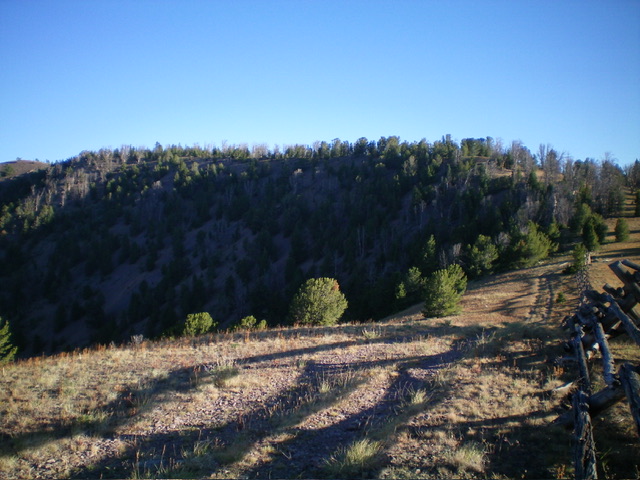
The final push up the forested section of the Continental Divide to the open summit hump of Peak 9180 (at far left edge of photo). Livingston Douglas Photo
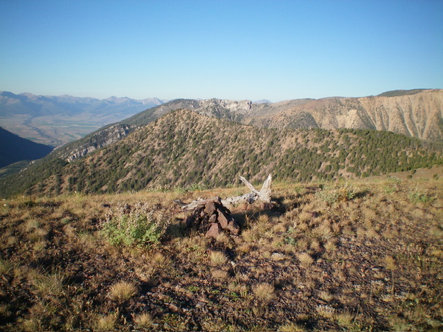
The summit cairn atop Peak 9180, looking southwest. Livingston Douglas Photo
Additional Resources
Regions: Beaverhead Range->EASTERN IDAHO
Mountain Range: Beaverhead Range
Longitude: -113.3854 Latitude: 44.8377