Elevation: 9,188 ft
Prominence: 328
This peak is not in the book. Published November 2021
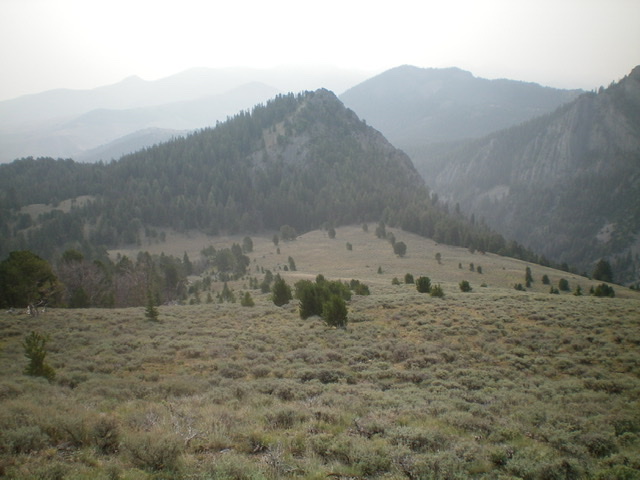
Peak 9188 is located across the Wet Creek drainage from Octoberfest Peak (10,820 feet). It is a forested hump on the vast east side of Last Lost Peak (11,260 feet). USGS Massacre Mountain
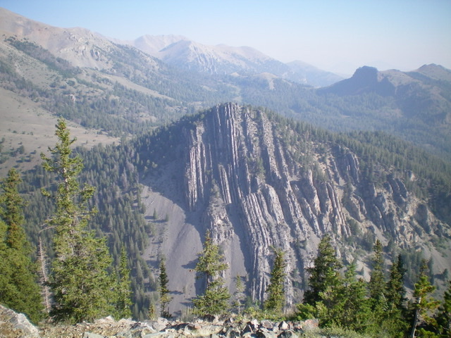
Peak 9188 (mid-ground) and its unclimbed south face. Livingston Douglas Photo
Access
This is the first leg of a 2-peak adventure that includes Peak 9188 and Last Lost Peak. It covers 8.8 miles with 4,100 feet of elevation gain round trip. Pass Creek Road/CR-122 is located along US-93 south of Mackay and is signed as 3900W. This junction is exactly 7.4 miles south of Main Street in Mackay and 18.3 miles north of the junction of US-93 and US-20 in Arco. Turn north onto [signed] Pass Creek Road and reset your odometer. At 11.5 miles, reach Pass Creek Summit and cross a cattle guard. Turn left/west here onto [unsigned] FSR-539 and drive 2.1 miles to the signed trailheads for FST-4092 and FST-245/Wet Creek Trail (signed as FST-063 and “Wet Creek/Long Lost Trail”). Park in a pullout across from the trailhead (8,020 feet).
Map Errors
The USGS map fails to show FST-245/Wet Creek Trail and FST-092/East Side Crest Trail. This is a MAJOR oversight on the part of the USGS and makes the map almost useless except for the terrain and contour lines. The USGS map mispositions FSR-539. From Point 8015, the road heads north then northeast then east to follow the Wet Creek drainage downstream. It does NOT head northwest then northeast as the USGS topo map indicates.
Northeast Ridge, Class 2
The Climb
From the trailhead, FST-245/Wet Creek Trail follows an old 2-track road (shown on the USGS topo map) west then northeast, descending to cross to the north side of Wet Creek. The trail/road then bends hard left/west and climbs up to a drainage at about 8,000 feet. The trail becomes a footpath here and heads northwest up a gully to reach a 9,140-foot saddle at the base of the northeast ridge of Last Lost Peak. FST-245 is accurately shown on the Challis National Forest Map. The book (on Page 294) refers to this trail as the East Side Crest Trail but it is not signed as such.
Follow FST-245 from the trailhead down to 7,800 feet after a sharp right/northeast bend in the trail/road. The trail now emerges from the forest into a meadow. Leave the trail here and head left/northwest, following the right/northeast edge of the forest in some marshy, boggy terrain. Keep heading northwest to reach drier ground and an easy crossing of [small] Wet Creek. Once on the north side of Wet Creek, scramble northwest up open sagebrush slopes toward the toe of the northeast ridge of Peak 9188. You will soon intercept FST-245 (still an old road). Hike briefly west on FST-245 to reach a point where it crosses the northeast ridge, becomes a foot trail, and heads right/north up a drainage.
Leave the trail here and climb southwest up the ridge crest, soon entering a pine forest. Scramble up over rocky Point 8287 then continue heading southwest then west up through an open pine forest. This is an easy bushwhack with elk trails on or near the ridge crest to help. Reach a flat, semi-open area at about 8,850 feet. From here, head left-ish/southwest to reach a steep, final patch of forest. Bushwhack left-ish/south to gain the crest of the east ridge high up. Follow the ridge west for a short distance to the small, semi-open summit. The high point is obvious, but a bush covers the highest ground boulder. A decent summit cairn is nearby. The view of Octoberfest Peak from the summit is amazing.
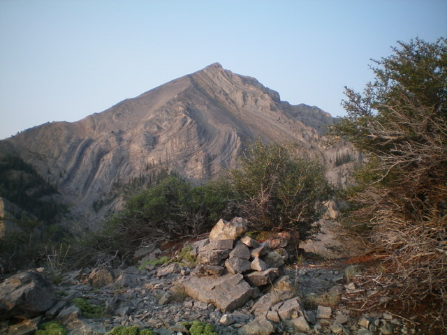
Peak 9188 (forested, dead center) and its steep west ridge coming at the camera. The west ridge was my descent route. Livingston Douglas Photo
The summit of Peak 9188 with Octoberfest Peak in the background. Livingston Douglas Photo
West Ridge, Class 2
The Descent
From the summit, descend northwest in easy, semi-open pine forest. The ridge then bends left-ish/west and becomes much steeper and rougher. Rocky outcrops and chutes mix in with the forested terrain. Stay on the ridge crest and downclimb the ridge rock (Class 2), avoiding steeper rock on both sides of the ridge. Finish with a final steep drop through easy pine forest to reach the wide, open sagebrush connecting saddle (8,860 feet) with Last Lost Peak. This concludes the first leg of today’s 2-peak journey. Last Lost Peak is up next.
Additional Resources
Regions: EASTERN IDAHO->Lost River Range
Mountain Range: Lost River Range
Longitude: -113.50709 Latitude: 44.02159