Elevation: 9,188 ft
Prominence: 368
This peak is not in the book. Please note that the name Squaw has officially been removed from all US Geographic Names. Older maps will still show names using the word. Hence, the narrative below still uses the word. Updated January 2023
Peak 9188 is the high point on a ridge that separates North Fork Squaw Creek from Squaw Creek. This ridge is essentially a continuation of the long southwest ridge of Sheep Mountain. Peak 9188 is merely another bump along the way. The peak is forested and somewhat hidden. It is a bit of a navigational challenge to find your way to the top of this one. USGS Gilmore
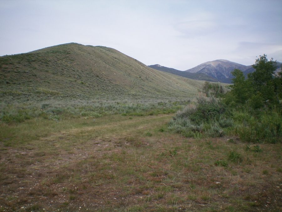
The southwest ridge as viewed from its base. The initial scrub hill/ridge is left of center. The summit of Peak 9188 is the forested point in dead-center. Sheep Mountain is right of center in the distance. The southwest ridge essentially goes all the way to the top of Sheep Mountain. Livingston Douglas Photo
FULL Southwest Ridge, Class 2
Access
Sawmill Canyon Road/FSR-101 is located 36.6 miles north of Howe on the Little Lost River Highway. Turn right/east onto [signed] Sawmill Canyon Road at a fork in the highway. At 6.7 miles, reach the Challis National Forest boundary. At 8.0 miles, reach a junction with [signed] Squaw Creek Road/FSR-102. At 8.1 miles (just after crossing Squaw Creek), reach an unsigned junction with a 2-track jeep road. Turn right/northeast here and park at a dispersed campsite near the junction with Sawmill Canyon Road. The elevation here is 6,790 feet.
The Climb
The dispersed campsite is at the toe of the southwest ridge of Peak 9188. From the campsite, leave the Squaw Creek drainage and scramble northwest to reach the crest of the ridge. The terrain here is short scrub and is easy. Follow a cattle trail on the ridge crest as you head north-northeast up the ridge. Higher up, a cattle fence appears on the left/west side of the ridge crest. About 1-1/2 miles up the ridge, reach a flat area just west of Point 7723.
From here, you have outstanding visuals of what lies ahead. A broad, mile-wide meadow lies below you to the north and northeast. Cattle graze here. There are three gullies that come up to this meadow. The first two are dry; the third is wet (North Fork Squaw Creek). Get a good visual of the forested southwest ridge of Peak 9188 from here. You must find it after crossing the vast expanse of the cattle meadow below you.
Leave the open bluff and descend 75 vertical feet to the open meadow and cross the first gully, heading in a northerly direction. Continue north, going slightly uphill then bend right/northeast to cross a second dry gully. From there, head east to reach the west side of the North Fork Squaw Creek. Stay in the open grass/scrub and out of the forest for as long as you can.
Cross an old 2-track jeep road near a cattle fence and, almost immediately, bushwhack a short distance to cross the North Fork Squaw Creek to the east. Once across the small creek, scramble up an easy semi-open face of scrub to reach the forested crest of the southwest ridge. Cross an old jeep road (still shown on the USGS topo map) here and continue up the ridge. The ridge goes relatively well but has some areas of dense pine forest and blowdown. Higher up, there are one or two sections of boulder fields to navigate.
The ridge eventually becomes very ill-defined and is more of a face climb for the final 600 vertical feet of ascent. If you reach the summit area just south of the high point, you must bushwhack through an unpleasant section of boulders and trees/blowdown. The summit area is forested but has visibility. The summit high point is open and has a modest cairn.
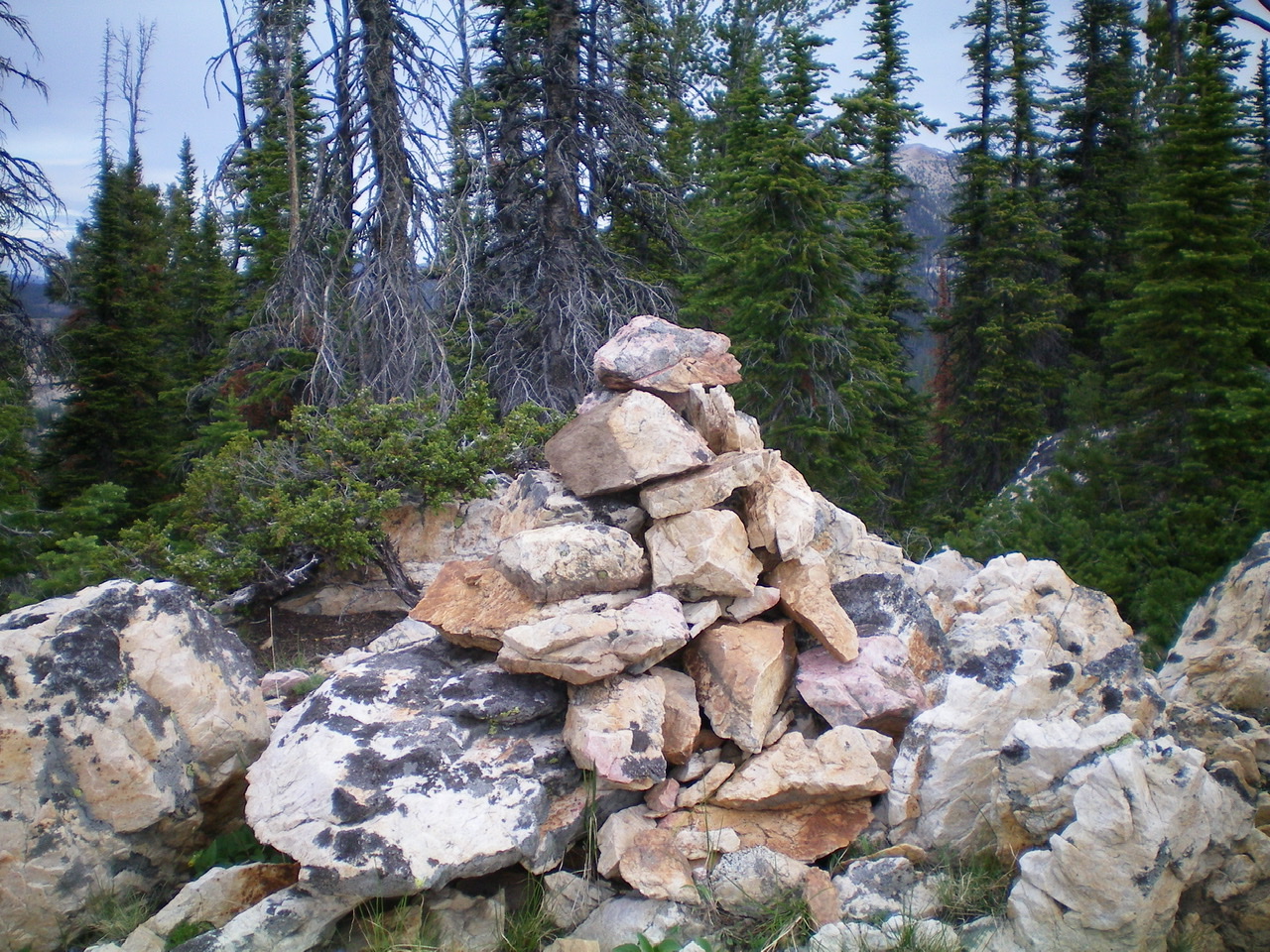
The newly-enhanced summit cairn atop forested Peak 9188. Livingston Douglas Photo

The southwest ridge as viewed from the upper reaches of the peak. The ridge crosses the meadow, follows a forested section (right of center), and then bends left to follow a ridge crest to the valley floor at Sawmill Canyon Road. Livingston Douglas Photo
Northeast Ridge, Class 2
Access
Same as for the southwest ridge. This is the first leg of a ridge traverse from Peak 9188 to Sheep Mountain.
The Descent
From the summit, descend the forest-and-rock mix of the narrow northeast ridge. This ridge traverse is somewhat long and tedious. Climb 40 vertical feet over Point 9007 then descend to a small saddle on a decent use trail. This 8,820-foot saddle connects Peak 9188 to Sheep Mountain. This is the terminus of the northeast ridge.
Additional Resources
Regions: EASTERN IDAHO->Lemhi Range
Mountain Range: Lemhi Range
Longitude: -113.31989 Latitude: 44.37859