Elevation: 9,220 ft
Prominence: 1,320
This peak is not in the book. Please note that the book identifies Peak 9220 as “Big Table Mountain” on Page 332 but that mountain is actually on the west side of East Camas Creek, much farther west on the Continental Divide than Peak 9220 (as per the USGS topo map and LOJ). Published December 2020
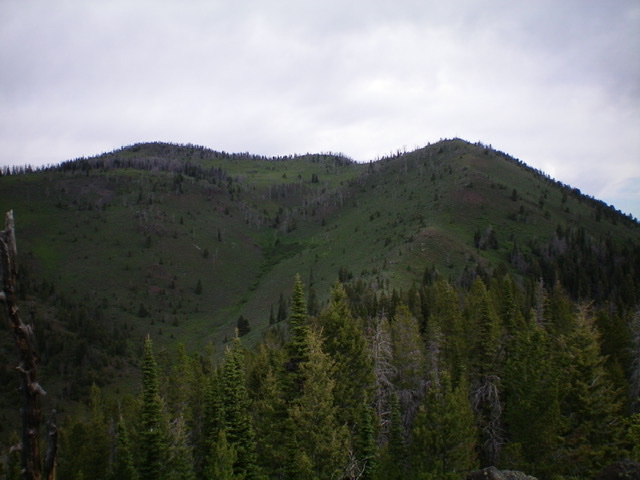
Peak 9220 is located east of Big Table Mountain (9,100 feet) in the Western Centennials. It sits on the Continental Divide at the headwaters of both East Camas Creek and Spruce Creek. It is a double-humped summit with the west summit (9,220 feet) notably higher than the east summit (Point 8943). The easiest ascent route is via Bear Trap Creek Road/FSR-023 and FST-135 to the Continental Divide and the CDT/FST-004. Follow the CDT southwest along the Divide to reach the south face of Peak 9220 and scramble a short distance to the top. USGS Winslow Creek
The summit cap of Peak 9220 (center) as viewed from the east. Livingston Douglas Photo
Access
From the north side of Kilgore, ID, drive north on [signed] Cottonwood Creek Road/FSR-026. At 3.9 miles, reach a [signed] junction with East Camas Creek Road. Turn left here and follow East Camas Creek Road for about 4 miles to a sharp right/east turn in the road at a junction with [signed] FSR-023/Pasture Creek Road (it follows Bear Trap Creek for most of its life so it is also called Bear Trap Creek Road). Park just below this road junction on East Camas Creek Road in a pullout on the left/west side of the road (7,010 feet).
South Ridge/Southeast Spur, Class 2
The Climb
From the parking pullout, bushwhack west through a thin strip of forest to reach a wide meadow/marsh. Head northwest across the open meadow/marsh to reach Spruce Creek. Drop 50 vertical feet in thick forest to reach the creek and cross it on a fallen tree or a beaver dam then climb steeply west for 70 vertical feet to reach the critical southeast spur/shoulder of the south ridge of Peak 9220. Traverse west across the broad shoulder to find an old 2-track road (now just a footpath) in an obvious, grassy clear-cut where the road had been. This old road is shown on the USGS topo map as a “pack trail” but is not shown on the National Forest map.
Follow the old road up to 7,350 feet. Leave the road and bushwhack west to continue up the southeast spur and leave the Spruce Creek drainage area. Reach the crest of the spur at about 7,600 feet. The spur is better defined here than lower down where it is broader and more rounded. Follow the spur northwest on a good elk trail (at or near the crest of the spur) up to Point 8493. This point is where the southeast spur joins the south ridge. From Point 8493, descend north on the ridge for 100 vertical feet to a narrow saddle then continue north up a more open scrub slope to get close to Point 8943, the [lower] east summit of Peak 9220. Skirt the left/west side of Point 8943 on easy grass/scrub to reach a narrow, clogged ridge section.
Bash your way briefly through this thick section of trees, brush, and boulders to reach a small saddle on the narrow ridge crest. The CDT crosses from Montana into Idaho here. Briefly follow the CDT west to cross the head of a prominent gully to the left/south and reach a shoulder. Leave the CDT and scramble right/north up the semi-open shoulder on a steep gravel/veg slope with scattered pines and blowdown. Higher up, move left/west and then right/north to reach the gentle open summit of Peak 9220. There was nothing on top so I built a small summit cairn on the high point. The summit offers unobstructed, beautiful views of Montana and the Continental Divide.
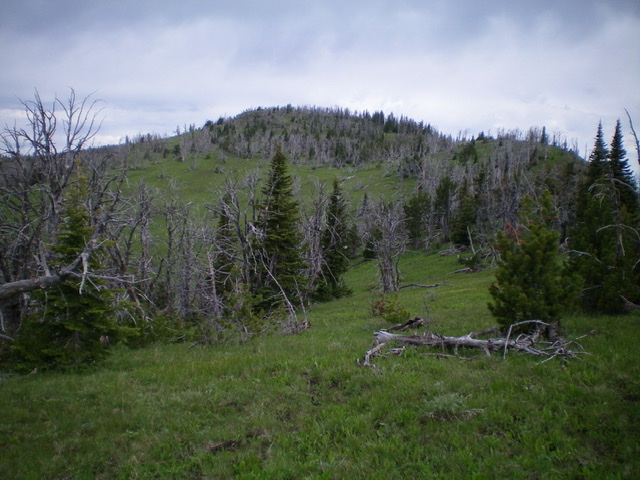
Peak 9220 is the forested hump to the left. Point 8943 is the hump to the right. This photo was taken from high on the south ridge. The final uphill section of the south ridge is right of center. Livingston Douglas Photo
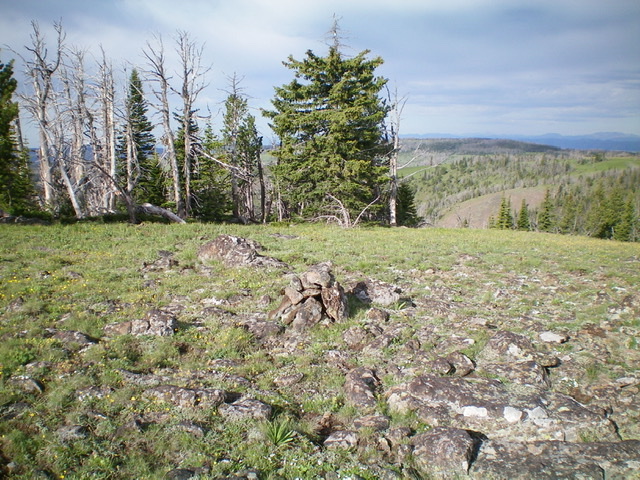
The gentle summit area of Peak 9220. Livingston Douglas Photo
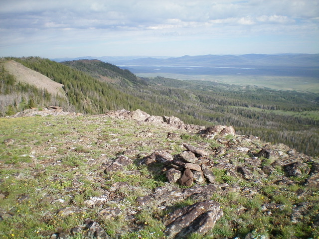
Looking northwest into Montana from the summit of Peak 9220. The Continental Divide is on the left and Lima Reservoir is in the distance. Livingston Douglas Photo
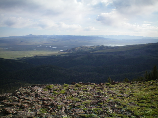
Looking northeast into Montana from the summit of Peak 9220. Upper Red Rock Lake is in the distance. Livingston Douglas Photo
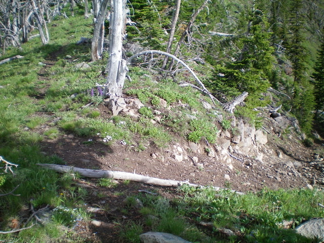
A tale of two CDTs: the well-maintained, broad trail on the MT side of the CD (right) and the weak foot path on the ID side of the CD (left). This is where the CDT crosses a small saddle at the base of the east ridge of Peak 9220. Livingston Douglas Photo
Additional Resources
Regions: Centennial Range->EASTERN IDAHO
Mountain Range: Centennial Range
Longitude: -111.98201 Latitude: 44.53669