Elevation: 9,242 ft
Prominence: 582
Climbing and access information for the lower summit of Mount Mills is on Page 129 of the book. Judi Steciak and Carl Hamke pointed out to me that the map makers placed the peak’s name on its lower northern summit (not an uncommon occurrence). This entry corrects the error and will get you to the true summit. Published September 2020
Mount Mills is located at the head of four large drainages: Float Creek (which holds Josephus Lake), Harlan Creek, Seafoam Creek, and Fall Creek. The peak’s towering location is an excellent spot to survey many lakes that dot this stretch of the Frank Church River of No Return Wilderness. USGS Soldier Creek
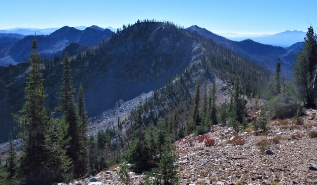
View of the ridge connecting Mount Mills (9,424 feet) with the point marked Mount Mills (9,195 feet) on the topographic map. Judi Steciak Photo
Access
This climb starts at Josephus Campground [(F)(1) on Page 140]. A high-clearance vehicle is recommended. As with almost all roads in the Salmon River Mountains, the access roads pass through burned areas. Judi and Carl recommend, “Packing a timber saw or chain saw, axe, leather gloves, and towing/skidding straps is recommended due to the possible deadfall across the roads in burned areas.“ The trails in this area have been renumbered since the book was published (FST-014 is now FST-013 and FST-019 is now FST-014.) Nevertheless, the trail access is unchanged.
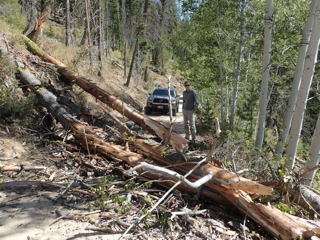
Judi Steciak reports this “picture is the worst of the deadfall that we cleared off the road.” Judi Steciak Photo
Northwest Ridge, Class 2 by Judi Steciak and Carl Hamke
On Page 129, the book describes the approach and route to the point on the topographic map marked as Mount Mills (9,185 feet). Take the time for a detour to the most northwestern point of the ridge for views of Helldiver Lake, Lost Lake, and Josephus Lake. Head southeast on generally good footing towards the crescent-shaped summit, the high point on the ridge.
Additional Resources
Mountain Range: Eastern Salmon River Mountains
Longitude: -115.15509 Latitude: 44.51489