Elevation: 9,284 ft
Prominence: 344
This peak is not in the book. Published November 2020
Peak 9284 is a peak on the Continental Divide that sits east of the [more rugged and higher] Peak 9900/The Knuckle and The Thumb (9,760 feet). Peak 9284 is a gentle hump that is in a somewhat remote position on the Divide and takes a bit of hiking to reach it unless you can make it up Edie Creek Road for several miles. The peak sits at the headwaters of Edie Creek (ID) and Shineberger Creek (MT). This climb is the first peak in a three-peak adventure that includes Peak 9284, Peak 9900/The Knuckle, and The Thumb (9,760 feet). USGS Edie Creek
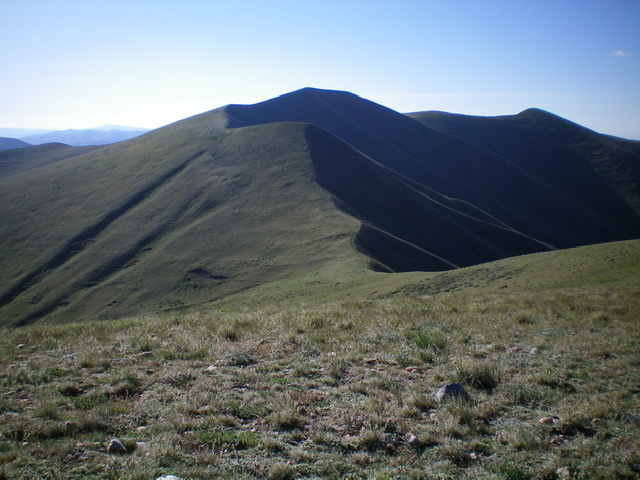
Peak 9284 as viewed from the west along the Continental Divide. The summit is dead-center and is dark with shadows. Livingston Douglas Photo
Access
From I-15 at Dubois, ID, drive west on ID-22 for 5.9 miles to Medicine Lodge Road. Turn right/north onto [signed] Medicine Lodge Road and reset your odometer. At 21.0 miles, the pavement ends. At 25.7 miles, reach a [signed] road junction with Irving Creek Road. Turn right/northeast and reset your odometer. At 2.7 miles, reach an unsigned road junction with a cattle gate for each road. Go straight/north to continue up Irving Creek Road. Go right/east for Bull Pen Road.
Turn right here to reach the Bull Pen. Go through the cattle gate and continue eastward to reach BLM land. The road now gets much rougher. It is now a badly-rutted, 2-track dirt road and is getting overgrown with grass. But it is drivable if you have decent ground clearance, 4WD, and good tires. At 6.0 miles, reach the National Forest boundary. Park just inside the boundary as the road gets steeper, rockier, and rougher after this point. The elevation at the National Forest boundary is 7,540 feet.
The Approach, Class 2
Your first task is to reach the Continental Divide between Peak 9284 and Peak 9900/The Knuckle. From the National Forest boundary, hike up the Bull Pen Road/FSR-193 for 0.5 miles to a fork in the canyon at a meadow (Point 7737 on the USGS map). Leave the road here and bushwhack east up onto a forested shoulder of semi-open terrain with lots of sagebrush. The shoulder bends left-ish/northeast and the terrain becomes easy short grass/scrub. This shoulder ends at a north-south ridge just north of Point 9026. Skirt the left/north side of Point 9026 to reach the ridge crest at a minor saddle. Continue north on this ridge to reach its junction with the Continental Divide on easy, short scrub. This concludes the approach hike.
West Ridge, Class 2
The Climb
From the juncture on the Continental Divide (9,360 feet), go right/east and follow the Divide on a weak game trail (when available) on easy, open scrub for 1.5 miles to reach the summit of Peak 9284, with 3 ups-and-downs along the way. The summit has a decent cairn. Return west to the 9,360-foot juncture on the Continental Divide to conclude the first leg of today’s three-peak journey.
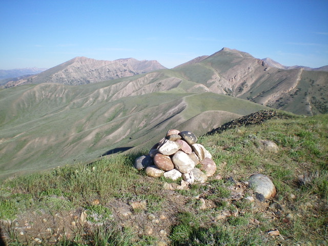
The round-rock summit cairn atop Peak 9284, looking west. Peak 9900/The Knuckle is right of center in the distance. Livingston Douglas Photo
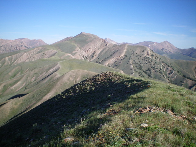
The weaving, undulating west ridge of Peak 9284 as viewed from the summit. Livingston Douglas Photo
Additional Resources
Regions: Beaverhead Range->EASTERN IDAHO
Mountain Range: Beaverhead Range
Longitude: -112.51269 Latitude: 44.47359