Elevation: 9,268 ft
Prominence: 528
This peak is not in the book. Updated October 2025
Peak 9268 is a rugged, rocky peak that sits on the east side of Big Rocky Canyon and on the north side of the East Fork Big Lost River in the western section of the White Knob Mountains. It is most easily climbed via its east face. This area is a mix of private and public land, so be careful. This climb is entirely on BLM land. USGS Harry Canyon
Access
Same as for Peak 9380. This is the third leg of a 3-peak adventure that includes Peak 9380, Peak 9292, and Peak 9268. It covers 9.5 miles with 3,750 feet of elevation gain round trip.
North Ridge, Class 4
The Climb
From the 8,740-foot connecting saddle with Peak 9292, bushwhack southwest then south up into the pine forest. There are many hidden ridge blocks and towers to navigate in this forest. Stay just to the left/east of these towers to advance closer to the summit area. The north ridge narrows quickly and becomes very tedious. The mix of ridge towers, knife-edged ridge rock, pines, mountain mahogany, and thick brush is challenging. There are many ups and downs on the north ridge.
When you finally see the summit hump, it is a surprise—surprising in how much it protrudes from the ridge towers on the north ridge. The USGS topo map suggests that the summit is just another ridge tower. While it is great to finally see the summit, the remaining scramble to get there is wicked. Work along the exposed, knife-edged, Class 4 ridge crest to reach the easier ridge rock of the summit hump. A direct line to the top is impossible.
Work along the left/east side of the rocky ridge crest and find a spot just north of the high point to climb up Class 3+ face rock and ledges to reach the summit ridge. Once on the summit ridge, head south for a short distance (20-30 feet) to the cairned high point. The summit ridge is an unpleasant mix of boulders, talus, and mountain mahogany. The summit is small and has a modest cairn.
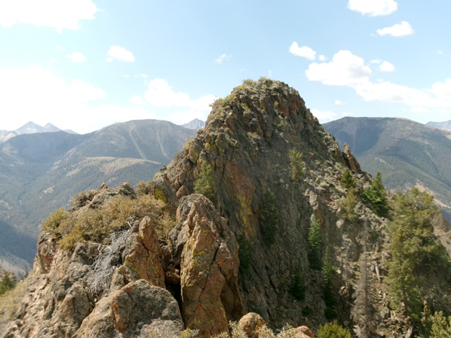
Peak 9268 (summit is right of center) and its rocky, rugged south ridge (in center and left of center). Livingston Douglas Photo
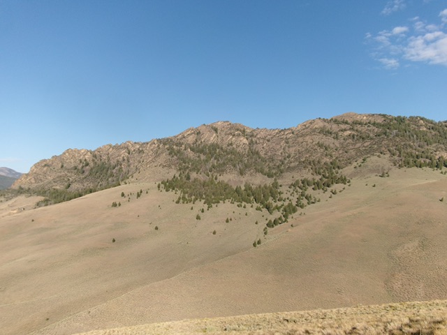
Peak 9268 (in mid-ground) as viewed from Peak 9380 to its northeast. The rugged north ridge (my ascent route) is right of center and center. The pointed summit hump is quite visible in this photo. Livingston Douglas Photo
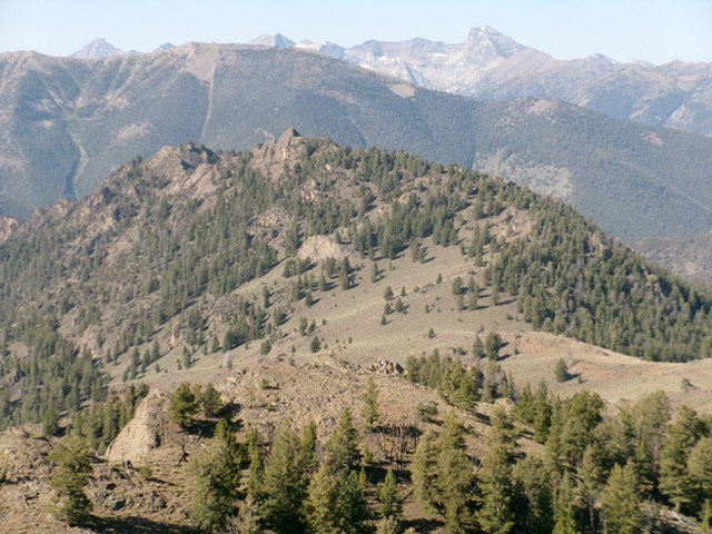
The rocky summit hump of Peak 9268 as viewed from high on the north ridge. This was my ascent route. Livingston Douglas Photo
East Face/Southeast Shoulder, Class 3+
The Descent
From the summit, return north to the entry point. Descend the face rock and ledges on the east face (Class 3+) to reach easier terrain below. Head right/south into a gully that heads diagonally down and left/northeast. This gully becomes a ramp lower down. From the bottom of this gully, descend east down Class 3 face rock and cliff bands to reach pine forest. The steep rock and underlying talus/scree ends but the pine forest has many hidden blocks and cliff bands to navigate (Class 3).
To make matters worse, mountain mahogany joins the forested mix. Zig-zag your way east down to the magnificent open scrub of the southeast shoulder. Exit the forest and descend east in thick-ish sagebrush with loose scree underneath to reach the easier southeast shoulder. Follow the shoulder right-ish/southeast in easy, short scrub all the way to its end at the crossing of a drainage (“Banana Gulch” according to Baugher). Cross the drainage and scramble east-southeast up sagebrush (with cattle trails to help) to reach a 7,700-foot ridge saddle just north of Point 7712 on the south ridge of Peak 9380. Reaching this saddle requires about 250 vertical feet of uphill effort.
From the saddle, head east to intercept the southeast spur of the south ridge. Follow this spur back down to the crossing of the East Fork Big Lost River, using cattle trails to expedite your descent to the valley floor whenever possible. Ford the river and return to your parked vehicle.
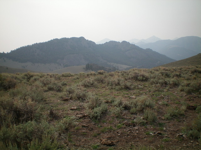
A side view of rugged Peak 9268 as seen from the northwest. The high point is just left of center. Livingston Douglas Photo
Additional Resources
Regions: EASTERN IDAHO->White Knob Mountains
Mountain Range: White Knob Mountains
First Ascent Information:
- Other First Ascent: North Ridge
- Year: 2025
- Season: Summer
- Party: Livingston Douglas
Longitude: -114.03149 Latitude: 43.91469