Elevation: 9,340 ft
Prominence: 320
This peak is not in the book. I followed Livingston’s route to the summit but discovered a better route to the summit which I call the Fence Line Route. Updated August 2022
Peak 9340 is located southwest of Bayhorse Lake on Buffalo Ridge. It is a minor, forested hump and is NOT the high point on Buffalo Ridge. Peak 9340 is most easily climbed via its north ridge from FST-4159. USGS Bayhorse Lake
The summit hump of Peak 9340. Livingston Douglas Photo
Access
Bayhorse Lake Road/FSR-051 is located along ID-75 exactly 7.9 miles south of the junction of US-93 and ID-75 just south of Challis. Turn right/west onto Bayhorse Lake Road and reset your odometer. At 3.2 miles, reach the Bayhorse townsite. At 4.4 miles, reach the Challis National Forest boundary. At 6.7 miles, reach a signed road junction. Go left to stay on Bayhorse Lake Road. At 8.4 miles, reach the Bayhorse Lake Campground. About 100 feet before reaching the campground turnoff, FST-4159 (signed) is on the left/south side of the road. Park at the campground entrance.
Map Errors
The USGS topo map shows the Bayhorse Campground as located alongside the east shore of Bayhorse Lake. In fact, the campground is located on a forested knoll that is about 0.1 miles east of the lake. FST-4159 is not located along Bayhorse Lake. It begins about 0.1 miles south of the lake and climbs over a forested hump that is located south of the lake and then drops into a meadow southwest of the lake before climbing up to Buffalo Ridge at a saddle. From the open meadow, the USGS topo map shows the trail correctly as it heads southwest to the aforementioned saddle at 9,020 feet.
North Ridge, Class 2
The Climb
Hike south then west on FST-4159 (an ATV trail) for about 1.3 miles to reach a 9,020-foot saddle on Buffalo Ridge. This saddle sits at the base of the north ridge of Peak 9340. Leave the trail here and bushwhack south up the thickly forested ridge. The forest has lots of blowdown but also has some semi-open areas and a final rocky ridge face (then ridge) climb to reach the open summit. There is a section of an old 2-track road on the right/west side of the ridge that I found about halfway up the ridge. Its origin may be at an open meadow just west of the aforementioned 9,020-foot saddle, but I can’t be sure.
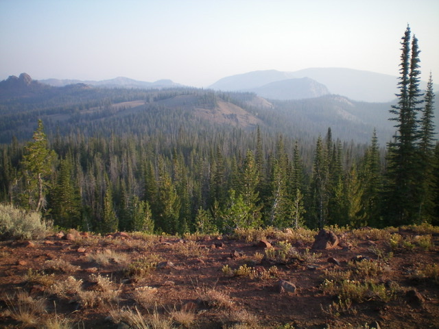
Higher up, the ridge is poorly defined. Just keep heading south and a little right-ish/southwest as you gain altitude. Unfortunately, the forest is fairly flat which makes navigation difficult because visibility is often nil. At about 9,200 feet, the rocky northwest ridge becomes visible. Scramble right/southwest up a scree face to reach the narrow, rocky ridge crest. Follow it left/southeast to quickly reach the summit. The summit has a gold benchmark but no summit cairn, so I built one. The summit offers a nice view of the intimidating spire that is the high point of Buffalo Ridge (9,443 feet) which is to the north-northwest.
Fence Line Route, Class 2
Access
Primary Access is from ID-75. Turn onto the signed Bayhorse Lake Road which is 55.5 miles from the junction of ID-21 and ID-75 in Stanley or 17.3 miles from the junction of ID-75 and US-93. Follow the road to Bayhorse Lake [(G)(1) Page 141]. The maps of this area, including the Forest Service 2016 tops are completely inaccurate when it comes to the location of trails. The Bayhorse Lake CG is now located south of the lake. Just before reaching the CG entrance the start of FST-149 now leaves the road’s west side. This trail is open to ATVs. Follow the trail west. It gradually climbs to a saddle on Peak 9340’s north ridge. Continue west until you reach a fence line. The fence is not shown on the map.
Route
Based on the inaccurate FS topo we climbed the peak by ascending it’s forested north ridge as described by Livingston. This route, while not difficult, encounters a lot of down fall and brush as well as short sections of overgrown logging roads. The last section to the summit crosses steep, open terrain. Upon descending northwest off the summit I spotted a fence line. The fence line provided a much better route as the FS has kept it clear of debris. We descended the fence line down to FST-149 as shown in the map below.
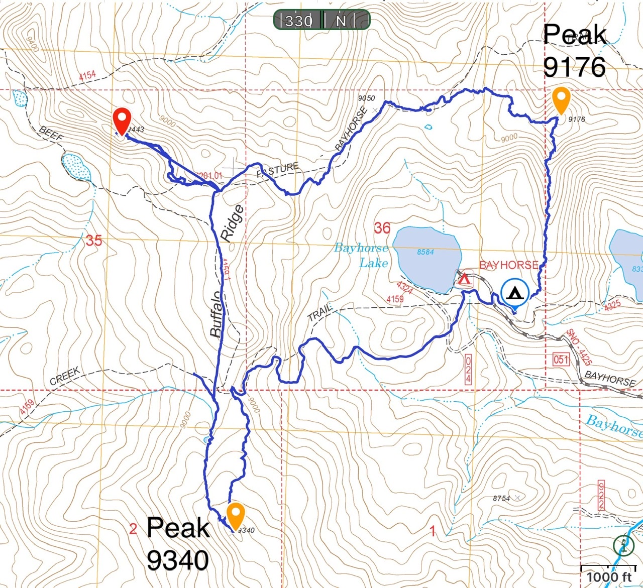
This map shows the Buffalo look that provides access to Peak 9340, Little Buffalo Hump and Peak 9176. The loop utilizes an ATV trail, fence lines, FST-201 and crosscountry travel. Total distance with visits to all three peaks is 7.5 miles with roughly 1,400 feet of elevation gain.
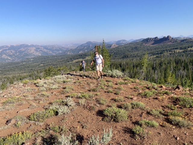
Steve Grantham and Chris Elrod approaching the summit.
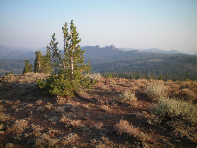
The summit area of Peak 9340. Livingston Douglas Photo
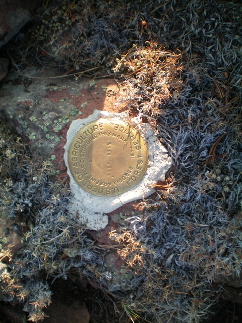
The benchmark atop Peak 9340. Livingston Douglas Photo
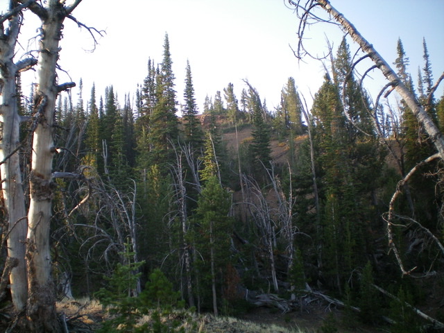
Looking down the forested north ridge. Livingston Douglas Photo
Additional Resources
Regions: Eastern Salmon River Mountains->Salmon River Mountains->Southeast Corner Peaks->WESTERN IDAHO
Mountain Range: Eastern Salmon River Mountains
Longitude: -114.41649 Latitude: 44.39901