Elevation: 9,366 ft
Prominence: 1,306
This peak is not in the book. Published December 2019
Peak 9366 is a forested pile of shale that overlooks Tater Creek and the mouth of Tater Canyon. The easiest ascent route is the south ridge from mouth of Tater Canyon. Beware of timber rattlers in this ideal combination of woods and underlying shale rock. Peak 9366 doesn’t see too many visitors as the nearby higher peaks (e.g., May Mountain, Mogg Mountain) receive much more attention from mountain climbers. The peak makes for a good early-season, snow-free climb. USGS May Mountain
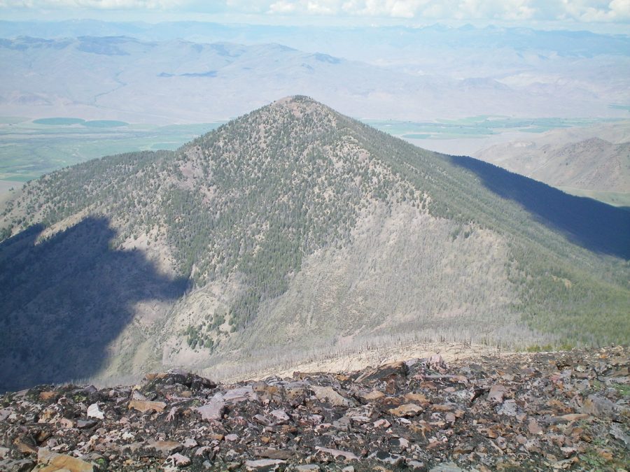
Peak 9366 as viewed from the summit of Peak 10349. Livingston Douglas Photo
South Ridge, Class 2
Access
Tater Canyon is accessed either by Tater Creek Road (if it is still publicly accessible) or via Morse Creek Road and a connecting road (which can be hiked or driven). Morse Creek Road is located 10.2 miles south of US-93 on the [paved] Pahsimeroi Highway. The road is signed and is just north of the hamlet of May, ID. Drive 3.3 miles up Morse Creek Road to an unsigned junction. Go left/north onto a jeep road, pass through a cattle fence, and hike/drive 1-1/2 miles to a hilltop that overlooks the mouth of Tater Canyon. Park here. Follow a cattle trail diagonally down to Tater Creek.
Tater Creek Road is located about 9.3 miles south of US-93 on the Pahsimeroi Highway. This turnoff is about a mile north of the hamlet of May, ID. Tater Creek Road leaves the Pahsimeroi Highway at a sharp turn in the highway. Drive up Tater Creek road to its end at the mouth of Tater Canyon and park.
The Climb
From the mouth of Tater Canyon (5,900 feet), cross to the north side of Tater Creek and begin a sagebrush bushwhack north then northeast then north up to the pine forest at 7,700 feet. The terrain is open sagebrush/scrub with a shale scree base. You may find an occasional game trail to help you get through the sagebrush. The pine forest is delightful at first but has a fair amount of blowdown in steeper areas and some areas of loose scree.
Higher up the rounded south ridge, the pine trees thin out and the climb becomes a scramble up steep, exhausting shale scree/talus with scattered trees and blowdown. Peak 9366 is essentially a massive hump of shale scree/talus with some scattered pines. The slope steepens at 8,300 feet and the ridge bends right-ish/northeast at 8,600 feet. The final 900 vertical feet of climbing is on loose talus/scree. The gentle summit had a torn-down cairn so I rebuilt it.
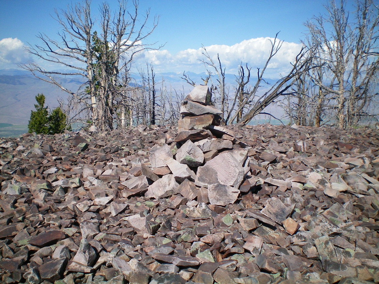
The rebuilt summit cairn atop Peak 9366. Livingston Douglas Photo
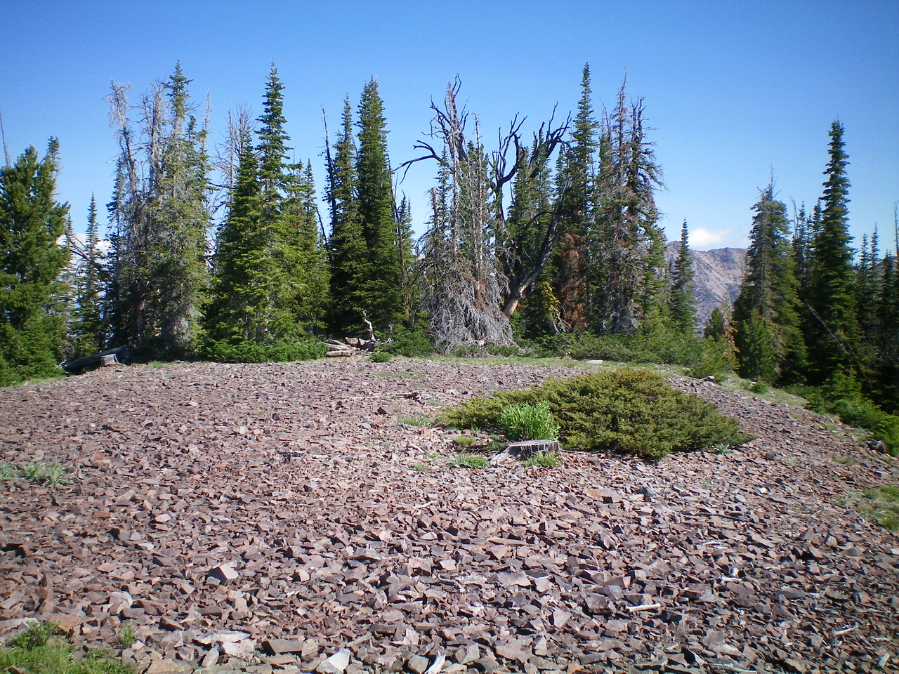
The scree-and-pine tree summit area of Peak 9366. Livingston Douglas Photo
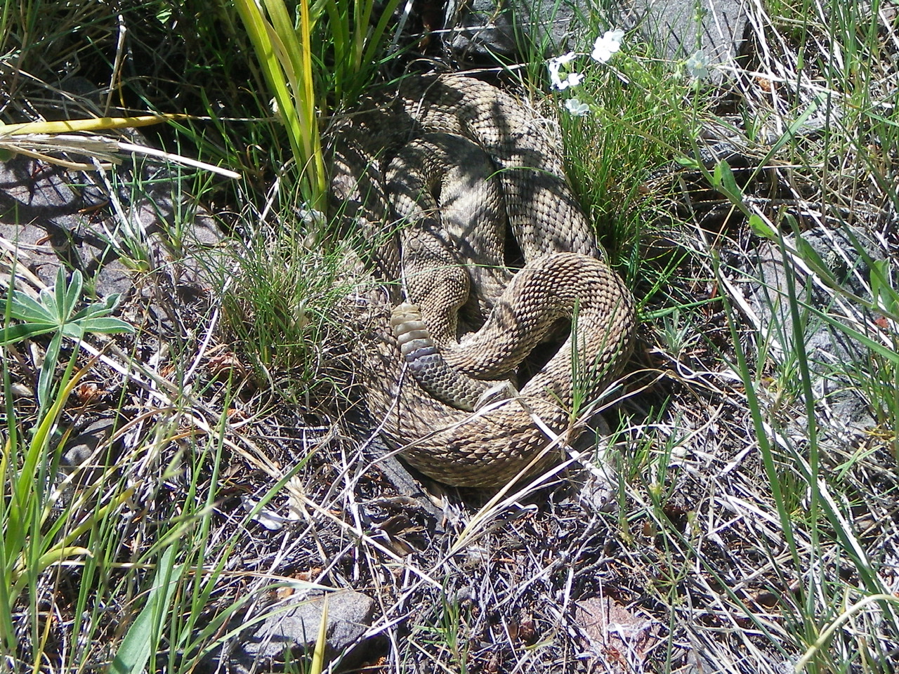
A timber rattler sunning itself in the pine forest of the south ridge of Peak 9366. Another one was two feet away. Livingston Douglas Photo
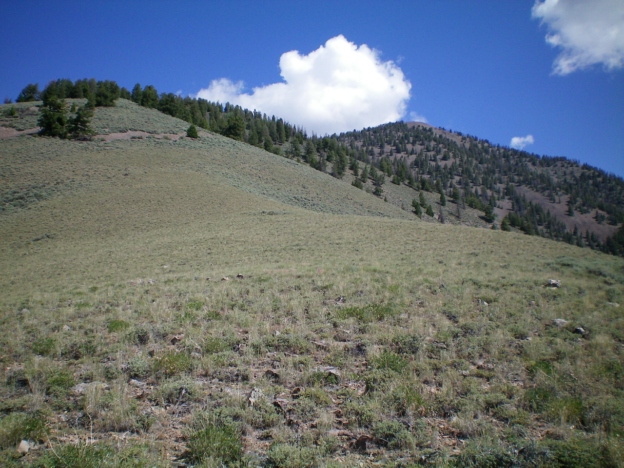
The south ridge of Peak 9366 as viewed from the sagebrush slope of the lower south ridge. The summit is right of center. Livingston Douglas Photo
Additional Resources
Regions: EASTERN IDAHO->Lemhi Range
Mountain Range: Lemhi Range
Longitude: -113.85549 Latitude: 44.65269