Elevation: 9,381 ft
Prominence: 521
This peak is not in the book. Published December 2019
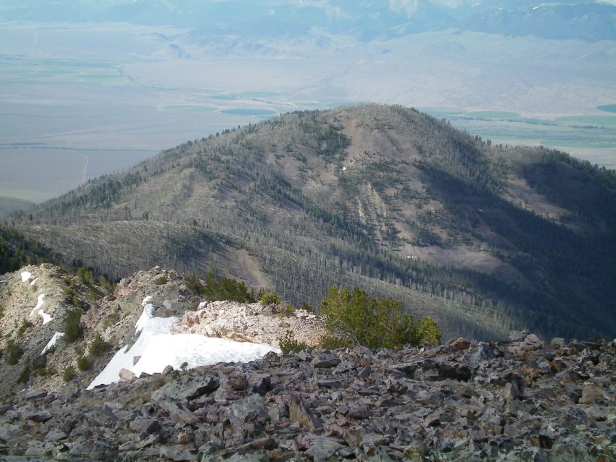
Peak 9381 is a charred hump that is the southernmost point on the south ramparts of Peak 10349. It separates Tater Canyon from Morse Creek Canyon and towers over Morse Creek by over 3,000 vertical feet. The easiest ascent route is via FST-071 and the northeast ridge. USGS May Mountain
Peak 9381 as viewed from the summit of Peak 10349. Livingston Douglas Photo
Northeast Ridge, Class 2
Access
Morse Creek Road/FSR-094 is located exactly 10.2 miles south of US-93 on the [paved] Pahsimeroi Highway. From the signed turnoff on the east side of the highway, drive 4.3 miles to the Challis National Forest boundary. At 6.2 miles, park in a pullout on the right/east side of the road (6,220 feet). FST-071 (signed) is across the road.
The Climb
From the parking pullout, hike up steep, poorly-maintained FST-071 to a saddle at 8,860 feet. Contrary to what the USGS topo map shows, the trail does NOT reach a high point (at 9,040 feet) much closer to Peak 9381 then drop 180 vertical feet to the saddle. The trail does a steady climb up to the saddle and has no meaningful descents prior to reaching the critical saddle. This saddle is the low point between Peak 9381 and Peak 10349. The saddle is at least ¾ mile from the summit of Peak 9381. It is a grueling 3-1/2 miles and 2,640 vertical feet of trail hiking to get here. Contrary to the USGS topo map, the trail has numerous switchbacks which adds to the mileage you must log.
The terrain leading up to, and around, this saddle is confusing. It’s thickly forested (albeit completely burnt) and has two or three large cairns along the trail just BEFORE you reach the saddle. The saddle is in a wide, flat burn area with lots of charred pines. You might not even realize that you are on a saddle. But if you peek through the snags, you will see a burnt summit off in the distance to your southwest. That summit is Peak 9381 and you must now do a rather unpleasant bushwhack to get there.
From the saddle, bushwhack south then southwest in open, burnt forest with lots of blowdown to navigate. There is some brush and rocky outcrops as well. Find a game trail on the left/east side of the ridge crest to expedite the tedious ascent. The top of Peak 9381 is a tangle of downed timber and brush. There were no signs of previous ascent so I built a summit cairn with the few pieces of talus that I could find. The high point seems to be in the middle of the somewhat-elongated summit area as the USGS topo map suggests.
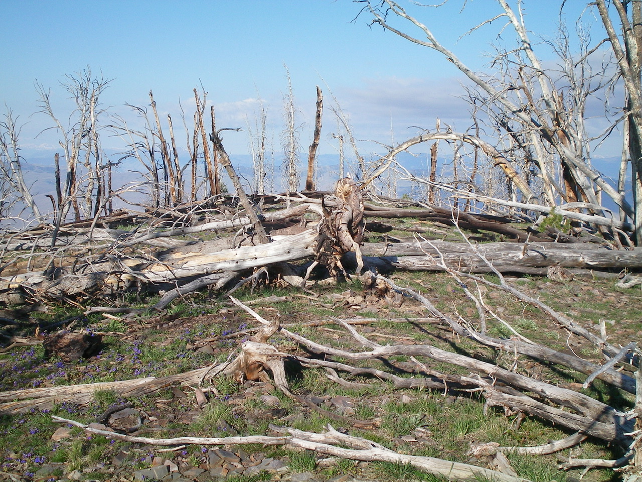
The burnt summit area of Peak 9381. Livingston Douglas Photo
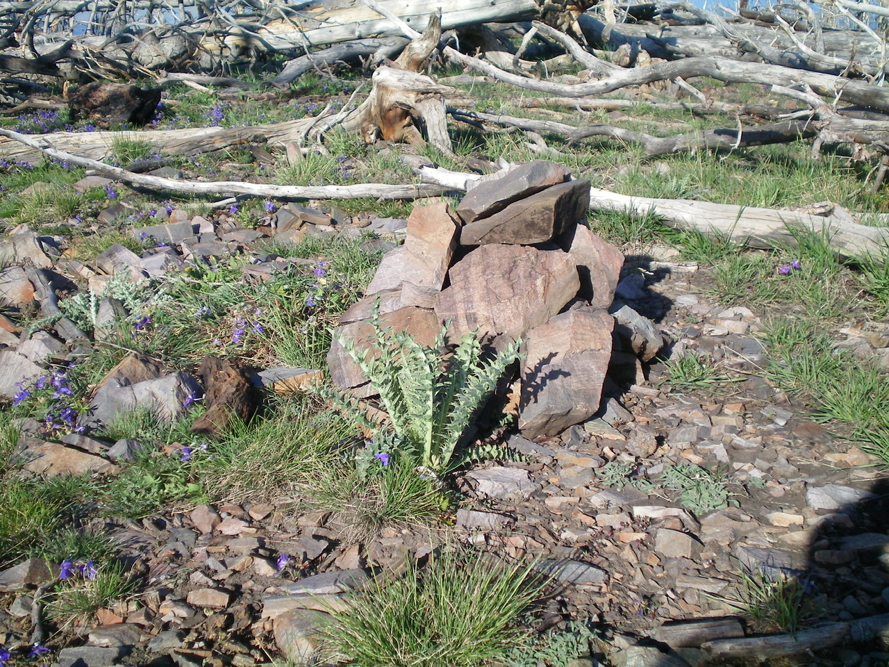
The newly-built summit cairn atop Peak 9381. Livingston Douglas Photo
Additional Resources
Regions: EASTERN IDAHO->Lemhi Range
Mountain Range: Lemhi Range
Longitude: -113.82179 Latitude: 44.63639