Elevation: 9,542 ft
Prominence: 602
This peak is not in the book. Revised by Livingston Douglas. Updated October 2025
Peak 9542 is located in the Northern Boulder Mountains, three miles north of Jerry Peak. The peak sits at the headwaters of both Bradshaw Creek and North Fork Sage Creek. It is most easily climbed via its east ridge from the Bradshaw Creek BLM road. USGS Jerry Peak
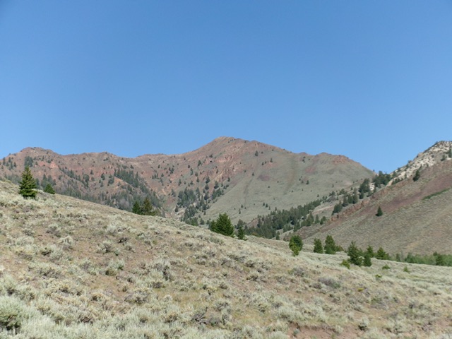
Peak 9542 as viewed from Peak 7442
Access
From a signed junction along Trail Creek Road (2.9 miles northeast of Bartlett Point Road), turn north onto Swenson Basin Road/BLM-400 and drive 3.1 miles to a junction with Walker Way. Turn left/west onto Walker Way and drive 2.6 miles to a signed junction. Go left onto Sage Creek Road. Drive 0.6 miles to a signed junction. Go straight here and continue another 0.5 miles to an unsigned junction with Bradshaw Creek Road. Park at this junction [7,142 feet; 44°05’11.2”N, 114°03’11.3”W] or continue another 0.4 miles straight up Sage Creek Road to a large meadow and park at the base of a spur road that heads right/north up a steep hill to intersect Bradshaw Creek Road.
Map Updates
The USGS topo map fails to show the helpful 2-track that goes from the Sage Creek drainage over to the south side of the Bradshaw Creek drainage. The first segment of Bradshaw Creek Road is not shown on the National Forest map.
Approach from Sage Creek, Class 1
From the Sage Creek drainage, hike northwest then west up Bradshaw Creek Road to its end in the Bradshaw Creek drainage.
East Ridge, Class 2
The Ascent
From the end of Bradshaw Creek Road, cross a minor stream then head immediately left up a use trail into the pine forest. This good trail (not shown on maps) stays on the left/south side of Bradshaw Creek all the way to the side gully that heads right/north up to the east ridge. This side gully is at about 8,200 feet. Bushwhack northwest up the left/west side of the sagebrush gully to reach face terrain higher up.
Scramble up a green, bare (or so it appears from a distance) patch of short veg (with some loose scree/gravel underneath) up a gully of sorts to reach the rocky crest of the east ridge. Once on the east ridge, scramble west up this easy ridge on stable rock and talus/scree. Skirt the right/north side of a few rocky ridge humps/outcrops and quickly reach the gentle summit. I rebuilt and enlarged the summit cairn. The high point is a ridge corner of the east ridge and the south ridge. A slightly-lower rocky bump sits just to the northwest of the cairned high point.
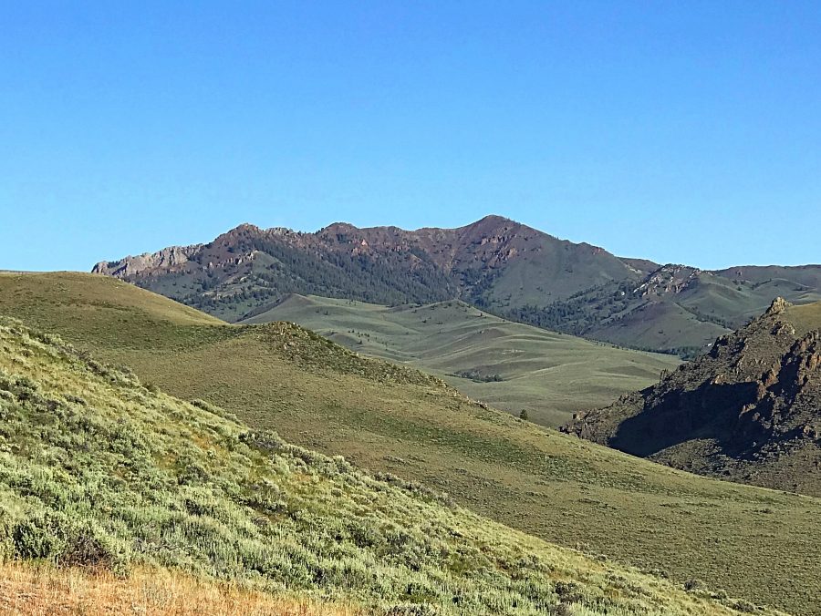
Peak 9542 as viewed from the Bradshaw Creek drainage to its east. The east ridge (my ascent route) is the skyline right of center. Livingston Douglas Photo
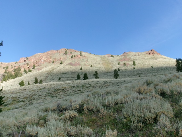
Climbing up to the east ridge from the Bradshaw Creek drainage. Aim for the green-ish patch in the center. The summit is left of center. Livingston Douglas Photo
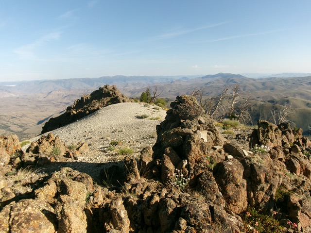
The enlarged summit cairn atop Peak 9542, looking northwest along the high ridge. Livingston Douglas Photo
Additional Resources
Regions: Boulder Mountains->EASTERN IDAHO
Mountain Range: Boulder Mountains
Longitude: -114.10439 Latitude: 44.10539