Elevation: 9,489 ft
Prominence: 514
This peak is not in the book. Published November 2022
Peak 9489 is a ridgeline summit that sits above the Prairie Creek drainage. It is a peak that is quite visible from ID-75 to its east. Peak 9489 can be climbed from either Prairie Creek Road to its south or from the West Fork Prairie Creek Trail/FST-133. USGS Galena
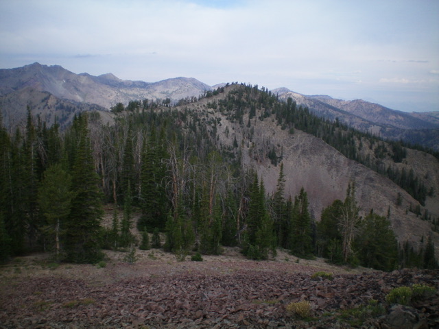
Peak 9489 as viewed from Point 9483 to its east. Livingston Douglas Photo
Access
From ID-75 north of Ketchum, turn left/west onto [signed] Prairie Creek Road/FSR-179 and drive 1.4 miles to a spur road to multiple campsites at “Campsite 4.” Park near the road junction or at Campsite 4C if it is unoccupied (7,085 feet). GPS coordinates: 43⁰38’39”N, 114⁰37’15”W.
East Ridge, Class 2
The Climb
From the campsite, walk a short distance back to Prairie Creek Road and cross to the north side of the road. Bushwhack a short distance through the forest to reach open terrain. Stay right/east of a rocky hump and scramble up steep scrub and gravel to reach flatter terrain and a pine forest. Head left (northwest then west) up through a pine forest that is more of a face than a ridge. The blowdown is a bit bothersome but there is not much underbrush to contend with.
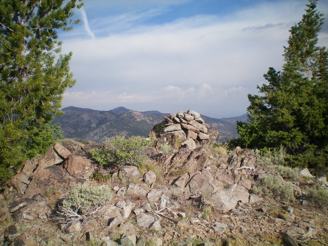
Keep heading west and the ridge steepens and gains definition. Move left/south to gain a ridge edge and open terrain at about 8,200 feet. Follow the ridge steeply upward and west on the edge of a pine forest. The open terrain eventually flames out but the forested ridge continues until it ends at the base of a talus heap. Scramble up this relatively stable, but somewhat steep, pile of rubble until it tops out just southeast of Point 9483, another talus hump. No, this is not the summit. Drop about 10 feet to a broken rock gap/saddle then scramble briefly up to the well-cairned summit of Point 9483.
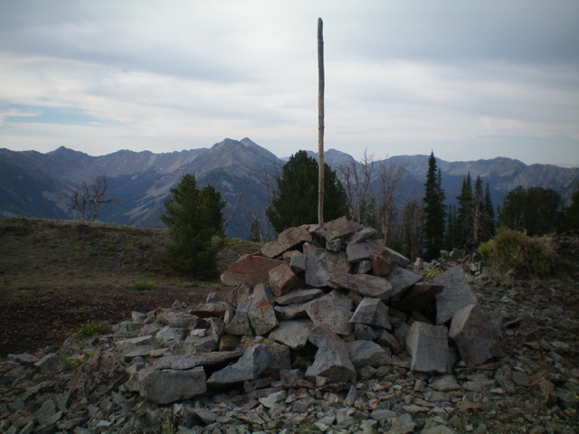
No, this is not the summit either. Discouragingly, the true summit is a tiresome 0.7 miles away on a curving ridge of ridge pines and talus/scree. The true summit is readily visible from here (see photo). It is only six feet higher but looks like it might be lower. From Point 9483, descend west about 185 vertical feet to an ill-defined saddle that is thickly forested. The initial descent is through easy scree then easy pine forest. Find an old elk trail on the right/north side of the clogged ridge crest to cover much of the climb through the forested saddle area and up to the semi-forested summit of Peak 9489. The summit has a small cairn so I built it up significantly.
From the summit, return to Point 9483 then descend eastward. It is difficult, if not impossible, to find the east ridge until you are much lower on the “ridge.” Unfortunately, the ridge is much more of a forested face for the first 1,000+ feet of descent. And the thick pine forest limits visibility to keep you on track to find the elusive ridge. I emerged a bit right/south of my ascent route and had to descend some steep cliff bands to reach Prairie Creek Road only about 50 yards west of the spur road to Campsite 4C.
The newly-enhanced summit cairn atop Peak 9489. Livingston Douglas Photo
The large cairn atop Point 9483. This is not the summit. The summit is over 1/2 mile away and is six feet higher. Livingston Douglas Photo
Additional Resources
Regions: Smoky Mountains->WESTERN IDAHO
Mountain Range: Smoky Mountains
Longitude: -114.65419 Latitude: 43.81901